

- Usage in publication:
-
- Frederika Formation*
- Modifications:
-
- Named
- Biostratigraphic dating
- Dominant lithology:
-
- Conglomerate
- Sandstone
- Shale
- Coal
- AAPG geologic province:
-
- Alaska Southern region
Summary:
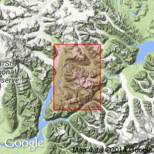
Named for and type area designated as exposures in valley walls of westward-flowing tributary of Frederika Creek, southeast of terminus of Frederika Glacier [sec.5 T2S R18E, northeastern] McCarthy C-4 quad, AK. Comprises heterogeneous assemblage of thin- to thick-bedded continental sedimentary rocks: conglomerate, sandstone, siltstone, shale, and subordinate thin seams of low-rank coal; light colored except for shale and coal. Gradationally underlies Wrangell Lava, and overlies with slight angular unconformity Moonshine Creek Formation or older rocks. Thickness ranges from a few tens of ft to at least 1500 ft. Assigned middle Miocene age on basis of plant fossils found near base of unit.
Source: GNU records (USGS DDS-6; Menlo GNULEX).
For more information, please contact Nancy Stamm, Geologic Names Committee Secretary.
Asterisk (*) indicates published by U.S. Geological Survey authors.
"No current usage" (†) implies that a name has been abandoned or has fallen into disuse. Former usage and, if known, replacement name given in parentheses ( ).
Slash (/) indicates name conflicts with nomenclatural guidelines (CSN, 1933; ACSN, 1961, 1970; NACSN, 1983, 2005, 2021). May be explained within brackets ([ ]).