

- Usage in publication:
-
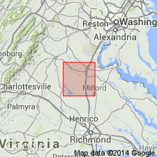
- Fredericksburg Complex*
- Modifications:
-
- Named
- Dominant lithology:
-
- Gneiss
- Schist
- Amphibolite
- Granite
- AAPG geologic province:
-
- Piedmont-Blue Ridge province
Summary:
Originally defined informally by Pavlides and others (1974) as an injection zone of dikes and sills, and pegmatoid bodies into host rocks which included Quantico Slate (Formation) as well as several types of gneiss, schist and meta-igneous rocks. On basis of recent mapping, is redefined and subdivided lithologically into Po River and Ta River Metamorphic Suites (composed of gneisses, schists, metagabbro, and granitoid and pegmatoid bodies), Holly Corner Gneiss, and Falls Run Granite Gneiss (all new names). Named for city of Fredericksburg, east-central VA. Includes the Fredericksburg granite and Fredericksburg gneiss of Lonsdale (1927) and excludes rocks of Quantico Formation. Includes rocks previously called Berea quartz monzonite (Neuschel and others, 1971), now assigned to Falls Run Granite Gneiss; the name "Berea" is pre-empted for the Berea Sandstone elsewhere. Granitoid dikes, sills, and irregular intrusions and pegmatoid bodies that constituted injection zone of informally defined Fredericksburg are now assigned to Falmouth Intrusive Suite (new). Age is Proterozoic Z(?) to Early Devonian based on regional correlations and stratigraphic relationships.
Source: GNU records (USGS DDS-6; Reston GNULEX).
For more information, please contact Nancy Stamm, Geologic Names Committee Secretary.
Asterisk (*) indicates published by U.S. Geological Survey authors.
"No current usage" (†) implies that a name has been abandoned or has fallen into disuse. Former usage and, if known, replacement name given in parentheses ( ).
Slash (/) indicates name conflicts with nomenclatural guidelines (CSN, 1933; ACSN, 1961, 1970; NACSN, 1983, 2005, 2021). May be explained within brackets ([ ]).