- Usage in publication:
-
- Frazier Well gravel
- Modifications:
-
- Named
- Dominant lithology:
-
- Gravel
- AAPG geologic province:
-
- Plateau sedimentary province
Koons, Donaldson, 1948, High-level gravels of western Grand Canyon: Science, v. 107, p. 475-476.
Summary:
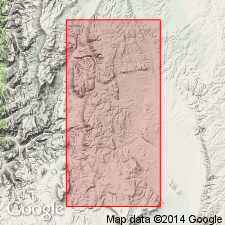
No type designated, though gravels are best exposed near Frazier Well, for which unit is named, in Hualpai Indian Reservation, AZ, Plateau sedimentary province. Consists of well-rounded pebbles and boulders of vein quartz, granite, gneiss, schist, red and white quartzite, and sandstone. Thickness varies from thin veneer to more than 200 ft, with maximum thickness near Frazier Well. Elevation of deposits range from 5660 (younger deposits) to 7150 (older deposits) ft. Gravels were deposited by north-flowing tributaries to Colorado [River] originating in Prescott-Jerome area, 50 mi to southeast, and drainage reversal followed Basin-Range faulting. Assigned pre-Pleistocene age based on weathering.
Source: GNU records (USGS DDS-6; Denver GNULEX).

- Usage in publication:
-
- Frazier Well Gravel
- Modifications:
-
- Areal extent
- Overview
- AAPG geologic province:
-
- Plateau sedimentary province
Summary:
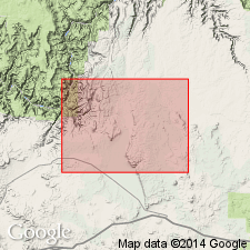
Gravel deposits at Blue Mountain, Coconino Co, AZ, Plateau sedimentary province, previously assigned to Blue Mountain Gravel (not used) by author (Koons, 1948) are here assigned to Frazier Well Gravel. Frazier Well occurs near Blue Mountain, surrounding Frazier Well, and northward from Rose Well with smaller deposits occurring in many places over surface of plateau notably near the Pinnacle and east of reservation boundary. Geologic map (fig. 2). In author's opinion there is not enough evidence to base a reliable age for unit; it may have been deposited any time during Miocene or Pliocene but is probably no younger than early Pleistocene.
Source: GNU records (USGS DDS-6; Denver GNULEX).

- Usage in publication:
-
- Frazier Well Gravel*
- Modifications:
-
- Age modified
- Mapped 1:48k
- AAPG geologic province:
-
- Plateau sedimentary province
Summary:
Occurs north of Blue Mountain, at Frazier Well, and around Thornton Lookout Tower, Coconino Co, northwest AZ, Plateau sedimentary province. Gravel consists only of Precambrian clasts. Overlain by basalt flows of Blue Mountain volcano which have been dated at 14.6 Ma (Damon, 1968, Ann. Prog. Report no. COD-689-100, U.S. Atomic Energy Comm., p. 49-50) suggesting a Miocene or older age. Sediments of similar lithology occur throughout Hualapai and Coconino Plateaus have been shown to be no younger than Eocene (Young, 1985, Tectonic Geomorphology, p. 261-278). At Frazier Well and southwest of Thornton Lookout, Frazier Well Gravel is deposited in a wide valley that is inset into Robbers Roost Gravel, thus, Frazier Well Gravel is in part younger than Robbers Roost. Frazier Well north of Blue Mountain interfingers with and overlies unnamed fanglomerates in upper Blue Mountain Canyon drainage. Unconformably overlies Lower Permian rocks. Assigned Paleocene? to Miocene? age.
Source: GNU records (USGS DDS-6; Denver GNULEX).
For more information, please contact Nancy Stamm, Geologic Names Committee Secretary.
Asterisk (*) indicates published by U.S. Geological Survey authors.
"No current usage" (†) implies that a name has been abandoned or has fallen into disuse. Former usage and, if known, replacement name given in parentheses ( ).
Slash (/) indicates name conflicts with nomenclatural guidelines (CSN, 1933; ACSN, 1961, 1970; NACSN, 1983, 2005, 2021). May be explained within brackets ([ ]).

