

- Usage in publication:
-
- Franklin Canyon Formation*
- Modifications:
-
- Named
- Dominant lithology:
-
- Metavolcanics
- AAPG geologic province:
-
- Sierra Nevada province
Summary:
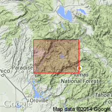
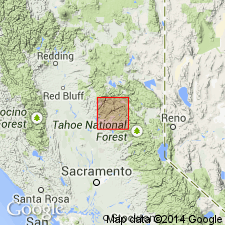
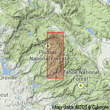
Type section designated as exposures in Franklin Canyon on Middle Fork of Feather River, secs.3-5 T22N R8E, Bucks Lake 15' quad, Plumas Co, CA. Consists of fine-grained, greenish-gray meta-andesite, metadacite with quartz phenocrysts and amygdules, light-gray to white, fine-grained metasodarhyolite, and associated tuffaceous layers interbedded with fine-grained, foliated, dark-greenish or bluish-gray to light-brownish-gray metavolcanic rocks. Overlies with angular unconformity phyllite of Calaveras Formation. Is in fault contact with Horseshoe Bend Formation, youngest formation in Paleozoic(?) metavolcanic sequence. Age assigned to Franklin Canyon Formation is Paleozoic(?) because of its continuity with Paleozoic section of Ferguson and Gannett (1932) to south.
Source: GNU records (USGS DDS-6; Menlo GNULEX).
- Usage in publication:
-
- Franklin Canyon Formation*
- Modifications:
-
- Age modified
- AAPG geologic province:
-
- Sierra Nevada province
Summary:
Unit tentatively correlated with Devonian metavolcanic rocks in Taylorsville. Age considered Devonian(?).
Source: GNU records (USGS DDS-6; Menlo GNULEX).
- Usage in publication:
-
- Franklin Canyon Formation*
- Modifications:
-
- Age modified
- AAPG geologic province:
-
- Sierra Nevada province
Summary:
Franklin Canyon Formation probably includes Paleozoic to Triassic rocks, the latter interbedded with Triassic metasedimentary rocks on north side of Yuba River.
Source: GNU records (USGS DDS-6; Menlo GNULEX).
- Usage in publication:
-
- Franklin Canyon Formation*
- Modifications:
-
- Areal extent
- AAPG geologic province:
-
- Sierra Nevada province
Summary:
Metabasalt of west end of Franklin Canyon Formation was formerly mapped as Duffey Dome Formation (Hietanen, 1973), name now abandoned. Rocks of Franklin Canyon Formation form well-defined geologic unit between two major sutures, Dogwood Peak and Camel Peak faults.
Source: GNU records (USGS DDS-6; Menlo GNULEX).
- Usage in publication:
-
- Franklin Canyon Formation*
- Modifications:
-
- Age modified
- Overview
- AAPG geologic province:
-
- Sierra Nevada province
Summary:
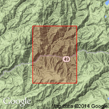
Age of Franklin Canyon Formation considered to be late Paleozoic and Triassic(?) on basis of stratigraphic relations with Triassic metasedimentary rocks that overlie and interfinger with unit. Detailed lithology included in report. Unit shown on geologic map of area west of Melones fault between Feather and North Yuba Rivers, CA with various lithologies shown separately.
Source: GNU records (USGS DDS-6; Menlo GNULEX).
For more information, please contact Nancy Stamm, Geologic Names Committee Secretary.
Asterisk (*) indicates published by U.S. Geological Survey authors.
"No current usage" (†) implies that a name has been abandoned or has fallen into disuse. Former usage and, if known, replacement name given in parentheses ( ).
Slash (/) indicates name conflicts with nomenclatural guidelines (CSN, 1933; ACSN, 1961, 1970; NACSN, 1983, 2005, 2021). May be explained within brackets ([ ]).