

- Usage in publication:
-
- Foxhollow Till Member
- Modifications:
-
- Areal extent
- Revised
- AAPG geologic province:
-
- Wisconsin arch
Summary:
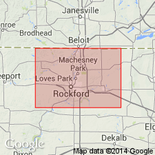
Unit extended to north-central IL where it occurs in the subsurface in extreme northern Boone Co. and northeastern Winnebago Co. Here assigned to the Glasford Formation as Foxhollow Till Member. Underlies Argyle and Nimtz Till Members and overlies Kellerville Till Member.
Source: GNU records (USGS DDS-6; Reston GNULEX).

- Usage in publication:
-
- Foxhollow Member
- Modifications:
-
- Principal reference
- Dominant lithology:
-
- Till
- AAPG geologic province:
-
- Wisconsin arch
Summary:
Pg. 4 (table 1); App., p. A1-2 to A1-3. Foxhollow Member of Walworth Formation. (Name credited to Carl Fricke, 1976, Univ. Wisconsin MS thesis, and David M. Mickelson.) Occurs in southern Wisconsin, east of Rock River and south of Turtle Creek, and in part of northern Illinois. Consists of gray pebbly, silty, clayey till and contains wood fragments. Overlies pre-Pleistocene rocks. Underlies AlIens Grove Member (new) of Walworth Formation (new) [=Argyle Till Member of the Winnebago Formation in Illinois], contact is sharp. Age is Pleistocene (early Wisconsinan or older).
Type section (subsurface): test hole 671 of Fricke (1976), 3 mi (5 km) east of Beloit on east side of Town Hall Road, north of WI State Highay 67 (formerly part of County Trunk Highway P), in center NE/4 SE/4 NE/4 sec. 33, T. 1 N., R. 13 E., [approx. Lat. 42 deg. 30 min. 18 sec. N., Long. 88 deg. 57 min. 36 sec. W.], Shopiere 7.5-min quadrangle, Rock Co., southern WI.
Named from the community of Foxhollow, [in sec. 25, about 3.4 mi northeast of type section], Shopiere 7.5-min quadrangle, Rock Co., southern WI; name credited to Carl Fricke and David M. Mickelson.
[Additional locality information from Syverson and others, 2011, Wisconsin lexicon of Pleistocene units, Wisconsin Geol. Nat. Hist. Survey Tech. Rpt., no. 1; supplemented from USGS historical topographic map collection TopoView and Wisconsin Highways www.wisconsinhighways.org, accessed on June 9, 2018.]
Source: Publication; US geologic names lexicon (USGS Bull. 1565, p. 113).
- Usage in publication:
-
- Foxhollow Member
- Modifications:
-
- Age modified
- AAPG geologic province:
-
- Wisconsin arch
Summary:
Pg. 4 (fig. 2), 7 (fig. 3), 8, 45-46. Foxhollow Member of Walworth Formation. Previously thought to be Wisconsinan (44,000 cal. yr B.P.). Recently obtained OSL ages from Illinois State Geol. Survey suggest it is Illinoian. Lies below Allens Grove Member of Walworth Formation (=Argyle Member of Winnebago Formation of Illinois).
Source: Publication.
For more information, please contact Nancy Stamm, Geologic Names Committee Secretary.
Asterisk (*) indicates published by U.S. Geological Survey authors.
"No current usage" (†) implies that a name has been abandoned or has fallen into disuse. Former usage and, if known, replacement name given in parentheses ( ).
Slash (/) indicates name conflicts with nomenclatural guidelines (CSN, 1933; ACSN, 1961, 1970; NACSN, 1983, 2005, 2021). May be explained within brackets ([ ]).