

- Usage in publication:
-
- Fox Hills beds*
- Modifications:
-
- Named
- Dominant lithology:
-
- Clay
- Sandstone
- AAPG geologic province:
-
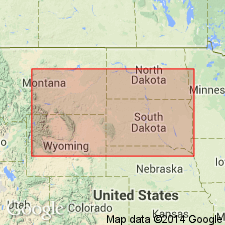
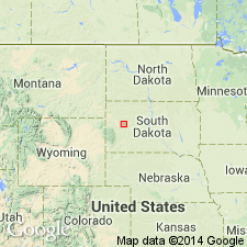
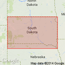
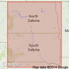
- Williston basin
Summary:
Named as top formation of Upper Cretaceous series, top of Upper Cretaceous. Formerly called "formation No. 5" (Meek and Hayden, 1857). Type not designated. Named for the Fox Hills between Cheyenne and Moreau Rivers above Fort Pierre, in central SD, in Williston basin. Also occurs in region of Long Lake, at Sage Creek and vicinity of White River, at the Black Hills, along Rocky Mountains as far south as Pikes Peak, and at Deer Creek on the North Platte River. Consists of fossiliferous, gray, ferruginous and yellowish sandstone and arenaceous clays. Estimated thickness 500 ft. Lower contact gradational with clays of underlying Fort Pierre Group (new). The two formations cannot be distinguished on basis of fossils; in fact, on paleontological principles the upper fossiliferous zone of Pierre Group could be included in Fox Hills Beds. Upper contact distinct with Tertiary bone beds of the MAUVAISES TERRES at Sage Creek. Correlated with Cretaceous beds in NJ and AL. Fort Pierre Group and Fox Hills Beds are synchronous with Upper, or White Chalk, and Maestricht beds of Europe (=Senonien of D'Orbigny) on basis of both stratigraphic and paleontologic evidence. Fossils listed.
Source: GNU records (USGS DDS-6; Denver GNULEX).
- Usage in publication:
-
- Fox Hills formation
- Modifications:
-
- Revised
- AAPG geologic province:
-
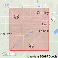
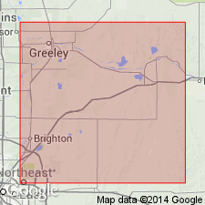
- Denver basin
Summary:
A massive, soft, gray-yellow upper 100 to 150 ft of sandstone is named Milliken sandstone member of Fox Hills formation for excellent exposures near Milliken station west of LaSalle, Weld Co, CO in the Denver basin. Of Cretaceous age.
Source: GNU records (USGS DDS-6; Denver GNULEX).
- Usage in publication:
-
- Fox Hills sandstone*
- Modifications:
-
- Revised
- AAPG geologic province:
-
- Williston basin
Summary:
Pg. 484-495. Fox Hills sandstone. Includes Colgate member. [Age is Late Cretaceous.]
Source: US geologic names lexicon (USGS Bull. 1200, p. 1411-1412).

- Usage in publication:
-
- Fox Hills sandstone*
- Fox Hills group (broad sense)†
- Modifications:
-
- Overview
- AAPG geologic province:
-
- Denver basin
Summary:
Fox Hills sandstone of Montana group; †Fox Hills group (broad sense). Age is Late Cretaceous. Occurs in South Dakota, North Dakota, eastern Montana, Wyoming, and eastern Colorado.
Named from exposures in Fox Ridge, northwestern Armstrong and southwestern Dewey Cos., SD (shown on pl. 1 of USGS Bull. 575).
In 1888 (Colorado Sci. Soc. Proc., v. 3, pt. 1, p. 93, footnote) G.H. Eldridge, "with the approval of Dr. C.A. White," Eldridge introduced Montana group to replace Fox Hills in broad sense of White --i.e., to include Fox Hills sandstone and Pierre shale of present nomenclature, which were mapped by Hayden Survey as Fox Hills group and Fort Pierre group. The original restricted definition of Fox Hills is the one that has been in use for many years.
Source: US geologic names lexicon (USGS Bull. 896, p. 767, 768).
- Usage in publication:
-
- Fox Hills formation
- Modifications:
-
- Revised
Summary:
After a field conference with J.B. Reeside, Jr., of the USGS, the Rocky Mountain Association of Petroleum Geologists has agreed to restrict the term Fox Hills as follows: the base of the Fox Hills formation shall be considered as the horizon below which the section is predominantly gray marine clay shales and sandy shales of Pierre age, and above which the section changes rapidly to a buff to brown sandstone containing numerous large gray to brown, hard, sandy concretions. This lower concretionary member is commonly overlain by a series of light-gray to brown sandstones and sandy shales. The top of the Fox Hills formation shall be considered as the horizon above which the section is composed predominantly of fresh- and brackish-water deposits accompanied by coals and lignitic shales, and below which it is predominantly marine. Provide 4 localities where Fox Hills is well exposed: (1) from Jackson Lake to Cottonwood Springs; (2) Osgood; (3) Poison Springs; and (4) from Wildcat Mound to Windsor.
Source: Publication; US geologic names lexicon (USGS Bull. 896, p. 767, Pierre entry p. 1657).
- Usage in publication:
-
- Fox Hills formation
- Modifications:
-
- Revised
- Redescribed
- Dominant lithology:
-
- Sandstone
- Shale
- AAPG geologic province:
-
- Williston basin
Summary:
Purposely designated Fox Hills formation in report area because it includes both sandstone and shale. Divided into (ascending): Trail City member (new), Timber Lake member (new), banded beds, and gray sandstone in Dewey and Corson Cos, SD in the Williston basin. The Trail City is a 50 to 90 ft thick brown or buff sandy clay. The Timber Lake is a 90 ft thick sandstone (lower part) and claystone and sandstone (upper part). The banded beds are thin-bedded, fine-grained sandstone and shale about 50 ft thick. The gray sandstone is about 20 ft thick. Fox Hills overlies Pierre formation and underlies Hell Creek formation. Pierre-Fox Hills contact is arbitrarily placed. Top of Pierre placed at top of highest bentonite. Of Late Cretaceous age. Columnar section.
Source: GNU records (USGS DDS-6; Denver GNULEX).
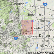
- Usage in publication:
-
- Fox Hills sandstone*
- Modifications:
-
- Mapped 1:24k (Golden quad, Jefferson Co, CO)
- Dominant lithology:
-
- Sandstone
- Shale
- AAPG geologic province:
-
- Denver basin
Summary:
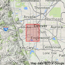
Is Upper Cretaceous formation mapped in northern Jefferson Co, CO (Denver basin). Conformably overlies Pierre shale (Upper Cretaceous); unconformably? underlies Laramie formation (Upper Cretaceous). Outcrops as northerly striking very narrow band from southern to northern borders of quad. In northern part of quad unit is composed entirely of sandstone, about 60 ft thick; near Golden it is composed of 8 ft of sandstone at base, 63 ft of shale in middle, and 23 ft of shale and interbedded sandstone at top. Sandstone described as grayish orange to light gray, fine grained, weathers light brown, and forms rounded outcrops. Shale is grayish olive, clayey, fissile and interbedded with thin siltstone layers at many places. Foraminifera found by other workers.
Source: GNU records (USGS DDS-6; Denver GNULEX).
- Usage in publication:
-
- Fox Hills sandstone
- Modifications:
-
- Areal extent
- AAPG geologic province:
-
- Green River basin
- Powder River basin
- Williston basin
Summary:
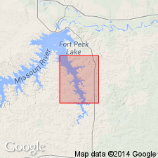
Extended into Greater Green River basin where it is exposed on northeast flank of Rock Springs uplift, WY. Becomes successively younger to southeast and east. Paleogeographic map shows Fox Hills to extend from Black Hills southwest across WY to Rock Springs uplift, then southeast into CO. Interfingers with upper part of underlying Lewis shale and with overlying Lance formation; overlies Bearpaw shale in central and eastern MT within Powder River and Williston basins. Unit consists of a series of individual sand bodies. Cross sections. Late Cretaceous age.
Source: GNU records (USGS DDS-6; Denver GNULEX).

- Usage in publication:
-
- Fox Hills sandstone*
- Modifications:
-
- Mapped 1:24k (Littleton quad, Arapahoe, Douglas, and Jefferson Cos, CO)
- Dominant lithology:
-
- Sandstone
- Shale
- AAPG geologic province:
-
- Denver basin
Summary:
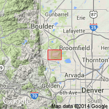
Is Upper Cretaceous formation mapped in east-central Jefferson Co, CO (Denver basin). Unit outcrops north of Deer Creek, north of Dutch Creek as well as between these areas in eastern part of quad. Map unit consists of mostly soft olive-brown sandy shale containing limy sandstone layers and carbonaceous plant fragments in lower part; massive soft olive-brown sandstone containing dark-brown hard limy sandstone concretions up to 4 ft in diameter in upper part. Overlies Pierre shale (Upper Cretaceous) with gradational contact; underlies Laramie formation (Upper Cretaceous) with transitional contact. Thickness north of Deer Creek is estimated to be about 145 ft.
Source: GNU records (USGS DDS-6; Denver GNULEX).
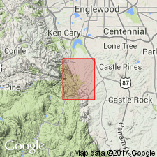
- Usage in publication:
-
- Fox Hills sandstone*
- Modifications:
-
- Mapped 1:24k (Kassler quad, Douglas and Jefferson Cos, CO)
- Dominant lithology:
-
- Sandstone
- Shale
- AAPG geologic province:
-
- Denver basin
Summary:
Is Upper Cretaceous formation mapped in northwestern Douglas Co, CO (Denver basin). Outcrops as northwesterly striking, northeast dipping narrow band parallel to Hogback in central part of map. Described (p.104) as consisting of a lower sandy shale, a middle ridge-forming sandstone, and an upper soft sandstone. Lower part is mostly soft, olive-brown sandy shale containing thin limy sandstone layers and carbonaceous plant fragments. Middle part is olive-gray to yellowish-gray fine grained massive to slabby sandstone; is friable to hard and thin bedded; cross-bedded in thin laminae in places. Upper part is mostly covered, but probably is olive-brown or olive-gray soft sandstone. Map unit is best exposed in NESW and SENW sec 29, T7S, R68W and in gully in SESW sec 7, T7S, R68W. Exposed thickness is 30 ft, but 155 ft of covered beds were included. Overlies Pierre shale (Upper Cretaceous); underlies Laramie formation (Upper Cretaceous). Neither lower nor upper contacts exposed. Measured sections. A few poorly preserved brackish-water pelecypods found in middle sandstone. Unit is transitional between marine Pierre and continental Laramie.
Source: GNU records (USGS DDS-6; Denver GNULEX).
- Usage in publication:
-
- Fox Hills Formation
- Modifications:
-
- Revised
- AAPG geologic province:
-
- Williston basin
Summary:
Divided into two newly named members in Meade Co, SD, Williston basin. Lower member named Fairpoint Member. Fairpoint overlies Pierre Shale; lower contact is transitional. White Owl Creek Member named as upper member of Fox Hills. Upper coal facies of Fairpoint designated Stoneville coal facies. Stoneville formerly called Stoneville Coal Member. Upper purple clay shale, green silt, and white to yellow sand and sandstone facies of White Owl Creek named Enning facies. Fox Hills underlies White River Group. Geologic map of eastern Meade Co. Measured sections. Columnar sections. Fox Hills rocks in report area similar to Hell Creek Formation. Fairpoint equivalent in part to part of Colgate and Bullhead Members, and perhaps to Trail City and Timber Lake Members farther east. White Owl Creek Member probably correlates with Hell Creek Formation, and probably is equivalent to Colgate Member in Creighton area. Of Late Cretaceous, Maestrichtian age.
Source: GNU records (USGS DDS-6; Denver GNULEX).
- Usage in publication:
-
- Fox Hills Formation
- Modifications:
-
- Overview
- Revised
- Biostratigraphic dating
- AAPG geologic province:
-
- Williston basin
Summary:
Detailed account of Fox Hills Formation in Dewey, Corson, and Ziebach Cos, SD in the Williston basin. Correlation chart; history of usage chart; measured sections; geologic map; facies maps; fossil identifications. Gradationally overlies Elk Butte Member of Pierre Shale, and gradationally underlies Hell Creek Formation in report area. Historical type locality delimited as south of Moreau River, southwest Dewey Co and northeast Ziebach Co, south of Hwy 212 on the Cheyenne-Moreau divide. Type area is the entire exposed Fox Hills in the three SD counties from the State border with ND south almost to the Cheyenne River. Divided into Trail City Member at base which has 2 newly named lithofacies--the Little Eagle lithofacies (east) and Irish Creek lithofacies (west); Timber Lake Member; and Iron Lightning Member at top which has a Bullhead lithofacies (formerly Bullhead Member) and Colgate lithofacies (formerly Colgate Member). Timber Lake present in east and central parts of report area. In west exposures Iron Lightning rests on Trail City. The members have gradational contacts. Is a marginal marine and brackish-water deposit. Ranges from Lower NICOLLETI Assemblage Zone (Trail City Member) to CRASSOSTREA and CORBICULA (top of Iron Lightning Member). Of Late Cretaceous, Maestrichtian age.
Source: GNU records (USGS DDS-6; Denver GNULEX).

- Usage in publication:
-
- Fox Hills Formation*
- Modifications:
-
- Reference
- Dominant lithology:
-
- Sandstone
- Shale
- AAPG geologic province:
-
- Green River basin
Summary:
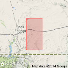
Reference section designated at SW1/4 SW1/4 sec 13 and SE1/4 SE1/4 sec 14, T22N, R89W, Carbon Co, WY in Greater Green River basin. Composed of yellowish-gray, very fine-grained sandstone and a few interbeds of gray to brown sandy shale and coal totaling 172 ft thick at that section. Some beds have concretionary masses. Is fossiliferous (OPHIOMORPHA, clams, and snails). Three distinctive ammonites indicate that the Fox Hills is younger in south-central WY than in SD. Is a marine unit assigned to the early Maestrichtian or Late Cretaceous. Correlation with other units in south-central WY of the same general age shown on table 1.
Source: GNU records (USGS DDS-6; Denver GNULEX).

- Usage in publication:
-
- Fox Hills Sandstone*
- Modifications:
-
- Mapped 1:24k (Jefferson Co, CO)
- Dominant lithology:
-
- Sandstone
- Shale
- AAPG geologic province:
-
- Denver basin
Summary:
Is Upper Cretaceous formation mapped in Jefferson Co, CO (Denver basin). Outcrops occur as narrow band along east side of Hogback. Upper 105 ft is olive-gray to dark-yellowish-brown silty shale and interbedded wavy-banded friable micaceous sandstone. Shale contains flattened gray limestone concretions 12 inches in diameter. Lower 75 ft is yellowish-orange massive to thin-bedded, locally cross-bedded, friable fine-grained ridge-forming sandstone and interbedded dark-olive-gray shale and claystone. Contains large reddish-brown hard calcareous iron-stained sandstone concretions about 65 ft above base. Shale beds are abundant near base. Contains large flow casts about 20 ft above base. Contains fossil pelecypods in lower part of upper shale and at top of lower sandstone. Thickness 180 ft. Entire mapped formation is considered Pierre Shale by one [anonymous] authority. Overlies Pierre Shale (Upper Cretaceous). Underlies Laramie Formation (Upper Cretaceous).
Source: GNU records (USGS DDS-6; Denver GNULEX).
- Usage in publication:
-
- Fox Hills Sandstone*
- Modifications:
-
- Geochronologic dating
- Biostratigraphic dating
- AAPG geologic province:
-
- Powder River basin
Summary:
Fox Hills Sandstone. Sample collected from a 30-cm-thick bentonite bed at base of Fox Hills Sandstone, between the HOPLOSCAPHITES aff. NICOLLETI and DISCOSCAPHITES ROANENSIS ammonite zones, in center sec. 14, T. 38 N., R. 62 W., Niobrara Co., WY (Powder River basin). K-Ar age on biotite 67.4 +/-0.7 Ma. Age is Late Cretaceous (Maestrichtian).
Source: Modified from GNU records (USGS DDS-6; Denver GNULEX).
- Usage in publication:
-
- Fox Hills Formation
- Modifications:
-
- Revised
- AAPG geologic province:
-
- Williston basin
Summary:
Name Linton Member applied to the uppermost butte-forming sandstone. Linton recognized in this report in Sioux and Emmons Cos, ND and Corson Co, SD in the Williston basin. The Linton ranges from 0.2 to 7 m thick. The member's contacts are poorly exposed; it may rest on Bullhead lithofacies of the Fox Hills, it may be overlain by Hell Creek Formation. Fox Hills is Late Cretaceous, Maestrichtian, age. Map of exposures studied of Linton.
Source: GNU records (USGS DDS-6; Denver GNULEX).
- Usage in publication:
-
- Fox Hills Sandstone*
- Modifications:
-
- Mapped 1:24k (Fort Logan quad, Arapahoe, Denver, and Jefferson Cos, CO)
- Dominant lithology:
-
- Sandstone
- Shale
- AAPG geologic province:
-
- Denver basin
Summary:
Is Upper Cretaceous formation mapped in eastern Jefferson Co, CO (Denver basin). Conformably overlies Pierre Shale (Upper Cretaceous); conformably underlies Laramie Formation (Upper Cretaceous). Unit described as light-gray to light-brown, fine-grained, micaceous, friable sandstone and olive-gray to yellowish-brown silty shale. Sandstone is generally water bearing and is an important aquifer in Denver area. Exposed only in extreme southwest corner of quad. Engineering properties discussed. Thickness ranges from 80 ft to 147 ft reported in well logs from various parts of quad.
Source: GNU records (USGS DDS-6; Denver GNULEX).
- Usage in publication:
-
- Fox Hills Sandstone
- Modifications:
-
- Overview
- AAPG geologic province:
-
- Williston basin
Summary:
Conformably overlies Bearpaw Shale; contact placed where yellow-gray sandstone (Fox Hills) predominates over dark-gray shale (Bearpaw). Overlain by Hell Creek Formation; contact placed at top of buff and yellow-gray sandstone with first persistent gray, brown mudstone (Hell Creek). Upper contact is time-transgressive eastward. Members defined by Waage (1961) considered to be time-transgressive units rather than mappable members, and were not specifically identified in this study. Waage's Trail City and Bull Head [Bullhead, Stevenson, 1957 and Waage, 1961] Members may be represented in parts of the formation. Most of the formation is equivalent to the Timber Lake Member. Consists mostly of uniform, consistently cross-bedded, well-sorted, very fine grained, gray to yellow, ledge-forming sandstone that shows little variation in report area, McCone Co, MT in the Williston basin. Has concretionary bands. Is a marginal marine to littoral unit deposited in a tidal area. Ranges between 15 to 20 m thick. Fossils: flora, burrows usually OPHIOMORPHA. Probably of early Maestrichtian, Late Cretaceous age in central MT. Geologic map. Measured sections. Columnar sections.
Source: GNU records (USGS DDS-6; Denver GNULEX).

- Usage in publication:
-
- Fox Hills Sandstone*
- Modifications:
-
- Areal extent
- AAPG geologic province:
-
- Powder River basin
Summary:
Identified in the subsurface of the Powder River basin in MT and WY. Overlies Lewis Shale in the west part of basin and overlies Pierre Shale in east part of basin. Underlies Lance Formation in WY, and underlies Hell Creek Formation, equivalent of the Lance, in MT. Of Late Cretaceous age. [This nomenclature shown on 22 cross sections in this OC series.]
Source: GNU records (USGS DDS-6; Denver GNULEX).
- Usage in publication:
-
- Fox Hills Sandstone*
- Modifications:
-
- Overview
- AAPG geologic province:
-
- Green River basin
Summary:
On east flank of Rock Springs uplift, Sweetwater Co, WY, Greater Green River basin, thickness ranges from 75-225 ft. Consists mostly of quartz sandstone that coarsens upward from very fine grained and silty at base to medium- to coarse-grained at top. Fossils within unit consist of oyster shells and trace fossils. Lower contact of Fox Hills intertongues with underlying Lewis Shale; upper contact intertongues with overlying Lance Formation. Beds making up Fox Hills represent the eroded remnants of three eastward offlapping barrier island chains. Cross sections; lithologic descriptions of measured sections; core descriptions. Assigned early Maastrichtian (Late Cretaceous) age based on occurrence of ammonite BACULITES CLINOLOBATUS in upper part of Lewis Shale.
Source: GNU records (USGS DDS-6; Denver GNULEX).
- Usage in publication:
-
- Fox Hills Sandstone*
- Modifications:
-
- Mapped 1:12k (Jefferson Co, CO)
- Dominant lithology:
-
- Sandstone
- Claystone
- Siltstone
- AAPG geologic province:
-
- Denver basin
Summary:
Is Upper Cretaceous formation mapped in northern Jefferson Co, CO (Denver basin). Conformably overlies and interfingers with Pierre Shale (Upper Cretaceous); conformably underlies Laramie Formation (Upper Cretaceous). Outcrops in western part of map area; strikes north-south. Upper half of map unit described as thick-bedded to massive and planar laminated to cross-bedded, fine- to medium-grained, feldspathic sandstone. Lower half commonly consists of light-olive-gray to yellowish-gray, thinly bedded, friable, silty, very fine to medium-grained, feldspathic sandstone and a minor amount of grayish-olive, silty claystone and sandy siltstone. Sandstone in lower half is laminated to thinly bedded and locally contains trace fossils and iron-stained calcareous concretions as much as 60 cm in diameter. Exposed sandstone is white to dark yellowish orange, has polygonal fracture patterns, and commonly forms ledges and cliffs. Thickness commonly about 12-27 m.
Source: GNU records (USGS DDS-6; Denver GNULEX).
- Usage in publication:
-
- Fox Hills Sandstone*
- Modifications:
-
- Mapped 1:24k
- Dominant lithology:
-
- Sandstone
- Shale
- AAPG geologic province:
-
- Green River basin
Summary:
Sheet 1 (figs. 1-3, geol. map). Fox Hills Sandstone. Sandstone with some interbedded shale. Sandstone, yellowish-orange to moderate-yellowish-brown, very fine-grained to fine-grained, thin-bedded to massive; locally calcareous, contains shrimp burrows OPHIOMORPHA. Shale, medium-gray to olive-brown, silty to sandy, locally calcareous, forms beds as much as 40 feet thick. Total thickness 150 to 200 feet. Basal contact gradational; upper contact sharp, locally intertongues with Lance Formation. Age is Late Cretaceous. Report includes geologic map, measured sections, correlation chart, cross sections.
Source: Publication.
For more information, please contact Nancy Stamm, Geologic Names Committee Secretary.
Asterisk (*) indicates published by U.S. Geological Survey authors.
"No current usage" (†) implies that a name has been abandoned or has fallen into disuse. Former usage and, if known, replacement name given in parentheses ( ).
Slash (/) indicates name conflicts with nomenclatural guidelines (CSN, 1933; ACSN, 1961, 1970; NACSN, 1983, 2005, 2021). May be explained within brackets ([ ]).