

- Usage in publication:
-
- Flag Rock formation
- Modifications:
-
- First used
- Dominant lithology:
-
- Schist
- AAPG geologic province:
-
- Midcontinent region
Summary:
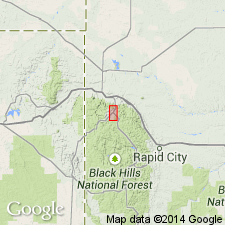
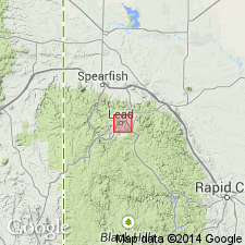
First published use as a name for some graphitic, sandy, or pyritic schists and quartzite 5,000 ft thick in the Lead area, Lawrence Co, SD in the Midcontinent region. Intent to name, designation of type, locality, and source of geographic name not stated. Unconformably overlies Northwestern formation. Underlies Grizzly formation. Of pre-Cambrian age.
Source: GNU records (USGS DDS-6; Denver GNULEX).
- Usage in publication:
-
- Flag Rock formation
- Modifications:
-
- Overview
- AAPG geologic province:
-
- Midcontinent region
Summary:
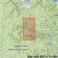
Known in few outcrops. Is heterogeneous in character. Thought to be 5,000 ft thick, but there may be some duplication due to folding. Rests unconformably on Northwestern formation. Most abundant rock type is the gray sericitic phyllite or schist. Also has sooty black schist or phyllite with abundant, widely distributed pyrite, a few beds of sandy schist, quartzite in bands 2 to 20 ft thick. Distribution map. Includes the Iron Dike, a dense, black, jaspery siliceous rock that is an alteration product of parts of the formation. Underlies Grizzly formation. Of pre-Cambrian age. Cross section. Present in the Black Hills area, SD in the Midcontinent region.
Source: GNU records (USGS DDS-6; Denver GNULEX).
- Usage in publication:
-
- Flag Rock Group*
- Modifications:
-
- Revised
- AAPG geologic province:
-
- Midcontinent region
Summary:
Raised in stratigraphic rank to Flag Rock Group in Lawrence and Pennington Cos, SD in the Midcontinent region. Divided into Montana Mine Formation, Nahant Schist, Rapid Creek Greenstone, and Rochford Formation, all named in this report. Overlies Irish Gulch Slate (new) unconformably. Underlies Poverty Gulch Slate (new). Very generalized description of lithology. Areal extent beyond report boundaries not discussed. Of middle Precambrian age. Geologic map.
Source: GNU records (USGS DDS-6; Denver GNULEX).

- Usage in publication:
-
- Flag Rock Group*
- Modifications:
-
- Age modified
- AAPG geologic province:
-
- Midcontinent region
Summary:
Mapped with an Early Proterozoic unit, Xb (pl. 1) in the Rochford area, Pennington Co, and in the Lead area, Lawrence Co, Midcontinent region, SD. Is younger than about 2.0 Ga and probably equivalent to Rochford Formation. Also called Flag Rock Formation. Geologic map.
Source: GNU records (USGS DDS-6; Denver GNULEX).
For more information, please contact Nancy Stamm, Geologic Names Committee Secretary.
Asterisk (*) indicates published by U.S. Geological Survey authors.
"No current usage" (†) implies that a name has been abandoned or has fallen into disuse. Former usage and, if known, replacement name given in parentheses ( ).
Slash (/) indicates name conflicts with nomenclatural guidelines (CSN, 1933; ACSN, 1961, 1970; NACSN, 1983, 2005, 2021). May be explained within brackets ([ ]).