
- Usage in publication:
-
- Fitch Formation*
- Modifications:
-
- Overview
- AAPG geologic province:
-
- New England province
Summary:
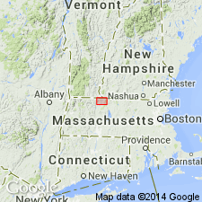
Used as Fitch Formation of Late Silurian age. Consists of calcsilicate granofels, biotite granofels, minor sulfidic schist, and marble. Correlated with fossiliferous Fitch Formation in western NH.
Source: GNU records (USGS DDS-6; Reston GNULEX).
- Usage in publication:
-
- Fitch Formation*
- Modifications:
-
- Age modified
- AAPG geologic province:
-
- New England province
Summary:
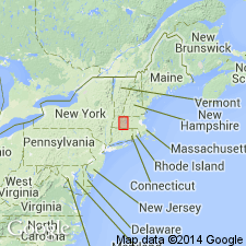
Conodonts indicative of earliest Devonian 'woschmidti' to 'eurekaensis' Zones recovered from regionally metamorphosed marbles of the lower amphibolite facies of the Fitch Formation at the fossil locality near Bernardston, MA, refine the age of the Fitch in this area and extend the regional upper age limit of the Fitch, and confirm the existence of the inverted limb of the Bernardston nappe.
Source: GNU records (USGS DDS-6; Reston GNULEX).
- Usage in publication:
-
- Fitch Formation*
- Modifications:
-
- Age modified
- Biostratigraphic dating
- AAPG geologic province:
-
- New England province
Summary:
Although the text and figures of this report show the Fitch as Silurian, a footnote [added just before this report went to press] cites a change in age from Silurian to Early Devonian based on conodonts found at the Bernardston, MA, locality, as reported in Elbert and others (1988). In Bronson Hill anticlinorium in MA, Fitch occurs as lenses between Clough Quartzite and Littleton Formation. Most common rock types in MA are gray, massive to weakly bedded, quartz-labradorite-biotite granulite containing a moderate amount of some combination of calc-silicate minerals (calcic amphibole, zoisite or clinozoisite, diopside, sphene, and microcline); commonly interbedded with biotite-free granulite that contains same calc-silicate minerals. One small exposure consists of nearly pure calcite marble. Larger lenses of Fitch consist of varieties of schist, similar to Partridge Formation. Best exposures are in low hills west of village of Orange, northeast of junction of MA Hwys 2A and 78. As shown on MA State bedrock geologic map, Fitch everywhere overlies Clough Quartzite and is never in contact with Partridge. Fossils dating the Fitch as Pridolian (Harris and others, 1983) are all from Littleton, NH, area [however, see mention of footnote, above]. [Papers presented as chapters in U.S. Geological Survey Professional Paper 1366 are intended as explanations and (or) revisions to MA State bedrock geologic map of Zen and others (1983) at scale of 1:250,000.]
Source: GNU records (USGS DDS-6; Reston GNULEX).
- Usage in publication:
-
- Fitch Formation*
- Modifications:
-
- Age modified
- AAPG geologic province:
-
- New England province
Summary:
Fitch Formation is of latest Silurian, Pridoli age, near Littleton, NH, and correlates with the Madrid Formation in this map area. [Fitch not shown on map; discussed in text only.]
Source: GNU records (USGS DDS-6; Reston GNULEX).
- Usage in publication:
-
- Fitch Formation*
- Modifications:
-
- Areal extent
- AAPG geologic province:
-
- New England province
Summary:
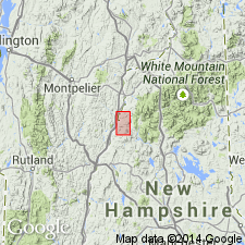
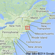
Bronson Hill autochthonous sequence, separated from Piermont allochthon by Foster Hill sole fault, consists of the mainly basaltic facies of the lower member of Ammonoosuc Volcanics (Middle Ordovician), Partridge Formation (Middle Ordovician), Clough Quartzite (Lower Silurian), Fitch Formation (Upper Silurian), and Littleton Formation (Lower Devonian). Fitch is exposed mainly east of Indian Pond pluton, but also locally to the west. Consists of calcareous metasandstone and schist, impure metalimestone, and calc-silicate rock. Report includes geologic map and correlation chart.
Source: GNU records (USGS DDS-6; Reston GNULEX).
- Usage in publication:
-
- Fitch Formation*
- Modifications:
-
- Overview
- AAPG geologic province:
-
- New England province
Summary:
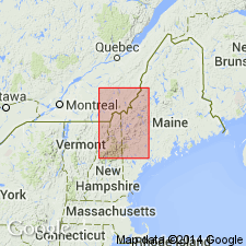
Fitch Formation in Ware subbelt of Merrimack belt corresponds to Fitch at Gee Mill in Lovewell Mountain area, NH; to rusty quartzite member of Littleton Formation in Monadnock quad, NH; and to Francestown Formation (formerly a member of Littleton Formation) in Peterborough, NH, area, and elsewhere in central and southern NH. With Francestown now at formation rank, these rocks could have been assigned to either Francestown or Fitch in MA, but correlation with Fitch elsewhere is still valid, such as in Connecticut valley in MA. Subordinate rusty-weathering sillimanite-graphite-pyrrhotite-biotite schist is very similar to schist in schist-quartzite unit of Paxton Formation.
Source: GNU records (USGS DDS-6; Reston GNULEX).
- Usage in publication:
-
- Fitch Formation*
- Modifications:
-
- Age modified
- Biostratigraphic dating
- AAPG geologic province:
-
- New England province
Summary:
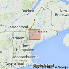
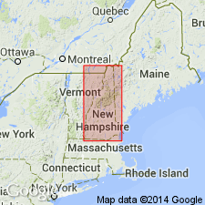
Mapped in Bronson Hill-Boundary Mountain anticlinorium. Mapped with certainty in areas of Littleton and Moosilauke, NH, 15-min quads, and with uncertainty in Second Connecticut Lake, NH, and Cupsuptic, ME, 15-min quads. Age is refined to Silurian, latest Ludlovian to Pridolian based on complex shelly fauna found at six localities in Littleton quad, and conodonts found at two of the same localities. Fossils were found in weakly metamorphosed limestone, calcareous and noncalcareous slate, grainstone, and packstone by Billings and Cleaves (1934) and by Harris and others (1983). In Arnold Pond 15-min quad, Ludlovian shelly fauna were found in calcareous slate, shaly limestone, and conglomeratic limestone mapped as Fitch(?) Formation based on work by Green (1968) and Harwood (1973). In Second Connecticut Lake 15-min quad, Ludlovian(?) fossils (corals, brachiopods, and crinoid columnals) were found in small outliers of clastic limestone (Green, 1968). Pridolian brachiopods and corals were found at one locality in arenaceous limestone mapped as Fitch(?) Formation at Parmachenee Lake in Cupsuptic 15-min quad, ME (Harwood, 1973).
Source: GNU records (USGS DDS-6; Reston GNULEX).
- Usage in publication:
-
- Fitch Formation*
- Modifications:
-
- Overview
- AAPG geologic province:
-
- New England province
Summary:
Used as Late Silurian (Ludlovian and Pridolian) Fitch Formation. Consists of metamorphosed limestone, calcareous sandstone, siltstone, and dark pelitic schist. Unit is fossiliferous. Lower contact is disconformable on Clough Quartzite. Also mapped undivided with Clough Quartzite in places. Report includes geologic map, cross sections, correlation chart, and four 1:500,000-scale derivative maps.
Source: GNU records (USGS DDS-6; Reston GNULEX).
For more information, please contact Nancy Stamm, Geologic Names Committee Secretary.
Asterisk (*) indicates published by U.S. Geological Survey authors.
"No current usage" (†) implies that a name has been abandoned or has fallen into disuse. Former usage and, if known, replacement name given in parentheses ( ).
Slash (/) indicates name conflicts with nomenclatural guidelines (CSN, 1933; ACSN, 1961, 1970; NACSN, 1983, 2005, 2021). May be explained within brackets ([ ]).

