

- Usage in publication:
-
- Fiss fanglomerate*
- Modifications:
-
- Original reference
- Dominant lithology:
-
- Fanglomerate
- AAPG geologic province:
-
- Mojave basin
- San Joaquin basin
Summary:
Pg. 137 (fig. 1), 138, 141. Fiss fanglomerate of Tropico group. Composed of ill-sorted cobbles and boulders of pinkish-brown rhyolitic volcanic and granitic rocks; crudely bedded; nonfossiliferous. Thickness at type section about 500 feet; 1 mile northwest 900 feet; at Antelope Buttes about 1,700 feet. Is upper unit of Tropico group. Overlies Gem Hill formation (new) of Tropico group, in places unconformably. Top is eroded, and, north of Rosamond, fanglomerate is unconformably overlain by gravel of probable Pleistocene(?) age. Age is considered Miocene(?), based on stratigraphic correlation.
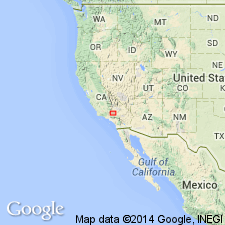
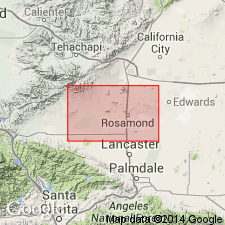
Type locality: Fiss Hill, [on west side of Mojave Tropico Road, 1+ mi south-southeast of Gem Hill], 1.5 mi north-northeast of Tropico mine, 4.5 mi northwest of Rosamond, in west-central part of sec. 1, T. 9 N., R. 13 W., San Bernardino Base and Meridian, [Lat. 34 deg. 54 min. 05 sec. N., Long. 118 deg. 13 min. 06 sec. W., Soledad Mountain 7.5-min quadrangle], Kern Co., southern CA. Crops out discontinuously about 8 mi along southwestern margin of Rosamond Hills from the west end 6 mi northwest of Rosamond to Red Hill.
[Additional locality information from USGS GNIS database and ACME Mapper 2.0, accessed May 3, 2018.]
Source: US geologic names lexicon (USGS Bull. 1200, p. GNU records (USGS DDS-6; Menlo GNULEX).
- Usage in publication:
-
- Fiss fanglomerate*
- Modifications:
-
- Overview
- AAPG geologic province:
-
- Mojave basin
Summary:
Distribution, detailed lithology, measured section at type locality, maps, correlation included. Is tentatively assigned to middle or late Miocene age based on correlation.
Source: GNU records (USGS DDS-6; Menlo GNULEX).
For more information, please contact Nancy Stamm, Geologic Names Committee Secretary.
Asterisk (*) indicates published by U.S. Geological Survey authors.
"No current usage" (†) implies that a name has been abandoned or has fallen into disuse. Former usage and, if known, replacement name given in parentheses ( ).
Slash (/) indicates name conflicts with nomenclatural guidelines (CSN, 1933; ACSN, 1961, 1970; NACSN, 1983, 2005, 2021). May be explained within brackets ([ ]).