

- Usage in publication:
-
- Fence Lake Formation*
- Modifications:
-
- Original reference
- Dominant lithology:
-
- Conglomerate
- Sandstone
- AAPG geologic province:
-
- San Juan basin
Summary:
Fence Lake Formation. Previously called upper member of Bidahochi Formation by Repenning and Irwin, 1954 (AAPG Bull., v. 38, no. 8, p. 1821-1826); lower part includes informal Fence Lake gravel of R.J. Marr (Univ. Texas MA thesis, 1956). At type, divided into (ascending): (1) a lower coarse conglomerate consisting of subrounded to subangular granules, pebbles, cobbles and boulders of basalt, rhyolite, and other volcanic rocks that are fine- to coarse-grained and poorly sorted, thickness 50 feet; and (2) an upper poorly sorted, very fine-grained to coarse-grained, calcareous, grayish-pink sandstone with a few lenses of conglomerate, thickness 180 feet. Unconformably overlies Upper Cretaceous upper member of Moreno Hill Formation. Interpreted as a fluvial deposit. Age is considered Miocene, based on derivation of clasts from Oligocene basaltic andesites and rhyolites of Datil-Mogollon area (citing John Hawley, personal commun., 1981-1982).
[See also entry under Bidahochi, and E.R. Landis and others, 1985, USGS Misc. Field Stud. Map MF-1750 (available online: http://ngmdb.usgs.gov/Prodesc/proddesc_7451.htm).]
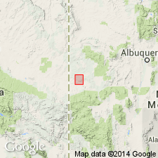
Type section: in sec. 1, T. 4 N., R. 18 W., [in vicinity of Lat. 34 deg. 36 min. 06 sec. N., Long. 108 deg. 40 min. 36 sec. W., Fence Lake SW 7.5-min quadrangle], southwestern Cibola Co., NM. Named from community of Fence Lake [north of type section, Fence Lake 7.5-min quadrangle], Cibola Co., NM.
[Additional locality information from USGS GNIS database and USGS historical topographic map collection TopoView, and Cibola County (est. 1981) government website; accessed July 25, 2018.]
Source: Publication.
For more information, please contact Nancy Stamm, Geologic Names Committee Secretary.
Asterisk (*) indicates published by U.S. Geological Survey authors.
"No current usage" (†) implies that a name has been abandoned or has fallen into disuse. Former usage and, if known, replacement name given in parentheses ( ).
Slash (/) indicates name conflicts with nomenclatural guidelines (CSN, 1933; ACSN, 1961, 1970; NACSN, 1983, 2005, 2021). May be explained within brackets ([ ]).