

- Usage in publication:
-
- Eutaw group
- Modifications:
-
- Original reference
- Dominant lithology:
-
- Clay
- Sand
- Lignite
- AAPG geologic province:
-
- Black Warrior basin
Summary:
Pg. 3, 61-68. Eutaw group. Bluish, black, or reddish laminated clays, often lignitic, alternating with and usually overlain by noneffervescent sands, mostly, though not always, poor in mica and of gray or yellow tint. Contains beds of lignite, and very rarely other fossils. Lowest Cretaceous formation in Mississippi. Underlies Tombigbee sand group. Overlies Carboniferous.
[Named from Eutaw, Greene Co., AL.]
Source: US geologic names lexicon (USGS Bull. 896, p. 708).

- Usage in publication:
-
- Eutaw formation*
- Modifications:
-
- Overview
- AAPG geologic province:
-
- Black Warrior basin
- Mid-Gulf Coast basin
- South Georgia sedimentary province
- Upper Mississippi embayment
Summary:
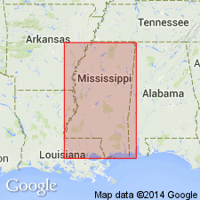
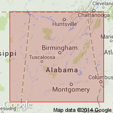
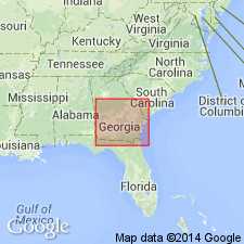
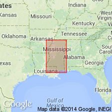
Eutaw formation. Age is Late Cretaceous. Recognized in western Georgia, Alabama, eastern and northern Mississippi, and western Tennessee.
[Post-1860] studies revealed that Coffee sand of J.M. Safford is lithologically like but younger than Eutaw group of E.W. Hilgard, and that in northern Mississippi it is underlain by a sand lithologically like Tombigbee sand of Alabama and forming the upward extension of that sand. The Coffee sand and Tombigbee sand were therefore for many years treated by the USGS and Mississippi Geol. Survey as members of Eutaw formation (See L.W. Stephenson, Georgia Geol. Survey Bull. 26, pl. 5, 1911; Washington Acad. Sci. Jour., v. 7, no. 9, 1917; and USGS Water Supply Paper 576, 1928). Further studies, however, led Stephenson to opinion that Coffee sand should be treated as a distinct formation, and in March, 1936, it was decided to remove it from Eutaw formation. It grades laterally into basal part of Selma chalk, but is lithologically distinct.
In central and western Alabama, the Eutaw formation as now [ca. 1936] defined is overlain by Selma chalk, with which it intertongues. In eastern Alabama and western Georgia it is overlain by Ripley formation. In northeastern Mississippi, it is overlain in places by Selma chalk, and in other places by Coffee sand. In western Tennessee it is everywhere separated from Selma chalk by Coffee sand. In western Tennessee it is in places underlain by Tuscaloosa formation and in other places it rests on Paleozoic rocks; in Mississippi and Alabama, it is underlain by Tuscaloosa formation.
Source: US geologic names lexicon (USGS Bull. 896, p. 708).
- Usage in publication:
-
- Eutaw formation*
- Modifications:
-
- Revised
- AAPG geologic province:
-
- Black Warrior basin
Summary:
Pg. 1642 (fig. 2), 1648-1649. Eutaw formation includes Tombigbee sand member at top. Underlies (west to east) Coffee sand, Mooreville tongue of Selma chalk, and Blufftown formation. Blufftown formation, as defined here, includes additional beds below Blufftown marl (as originally defined) that were correlated with upper part of Eutaw by Veatch (Georgia Geol. Survey Bull., no. 18, 1909) and with "typical beds of Eutaw" by Stephenson (1911). [Age is Late Cretaceous.]
Source: US geologic names lexicon (USGS Bull. 1200, p. 1298-1299).
- Usage in publication:
-
- Eutaw formation*
- Modifications:
-
- Revised
- AAPG geologic province:
-
- South Georgia sedimentary province
Summary:
Pg. 13-17. Eutaw formation. As herein described, formation in Georgia is restricted to beds that Stephenson (Georgia Geol. Survey Bull., no. 26, 1911) thought lay below Tombigbee sand member, but has since discovered that they are equivalent to it. Beds that Stephenson called Tombigbee sand member are herein called Blufftown formation. Eutaw is more than 100 feet thick. Base of formation is littoral deposit of coarse gray or iron-stained cross-bedded sand; remainder consists chiefly of platy sandy clay and clayey sand. Unconformably overlies Tuscaloosa formation; unconformably underlies Blufftown formation. [Age is Late Cretaceous.]
Source: US geologic names lexicon (USGS Bull. 1200, p. 1298-1299).
- Usage in publication:
-
- Eutaw formation
- Modifications:
-
- Mapped
- AAPG geologic province:
-
- Black Warrior basin
- Mid-Gulf Coast basin
Summary:
Eutaw formation. As mapped in Mississippi, includes Tombigbee sand member; overlies Tuscaloosa formation, undifferentiated. [Age is Late Cretaceous.]
Source: US geologic names lexicon (USGS Bull. 1200, p. 1298-1299).
- Usage in publication:
-
- Eutaw formation*
- Modifications:
-
- Revised
- AAPG geologic province:
-
- Black Warrior basin
Summary:
Eutaw formation. Restricted at base to exclude glauconitic cross-bedded sand, gravelly sand, and laminated clay beds herein named McShan formation. [Age is Late Cretaceous.]
Source: US geologic names lexicon (USGS Bull. 1200, p. 1298-1299).
- Usage in publication:
-
- Eutaw formation
- Modifications:
-
- Areal extent
Summary:
Pg. 188 (fig. 1), 207-210. Eutaw formation. Unconformably overlies McShan formation and apparently overlaps it toward north. Underlies Mooreville chalk. Includes Tombigbee sand member at top. Thickness about 175 feet. [Age is Late Cretaceous.]
Source: US geologic names lexicon (USGS Bull. 1200, p. 1298-1299).
- Usage in publication:
-
- Eutaw formation
- Modifications:
-
- Revised
- AAPG geologic province:
-
- Mid-Gulf Coast basin
Summary:
Map legend shows Eutaw formation in Selma group.
Source: US geologic names lexicon (USGS Bull. 1200, p. 1298-1299).
- Usage in publication:
-
- Eutaw formation*
- Modifications:
-
- Areal extent
- AAPG geologic province:
-
- South Georgia sedimentary province
Summary:
Pg. 23-32. Eutaw formation. In Georgia, formation in Chattahoochee River Valley consists of basal bed containing coarse grains of quartz sand and other detrital materials as well as borings of HALYMENITES MAJOR. Basal sand is overlain by dark-gray soft shale interbedded with fine white sand. Toward the east formation apparently becomes nonmarine and consists of pale-tinted sands containing a few thin beds of clay. Thickness about 125 feet in Chattahoochee Valley; thins toward the east, possibly owing in part to overlap, to about 77 feet in Marion County. East of Flint River, cannot be differentiated from overlying Blufftown formation. Overlies Tuscaloosa formation. Crops out along narrow belt from Chattahoochee River to Flint River; east of Flint River, forms base of sequence of rocks so similar lithologically that Eutaw and overlying rocks up to base of Ripley formation cannot be differentiated. [Age is Late Cretaceous.]
Source: US geologic names lexicon (USGS Bull. 1200, p. 1298-1299).
- Usage in publication:
-
- Eutaw formation
- Modifications:
-
- Areal extent
- AAPG geologic province:
-
- Black Warrior basin
Summary:
Pg. 22 (table 2), 30-40, pl. 3. Eutaw, in this report [Prentiss County], refers to strata between McShan formation below and Coffee formation above and includes two distinct units: the lower typical Eutaw beds, and Tombigbee sand member. Thickness 185 to 225 feet. [Age is Late Cretaceous.]
Source: US geologic names lexicon (USGS Bull. 1200, p. 1298-1299).
- Usage in publication:
-
- Eutaw Group, Formation, Member
- Modifications:
-
- Revised
- AAPG geologic province:
-
- Black Warrior basin
Summary:
"In the absence of new nomenclature concerning the Eutaw, the name is utilized in this report as defined in Stephenson and Monroe (1938 and 1940) as Eutaw Group, Formation, and Member designations." The McShan Formation is the lowermost unit of the Eutaw Group and unconformably overlies the Tuscaloosa Group. The Eutaw Formation overlies the McShan Formation and underlies the Selma Group. The Eutaw Formation is divided into the Lower Eutaw Member (Counce Member of Russell, 1965) and the upper Tombigbee Sand Member. The Lower Eutaw Member is 180 to 550 ft thick downdip, in the subsurface of MS, and contains an abundance of red-brown shale and pyroclastic material locally. Thickness is 120 to 150 ft thick in east-central MS and west-central AL. [Usage in this report is not is accordance with the 1983 North American Stratigraphic Code.]
Source: GNU records (USGS DDS-6; Reston GNULEX).

- Usage in publication:
-
- Eutaw Formation
- Modifications:
-
- Areal extent
- AAPG geologic province:
-
- Mid-Gulf Coast basin
Summary:
Eutaw Formation described here as light-greenish-gray fine- to medium-grained well-sorted micaceous cross-bedded sand that is fossiliferous and glauconitic in part and contains beds of greenish-gray micaceous, silty clay and medium-dark-gray carbonaceous clay. Thickness is 350 to 400 ft in outcrop in western and central AL. The formation thins eastward to 100 to 150 ft in easternmost AL. Downdip in southwestern AL, the Eutaw thins to about 200 ft. The Tombigbee Sand Member is present locally in west-central AL in the upper part of the formation. Age is Late Cretaceous (Santonian-Campanian).
Source: GNU records (USGS DDS-6; Reston GNULEX).
- Usage in publication:
-
- Eutaw Formation*
- Modifications:
-
- Age modified
- AAPG geologic province:
-
- Black Warrior basin
- Mid-Gulf Coast basin
Summary:
In MS the Austinian-Tayloran boundary occurs within the Mooreville Formation approximately 21+/-6 m above the Santonian-Campanian boundary. In AL the Santonian-Campanian boundary occurs within the Mooreville, approximately 35 m above the Eutaw-Mooreville contact, and the Austinian-Tayloran boundary occurs within the Mooreville approximately 36.5 m above the Santonian-Campanian boundary. The Arcola Limestone Member of the Mooreville, previously used to designate the Austinian-Tayloran boundary, lies well within the Tayloran Stage. In eastern MS the Santonian-Campanian boundary occurs within the Tombigbee Sand Member of the Eutaw Formation.
Source: GNU records (USGS DDS-6; Reston GNULEX).

- Usage in publication:
-
- Eutaw Formation
- Modifications:
-
- Areal extent
- AAPG geologic province:
-
- Black Warrior basin
Summary:
Tombigbee has been considered a member of the Eutaw Formation since Stephenson (1911). Though the two are without a doubt closely related, the Tombigbee is a lithologically distinct, mappable unit, and it is frequently very fossiliferous, while the typical Eutaw is not. It was deposited in a quiet zone transitional to shelf muds unlike the lower Eutaw, which was deposited in shallow, high-energy near-shore waters. Author suggests that perhaps the Tombigbee should be removed from the Eutaw.
Source: GNU records (USGS DDS-6; Reston GNULEX).
- Usage in publication:
-
- Eutaw Formation
- Modifications:
-
- Areal extent
- AAPG geologic province:
-
- Mid-Gulf Coast basin
Summary:
Eutaw Formation crops out in an arcuate band that extends 225 mi across the central part of AL. In the western half of the State, the outcrop band is approximately 20 mi wide, but narrows to 5 mi eastward. Maximum thickness in western portion is 500 ft. Ranges from 175 to 275 in the east. Lower portion of the Eutaw, which overlies the Gordo Formation of the Tuscaloosa Group, is composed of an unnamed well-developed basal transgressive sand. Consists of coarse sand, gravel, and phosphate nodules at the base and an overlying fining upward sequence of fine- to medium-grained sand and clay laminae. Thickness of this lower interval varies from 5 to 60 ft. Middle portion consists of unnamed discontinuous greenish-gray, cross-bedded, fine- to medium-grained, micaceous, fossiliferous, glauconitic sand, interbedded with gray, thinly laminated, micaceous, carbonaceous clay, and local phosphate. Upper portion is Tombigbee Sand Member, which extends from central AL northwestward into eastern MS. Tombigbee is composed of massive, fossiliferous, glauconitic and micaceous, fine-grained sand and silt interbedded with calcareous sandstone, silty clay, and local bentonite and phosphate. Gradationally underlies the Mooreville Chalk of the Selma Group in western AL and the Blufftown Formation of the Selma in eastern AL. Age is Late Cretaceous.
Source: US geologic names lexicon (USGS Bull. 1200, p. 1298-1299).
- Usage in publication:
-
- Eutaw Formation
- Modifications:
-
- Biostratigraphic dating
- AAPG geologic province:
-
- Mid-Gulf Coast basin
Summary:
In a composite reference section established in this report in Dallas Co., central AL, along the Alabama and Cahaba Rivers, the Tombigbee Sand Member of the Eutaw Formation and the lower 104 ft of the Mooreville Chalk are of late Santonian age as defined by the presence of DICARINELLA ASYMETRICA. The interval from 104 ft above the base of the Mooreville to 265 ft above the base of the Demopolis Chalk is assigned to the GLOBOTRUNCANITA ELEVATA Interval Zone of early to late Campanian age. The upper 95 ft of the Demopolis Chalk and the lower 50 ft of the Ripley Formation are assigned to the G. TRICARINATA Interval zone (early Maastrichtian). The ages of the stratigraphic units defined herein on the basis of a composite reference section in central AL using planktonic Foraminifera and ostracodes agree well with previous studies using calcareous microfossils. However, the ages of the units as published by King and Skotnicki (1992) and King (1993) are not based on any biostratigraphic or chronostratigraphic data and are suspect.
Source: GNU records (USGS DDS-6; Reston GNULEX).
For more information, please contact Nancy Stamm, Geologic Names Committee Secretary.
Asterisk (*) indicates published by U.S. Geological Survey authors.
"No current usage" (†) implies that a name has been abandoned or has fallen into disuse. Former usage and, if known, replacement name given in parentheses ( ).
Slash (/) indicates name conflicts with nomenclatural guidelines (CSN, 1933; ACSN, 1961, 1970; NACSN, 1983, 2005, 2021). May be explained within brackets ([ ]).