- Usage in publication:
-
- Esmond Granite*
- Modifications:
-
- Age modified
- Areal extent
- Revised
- AAPG geologic province:
-
- New England province
Summary:
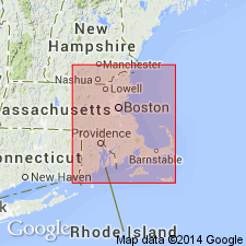
Age changed from Late Ordovician to Proterozoic Z following work by Hermes and others (1981). Has similar spatial and textural characteristics to Proterozoic Z granites of southeastern MA and northern RI. Extends from RI into MA in the Blackstone area. Granite that Emerson (1917) mapped as Milford Granite in RI is mapped now mostly as Esmond Granite (Quinn, 1971), thus restricting Milford to MA.
Source: GNU records (USGS DDS-6; Reston GNULEX).

- Usage in publication:
-
- Esmond Granite*
- Modifications:
-
- Overview
- AAPG geologic province:
-
- New England province
Summary:
Used as Esmond Granite of Proterozoic Z age. Gradational with Grant Mills Granodiorite. Intrudes Scituate Granite.
Source: GNU records (USGS DDS-6; Reston GNULEX).

- Usage in publication:
-
- Esmond Granite, Plutonic Suite
- Modifications:
-
- Revised
- Dominant lithology:
-
- Granite
- Quartz diorite
- Gabbro
- AAPG geologic province:
-
- New England province
Summary:
The Esmond Plutonic Suite of this report consists predominantly of the Esmond Granite, but also includes the Grant Mills Granodiorite, which grades into the Esmond Granite in the Pawtucket quad., and an unnamed quartz diorite, which is intruded by the Esmond Granite. As a suite, the Esmond is described as calc-alkaline, ranging from coarse- to fine-grained gabbro to quartz-diorite to two-feldspar granite and is massive to foliated. The Esmond Granite intrudes the Blackstone Group and has been correlated recently with the Dedham Plutonic Suite. Previous correlation with the Milford Granite (MA) is discredited. Age is Late Proterozoic based on U-Th-Pb (zircon) dating by Hermes and Zartman (1985) who record a 621+/-8 Ma emplacement date. [Usage in this report is not recommended. According to Article 41 of the NASC, "the geographic name of a suite may not be the same as that of a component lithodeme. Intrusive assemblages, however, may share the same geographic name if an intrusive lithodeme is representative of the suite."]
Source: GNU records (USGS DDS-6; Reston GNULEX).

- Usage in publication:
-
- Esmond Granite*
- Modifications:
-
- Overview
- Geochronologic dating
- AAPG geologic province:
-
- New England province
Summary:
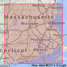
Esmond Granite occupies nearly 100 sq km in RI and forms an elongate pluton southeast of Woonsocket, RI, of which only the northern part is in MA. Occurs in Dedham batholith. Consists of mottled red and green, mainly massive granite. Coarse-grained facies intrudes Blackstone Group rocks and a related tonalite; fine-grained facies intrudes the tonalite and coarse-grained facies (Hermes and Zartman, 1985). Contact relations with Milford Granite not known, although phases of Milford resemble Esmond. Age of 621 +/-8 Ma (U/Pb methods on zircon by Hermes and Zartman, 1985) is close to age of Milford. Report includes geologic maps. [Papers presented as chapters in U.S. Geological Survey Professional Paper 1366 are intended as explanations and (or) revisions to MA State bedrock geologic map of Zen and others (1983) at scale of 1:250,000.]
Source: GNU records (USGS DDS-6; Reston GNULEX).
For more information, please contact Nancy Stamm, Geologic Names Committee Secretary.
Asterisk (*) indicates published by U.S. Geological Survey authors.
"No current usage" (†) implies that a name has been abandoned or has fallen into disuse. Former usage and, if known, replacement name given in parentheses ( ).
Slash (/) indicates name conflicts with nomenclatural guidelines (CSN, 1933; ACSN, 1961, 1970; NACSN, 1983, 2005, 2021). May be explained within brackets ([ ]).

