

- Usage in publication:
-
- Ely Greenstone*
- Modifications:
-
- Overview
- AAPG geologic province:
-
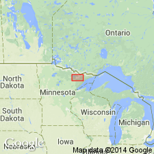
- Lake Superior region
Summary:
In the western part of the Vermilion district of northeastern MN, in Lake Superior region, is divided into a lower member--the Soudan Iron-formation--and an upper member. The lower unit consists of mafic, dominantly pillowed lava as much as 3,000 m thick; the middle unit, or Soudan Iron-formation Member, is iron-bearing with intermediate-mafic pyroclastic rocks as much as 150 m thick; and an upper unit of mafic lava, pyroclastic rocks, diabasic gabbro, and iron-formation as much as 3,600 m thick. Is oldest unit in district. Overlain by Knife Lake Group in central part of district, and by Lake Vermilion Formation in western part. Geologic history, structural relationships, geologic map, table of stratigraphic units. Is of early Precambrian age.
Source: GNU records (USGS DDS-6; Denver GNULEX).

- Usage in publication:
-
- Ely Greenstone*
- Modifications:
-
- Overview
- AAPG geologic province:
-
- Lake Superior region
Summary:
Is present in the Vermilion district of northern MN in the greenstone-granite terrane of Lake Superior region, northern MN. Is an interlayered sequence of metavolcanic and metasedimentary rocks that interfingers with and is overlain by Lake Vermilion Formation or Knife Lake Group. Stratigraphic relations obscured at east end of district by Sanganga batholith. Geologic map and generalized cross section. Shown as "stratified rocks of Vermilion district" on correlation chart. Is of Late Archean age.
Source: GNU records (USGS DDS-6; Denver GNULEX).
For more information, please contact Nancy Stamm, Geologic Names Committee Secretary.
Asterisk (*) indicates published by U.S. Geological Survey authors.
"No current usage" (†) implies that a name has been abandoned or has fallen into disuse. Former usage and, if known, replacement name given in parentheses ( ).
Slash (/) indicates name conflicts with nomenclatural guidelines (CSN, 1933; ACSN, 1961, 1970; NACSN, 1983, 2005, 2021). May be explained within brackets ([ ]).