

- Usage in publication:
-
- Ellensburg sandstone*
- Modifications:
-
- Named
- Dominant lithology:
-
- Sandstone
- Conglomerate
- AAPG geologic province:
-
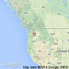
- Columbia basin
Summary:
Pg. 100-137, map. Ellensburg sandstone. Sandstones, loose incoherent conglomerates, sheets of volcanic lapilli and white volcanic dust. Thickness 800 to 1,000 feet. Is of fresh-water origin. Fossil plants are upper Miocene, according to F.H. Knowlton. Floors Kittitas Valley, [Kittitas Co., central WA], in which town of Ellensburg is situated. Separated from underlying Roslyn sandstone by several sheets of Columbia lava and associated tuffs.
[GNC remark (ca. 1938, US geologic names lexicon, USGS Bull. 896, p. 674): In 1901 (USGS Water-Supply Paper 55) G.O. Smith applied name Yakima basalt to the basalt underlying Ellensburg formation, and gave thickness of Ellensburg as 1,600 feet.]
Source: US geologic names lexicon (USGS Bull. 896, p. 674); supplemental information from GNU records (USGS DDS-6; Menlo GNULEX).
- Usage in publication:
-
- Ellensburg formation*
- Modifications:
-
- Adopted
- Mapped
- AAPG geologic province:
-
- Columbia basin
Summary:
See also USGS Prof. Paper 19. Ellensburg formation. Consists of 1,570 feet of largely volcanic sedimentary deposits, the sandstones and shales composed of finely comminuted andesitic material and the conglomerates containing pebbles and boulders of andesitic lavas. In Yakima region it is of fluviatile origin, while farther east along the Columbia it is truly lacustrine. The lava flows interbedded in lower part are here named Wenas basalt. Age is late Miocene, based on fossil leaves and HIPPARION remains.
[GNC remark (ca. 1938, US geologic names lexicon, USGS Bull. 896, p. 674): The beds farther east along the Columbia are now known to be younger than Ellensburg formation, and to be of Pleistocene age. They have been named Ringold formation by J.C. Merriam and J.P. Buwalda.]
Source: US geologic names lexicon (USGS Bull. 896, p. 674); supplemental information from GNU records (USGS DDS-6; Menlo GNULEX).

- Usage in publication:
-
- Ellensburg formation*
- Modifications:
-
- Overview
- AAPG geologic province:
-
- Columbia basin
Summary:
In 1924 Knowlton was inclined to classify Ellensburg flora as middle Miocene. In 1930 J.C. Merriam and J.P. Buwalda classified Ellensburg as late Miocene or [early] Pliocene, which was age designation given to it in 1918 by H.F. Osborn. E.W. Berry (1932) considered this flora in need of careful study.
Source: US geologic names lexicon (USGS Bull. 896, p. 674).
- Usage in publication:
-
- Ellensburg formation*
- Modifications:
-
- Revised
- AAPG geologic province:
-
- Columbia basin
Summary:
Includes Selah tuff member (new) which underlies Wenas basalt member.
Source: US geologic names lexicon (USGS Bull. 1200, p. 1239).
- Usage in publication:
-
- Ellensburg formation*
- Modifications:
-
- Areal extent
- AAPG geologic province:
-
- Columbia basin
Summary:
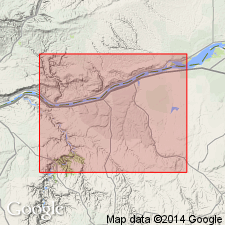
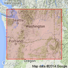
Mapped and described in Yakima East 15-min quadrangle, Yakima County, Washington, where it interfingers with underlying Yakima basalt. Interstratified basalt flows are (ascending) Wenas flow, Selah Butte flow (new), and Elephant Mountain flow (new). Present mapping indicates that contact between any one basalt flow and overlying sedimentary bed cannot serve as workable horizon for defining top of Yakima basalt and base of Ellensburg. At one locality Ellensburg pinches out and Wenas basalt rests directly on Yakima. In broad sense, entire lower part of Ellensburg can be considered marginal sedimentary facies of Yakima basalt flows. Much of Ellensburg is regarded as Pliocene. Map bracket shows Miocene and Pliocene age.
Source: GNU records (USGS DDS-6; Menlo GNULEX).
- Usage in publication:
-
- Ellensburg formation*
- Modifications:
-
- Age modified
- AAPG geologic province:
-
- Columbia basin
Summary:
Unit is alluvial deposit of volcanic detritus at least 1,600 feet thick that was transported eastward into central Washignton from position of present Cascades. Waters (1955) considered unit to be early Pliocene on basis of new finds of vertebrate fossils and fresh-water gastropods and suggested base of Ellensburg is probably placed at different stratigraphic positions in different areas. Problem of age is further complicated by fact that paleobotanists and other paleontologists are not agreed upon placement of Miocene-Pliocene boundary. Hence age is uncertain but unit is likely late Miocene and early Pliocene age.
Source: GNU records (USGS DDS-6; Menlo GNULEX).
- Usage in publication:
-
- Ellensburg Formation
- Modifications:
-
- Revised
- AAPG geologic province:
-
- Eastern Columbia basin
Summary:
Ellensburg Formation revised. Flow called Wenas Basalt in earlier reports, and believed to be continuous over much of Vantage-Priest Rapids area, is here designated Saddle Mountains Basalt Member (new) of Ellensburg Formation. Term "Beverly," originally used by Twiss (1933, unpub. thesis) for pumicite bed in sedimentary rocks beneath Saddle Mountains (Wenas) in Sentinel Gap section is here redefined to include all sedimentary rock and intercalated basalt between top of Yakima Basalt and base of Saddle Mountains in that section.
Source: US geologic names lexicon (USGS Bull. 1350, p. 62-63, 653, entries under Beverly and Saddle Mountains).
- Usage in publication:
-
- Ellensburg Formation*
- Modifications:
-
- Age modified
- AAPG geologic province:
-
- Columbia basin
Summary:
It is generally agreed that middle part of Ellensburg Formation is early Pliocene age (Axelrod, 1950; Chaney and Axelrod, 1959), although question of whether the lower part is late Miocene or early Pliocene age "has never been fully resolved."
Source: GNU records (USGS DDS-6; Menlo GNULEX).
- Usage in publication:
-
- Ellensburg Formation*
- Modifications:
-
- Age modified
- AAPG geologic province:
-
- Columbia basin
Summary:
Mapped in Ahtanum Valley, Yakima County, Washington. Underlies gravels of upland benches in vicinity of the Narrows and crops out in bands along slopes of Ahtanum Ridge and Sedge Ridge. Main body is principally indurated clay, silt, and sand with interbedded strata of unconsolidated sand and gravel; thickness 1,000 feet. Underlies Pleistocene cemented gravel. Apparently conformably overlies Yakima basalt. Probably deposited during Pliocene.
Source: GNU records (USGS DDS-6; Menlo GNULEX).
- Usage in publication:
-
- Ellensburg Formation*
- Modifications:
-
- Areal extent
- AAPG geologic province:
-
- Eastern Columbia basin
Summary:
Pg. G3 (fig. 1), G12-G14. Ellensburg Formation. Consists of (ascending): Beverly Member, pumicite, quartzite-bearing conglomerate, and tuffaceous sand, silt, and clay, 300 feet thick; and undifferentiated pebble conglomerate, sand, and mudflows, 1,800 feet thick. Beverly Member is intertongued with the Saddle Mountains Member of Yakima Basalt of Columbia River Group. Age is late Miocene to early Pliocene on basis of fossil evidence (citing Smiley, 1963, Ellensburg flora, Univ. Calif. Pub. Geol. Sci., v. 35, no. 3, p. 206).
Source: Publication.
- Usage in publication:
-
- Ellensburg Formation
- Modifications:
-
- Areal extent
- AAPG geologic province:
-
- Columbia basin
Summary:
Rattlesnake Ridge and Selah "members" of Ellensburg Formation are extended into Arlington-Shutler Flat area, Oregon, in surface and subsurface.
Source: GNU records (USGS DDS-6; Menlo GNULEX).
- Usage in publication:
-
- Ellensburg Formation*
- Modifications:
-
- Revised
- Age modified
- AAPG geologic province:
-
- Columbia basin
Summary:
Ellensburg Formation subdivided and age modified. Divided into (ascending) Vantage and Squaw Creek Members (both now renamed and reassigned from Yakima Basalt) and Beverly Member. Vantage Sandstone Member of Bingham and Grolier (1966) is renamed Vantage Member and reassigned to Ellensburg as lowermost member because it merges laterally and cannot be separated from the Ellensburg. Squaw Creek Diatomite Bed of Frenchman Springs Member and Quincy Diatomite Bed of Priest Rapids Member (both of Yakima Basalt; of Bingham and Grolier, 1966) are here renamed Squaw Creek Member and reassigned to Ellensburg as middle member. Reinterpretation of age of vertebrate fossils from the Ellensburg by C.A. Repenning (written commun., 1977) is late Miocene. Age of Ellensburg modified from late Miocene and early Pliocene --to-- middle and late Miocene [based also on stratigraphic relations].
[NOTE: The Department of the Interior's Secretarial Order 3404, issued on November 19, 2021, formally identifies the term “squaw” as derogatory. That Order will create a federal Derogatory Geographic Names Task Force, to find replacement names for geographic features in use by federal agencies. We’re awaiting guidance from the Task Force, and will then take the appropriate actions.]
Source: GNU records (USGS DDS-6; Menlo GNULEX); Changes in stratigraphic nomenclature, 1979 (USGS Bull. 1502-A, p. A81).
For more information, please contact Nancy Stamm, Geologic Names Committee Secretary.
Asterisk (*) indicates published by U.S. Geological Survey authors.
"No current usage" (†) implies that a name has been abandoned or has fallen into disuse. Former usage and, if known, replacement name given in parentheses ( ).
Slash (/) indicates name conflicts with nomenclatural guidelines (CSN, 1933; ACSN, 1961, 1970; NACSN, 1983, 2005, 2021). May be explained within brackets ([ ]).