

- Usage in publication:
-
- Edgecumbe volcanics*
- Modifications:
-
- Named
- Dominant lithology:
-
- Basalt
- Volcanics
- Pyroclastics
- AAPG geologic province:
-
- Alaska Southeastern region
Summary:
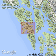
Named from Mount Edgecumbe, now dormant volcano which may have been active in historic time. Forms south half of Kruzof Island, southeastern AK. Is almost entirely post-glacial basaltic and andesitic lava and pyroclastic debris. Unconformably overlies vertical beds of Sitka Group (new) on north shore of Mud Bay and near Port Krestof. Nonconformably overlies quartz diorite of Jurassic or Cretaceous age on south shore of Mud Bay and probably on some of Magoun Islands. Assigned Holocene age.
Source: GNU records (USGS DDS-6; Menlo GNULEX).
- Usage in publication:
-
- Edgecumbe Volcanics*
- Modifications:
-
- Age modified
- AAPG geologic province:
-
- Alaska Southeastern region
Summary:
Map legend shows age as Pleistocene and Holocene. Consists mainly of basalt flows of tholeiitic affinities extruded from Mt. Edgecumbe and nearby vents.
Source: GNU records (USGS DDS-6; Menlo GNULEX).
- Usage in publication:
-
- Edgecumbe Volcanics*
- Modifications:
-
- Overview
- AAPG geologic province:
-
- Alaska Southeastern region
Summary:
Subdivided into 14 lithologic units; most units shown in correlation chart and on geologic sketch map of Mount Edgecumbe volcanic field. Detailed lithology, chemical analyses and petrogenesis of units included in report. Age of Edgecumbe Volcanics is late Wisconsin (Pleistocene and Holocene)
Source: GNU records (USGS DDS-6; Menlo GNULEX).
For more information, please contact Nancy Stamm, Geologic Names Committee Secretary.
Asterisk (*) indicates published by U.S. Geological Survey authors.
"No current usage" (†) implies that a name has been abandoned or has fallen into disuse. Former usage and, if known, replacement name given in parentheses ( ).
Slash (/) indicates name conflicts with nomenclatural guidelines (CSN, 1933; ACSN, 1961, 1970; NACSN, 1983, 2005, 2021). May be explained within brackets ([ ]).