

- Usage in publication:
-
- Echo Lake granodiorite
- Modifications:
-
- Named
- Dominant lithology:
-
- Granodiorite
- AAPG geologic province:
-
- Sierra Nevada province
Summary:
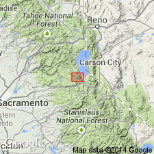
Shown on geologic sketch map of Mt. Tallac roof remnant in Fallen Leaf Lake 15' quad, El Dorado Co, CA. Intrudes Triassic(?) and Jurassic metasedimentary and metavolcanic rocks.
Source: GNU records (USGS DDS-6; Menlo GNULEX).
- Usage in publication:
-
- Echo Lake Granodiorite*
- Modifications:
-
- Adopted
- Age modified
- AAPG geologic province:
-
- Sierra Nevada province
Summary:
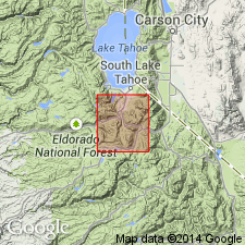
Echo Lake Granodiorite of Loomis (1966) is here adopted. Type locality designated as exposures on north shore of Lower Echo Lake, E/2 sec.35 and W/2 sec.36 T12N R17E, Fallen Leaf Lake 15' quad, El Dorado Co, CA. Consists of light-gray, medium-grained, weakly porphyritic biotite granodiorite. Commonly weathers to pale-orangish-gray grus. Age is Late Cretaceous on basis of K-Ar ages of 91.7 +/-.08 Ma on hornblende and 72.8 +/-1.0 Ma on biotite (R.W. Kistler, oral commun., 1981). Shown on map of Freel and Dardanelles Further Planning Area.
Source: GNU records (USGS DDS-6; Menlo GNULEX).
- Usage in publication:
-
- Echo Lake granodiorite
- Modifications:
-
- Age modified
- Geochronologic dating
- AAPG geologic province:
-
- Sierra Nevada province
Summary:
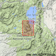
Composed of hornblende-biotite granodiorite that is exposed north and east of Echo Lake over 6 SW mi but is covered by glacial debris and lake sedimentary deposits for at least 10 to 15 sq mi in Lake Valley and Fallen Leaf Lake area in Fallen Leaf Lake 15' quad, El Dorado Co, CA. Most of pluton is granodiorite but locally it is quartz monzonite. Intrudes Keiths Dome quartz monzonite. Is intruded by Bryan Meadow granodiorite. K-Ar ages on biotite of 87.8 Ma and on hornblende of 91.4 Ma were obtained by Evernden and Kistler (1970). Age shown on map of quad is Cretaceous.
Source: GNU records (USGS DDS-6; Menlo GNULEX).
For more information, please contact Nancy Stamm, Geologic Names Committee Secretary.
Asterisk (*) indicates published by U.S. Geological Survey authors.
"No current usage" (†) implies that a name has been abandoned or has fallen into disuse. Former usage and, if known, replacement name given in parentheses ( ).
Slash (/) indicates name conflicts with nomenclatural guidelines (CSN, 1933; ACSN, 1961, 1970; NACSN, 1983, 2005, 2021). May be explained within brackets ([ ]).