

- Usage in publication:
-
- East Mesa Basalt*
- Modifications:
-
- Named
- Mapped 1:31,680
- Dominant lithology:
-
- Basalt
- AAPG geologic province:
-
- Plateau sedimentary province
Summary:
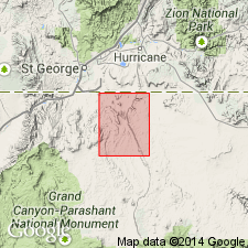
Named for occurrence on East Mesa which is designated as its type area and is located in Ts40,41, R10W, northern Mohave Co, AZ, Plateau sedimentary province. Mapped in type area within north-central part of map area. Forms top of East Mesa, including Joe Blake Hill, a northwesterly extension of East Mesa. Consists of three separately mapped volcanic deposits: 1) Basalt flows--dark-gray, massive, finely crystalline, aphanitic basalt; surface partly covered with fine-grained calcite and silt deposits or cinder and scoria deposits; about 9-55 m thick. 2) Intrusive dike or plug--dark-gray, finely crystalline, aphanitic; weathers into crumbly small fragments due to abundant cooling joints; source vents for basalt flows. 3) Cinder and scoria deposits--red-brown and black clasts of angular basalt deposits; unconsolidated; form cinder cones and thin cover on basalt flows; slope forming; up to 50 m or more thick. Similar in lithology and elevation, though slightly younger, as newly named West Mesa Basalt about 2 km to south. Flows traveled northwest down mostly bedrock surface of Shnabkaib Member, middle red member, and Virgin Limestone Member of Moenkopi Formation, and over some thin alluvial deposits. Younger than Pliocene Seegmiller Mountain and Black Rock Canyon Basalts (new). K-Ar whole rock age of 1.4 +/-0.25 Ma (Pleistocene) (Harold H. Mehnert, USGS, written commun., 1993).
Source: GNU records (USGS DDS-6; Denver GNULEX).
For more information, please contact Nancy Stamm, Geologic Names Committee Secretary.
Asterisk (*) indicates published by U.S. Geological Survey authors.
"No current usage" (†) implies that a name has been abandoned or has fallen into disuse. Former usage and, if known, replacement name given in parentheses ( ).
Slash (/) indicates name conflicts with nomenclatural guidelines (CSN, 1933; ACSN, 1961, 1970; NACSN, 1983, 2005, 2021). May be explained within brackets ([ ]).