

- Usage in publication:
-
- East Gallatin group
- Modifications:
-
- Original reference
- AAPG geologic province:
-
- Northern Rocky Mountain region
Summary:
Pg. 50. East Gallatin group. A complete section of Cambrian rocks exposed near mouth of East Gallatin River was made by Dr. [A.C.] Peale, and two lithologically well-defined groups (separated by a quartzitic sandstone [Flathead quartzite?] were studied. To the lower one, which was carefully searched, without success, for organic remains, the name East Gallatin group has been provisionally applied. It consists of a series, 2,300+ feet thick, of alternations of green and greenish-gray micaceous sandstones and clay slates (almost argillites), with thin bands of laminated limestones. The central part of Bridger or Gallatin Range, from Reese Creek to north end, is composed almost entirely of East Gallatin group. Rests on gneissic rocks. [As thus defined this name appears to have been applied to the Belt series, which has been mapped at mout of and for some distance along East Gallatin River, although the Cambrian rocks are exposed to north of the river. See USGS Three Forks folio (USGS Geol. Atlas Folio GF-24).]
Source: US geologic names lexicon (USGS Bull. 896, p. 653).
- Usage in publication:
-
- East Gallatin group
- Modifications:
-
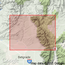
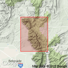
- Areal extent
- AAPG geologic province:
-
- Northern Rocky Mountain region
Summary:
Pg. 86. The East Gallatin group (probably middle Cambrian) forms the foothills on the west and a considerable part of main portion of Bridger Range itself. [Both Belt series and Cambrian have been mapped over large areas in Bridger Range. See Threeforks (Three Forks) folio.]
Source: US geologic names lexicon (USGS Bull. 896, p. 653).
- Usage in publication:
-
- East Gallatin group†
- Modifications:
-
- Abandoned
- AAPG geologic province:
-
- Northern Rocky Mountain region
Summary:
Pg. 16. †East Gallatin group replaced with Belt formation. The series of beds in vicinity of Three Forks which was in USGS 6th Ann. Rpt. provisionally called †East Gallatin group, from well-exposed outcrops along north side of East Gallatin River near its junction with West Gallatin, where a detailed section of 2,300 feet has been measured. In Bridger Range the section is carried lower than on the East Gallatin. In Big Belt Range the formation is 10,000 to 12,000 feet thick. [See also Peale (1893) entry under Belt.]
Source: US geologic names lexicon (USGS Bull. 896, p. 653).
- Usage in publication:
-
- East Gallatin Group†
- Modifications:
-
- Abandoned
- AAPG geologic province:
-
- Northern Rocky Mountain region
Summary:
A term abandoned. Name was formerly applied to the coarse facies of the Belt Series in the Northern Rocky Mountain region that is named LaHood Formation in this report.
Source: GNU records (USGS DDS-6; Denver GNULEX).
For more information, please contact Nancy Stamm, Geologic Names Committee Secretary.
Asterisk (*) indicates published by U.S. Geological Survey authors.
"No current usage" (†) implies that a name has been abandoned or has fallen into disuse. Former usage and, if known, replacement name given in parentheses ( ).
Slash (/) indicates name conflicts with nomenclatural guidelines (CSN, 1933; ACSN, 1961, 1970; NACSN, 1983, 2005, 2021). May be explained within brackets ([ ]).