

- Usage in publication:
-
- Dry Lake Member*
- Modifications:
-
- Named
- Dominant lithology:
-
- Pumice
- AAPG geologic province:
-
- Great Basin province
Summary:
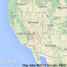
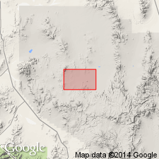
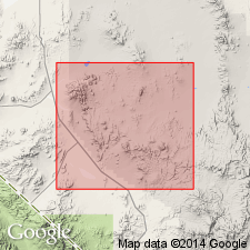
Pg. D24-D27. Dry Lake Member of Thirsty Canyon Tuff (new). Crops out northeast and southeast of Dry Lake and north of Tolicha Peak (fig.1). About 25 percent of a typical outcrop is composed of black to brown coarsely vesicular blocks of pumice as much as 3 feet in diameter. Only uppermost part of member is devitrified. Maximum thickness 30 feet. Overlies Trail Ridge Member (new); underlies Gold Flat Member (new). Age is Pliocene on basis of age of Thirsty Canyon Tuff. Report includes small distribution map.
Type locality: northeast of Dry Lake, Lat. 37 deg. 26 min. N., Long. 116 deg. 41 min. W., Black Mountain 15-min quadrangle, Nye Co., southern NV. Section extending from Trail Ridge Member through Gold Flat Member is exposed. Named from Dry Lake, in T. 6 S., R. 47 E., Nye Co., NV.
Source: US geologic names lexicon (USGS Bull. 1350, p. 223); GNU records (USGS DDS-6; Menlo GNULEX, Denver GNULEX).
- Usage in publication:
-
- Dry Lake Member
- Modifications:
-
- Not used
Summary:
Dry Lake Member of Thirsty Canyon Tuff not mapped in its type area (in vicinity of Dry Lake, T. 6 S., R. 47 E., Nye County, Nevada). Its rocks are assigned to underlying lithologically similar Trail Ridge member. The following subdivisions of the Thirsty Canyon are mapped (ascending): tuff of Rocket Wash, Spearhead, Trail Ridge, Gold Flat, and Labyrinth Canyon Members.
[GNU remark (Sept. 14, 1988, USGS DDS-6; Menlo GNULEX): Apparently Dry Lake was not considered to be abandoned.]
Source: GNU records (USGS DDS-6; Menlo GNULEX, Denver GNULEX).
- Usage in publication:
-
- Dry Lake Member*
- Modifications:
-
- Geochronologic dating
- AAPG geologic province:
-
- Great Basin province
Summary:
Dry Lake Member of Thirsty Canyon Tuff. Sample from Thirsty Canyon area, east of Black Mountain, Lat. 37 deg. 18 min. N., Long. 116 deg. 35 min. W., Nye County, Nevada. K-Ar age on sanidine 6.2 +/-0.2 Ma. [Age is Miocene based on time scale of Berggren (1972, Lethaia, v. 5, no. 2, p. 195-215).]
Source: Modified from GNU records (USGS DDS-6; Menlo GNULEX).
- Usage in publication:
-
- Dry Lake Member*
- Modifications:
-
- Not used
Summary:
Not clear, at present, if Dry Lake Member of Thirsty Canyon Tuff is a valid stratigraphic unit and if it predates or postdates Trail Ridge Member of Thirsty Canyon Tuff. Its rocks were assigned to the lithologically similar Trail Ridge Member by Rogers and others (1968) because a cooling break was not found between it and the Trail Ridge.
Source: GNU records (USGS DDS-6; Denver GNULEX).
For more information, please contact Nancy Stamm, Geologic Names Committee Secretary.
Asterisk (*) indicates published by U.S. Geological Survey authors.
"No current usage" (†) implies that a name has been abandoned or has fallen into disuse. Former usage and, if known, replacement name given in parentheses ( ).
Slash (/) indicates name conflicts with nomenclatural guidelines (CSN, 1933; ACSN, 1961, 1970; NACSN, 1983, 2005, 2021). May be explained within brackets ([ ]).