

- Usage in publication:
-
- Drayton limestone beds*
- Modifications:
-
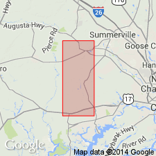
- Areal extent
- Dominant lithology:
-
- Limestone
- AAPG geologic province:
-
- Atlantic Coast basin
Summary:
Informally named the Drayton limestone beds in the Charleston, South Carolina area. Consists of medium-grained, very-light-gray to light-brown, soft, porous calcarenite composed of bryozoan fragments. Thickness is 16 meters. Unconformably overlies the Parkers Ferry Formation and unconformably underlies the Ashley Formation, both of the Cooper Group.
Source: GNU records (USGS DDS-6; Reston GNULEX).
- Usage in publication:
-
- Drayton Limestone Member/
- Modifications:
-
- Prinicpal reference
- Dominant lithology:
-
- Calcarenite
- AAPG geologic province:
-
- Atlantic Coast basin
Weems, R.E., Albright, L.B., III, Bybell, L.M., Cicimurri, D.J., Edwards, L.E., Harris, W.B., Lewis, W.C., Osborne, J.E., Sanders, A.E., and Self-Trail, J.M., 2016, Stratigraphic revision of the Cooper Group and the Chandler Bridge and Edisto Formations in the Coastal Plain of South Carolina: South Carolina Geology, v. 49, p. 1-24.
Summary:
Pg. 3 (fig. 2), 4, 5-6, 7 (fig. 4), 21 (tbl. 6). /Drayton Limestone Member of Harleyville Formation of Cooper Group. [= upper interval of the informal Drayton limestone at its type section in USGS OS-1 core (Weems and others, 1987, USGS Open-file Rpt. 87-661, p. 84).] Is a white to light brown, medium-grained bryozoan sand hash with scattered mollusk shells and abundant foraminifers. Occurs locally, only in subsurface. In fig. 4, the Drayton is shown overlying Osborn Member (new) of Harleyville Formation and underlying Runnymede Member (new) of Ashley Formation; all of Cooper Group. Contact between the Drayton and Osborn is rapid gradational or conformable. Fossils. Age is late Eocene (late Priabonian).
Type section (subsurface) [= upper interval of informal Drayton limestone of Weems and others, 1987, USGS Open-file Rpt. 87-661, p. 84]: depth-interval 59 to 91 ft (land surface elev. 13 ft above sea level), USGS OS-1 core, [along Route 165 btw. Ravenel and Warren Crossroads, approx. Lat. 32 deg. 48 min. 30 sec. N., Long. 80 deg. 16 min. 08 sec. W., Osborn 7.5-min quadrangle, Charleston Co., southern SC].
[Origin of name not stated; in conflict with nomenclature guidelines (NACSN, 2005, 2021). Presumably named from Drayton Swamp just west of type section, Lat. 32 deg. 49 min. 40.63 sec. N., Long. 80 deg. 17 min. 43.36 sec. W., Osborn 7.5-min quadrangle (1980 ed.), Charleston Co., southern SC. But possibly named from Drayton Hall, along Ashley River a few mi northwest of Charleston, Johns Island 7.5-min quadrangle (1979 ed.), Charleston Co., southern SC.]
[Additional locality information from USGS historical topographic map collection TopoView and USGS GNIS database, accessed February 16, 2023.]
Source: Publication.
For more information, please contact Nancy Stamm, Geologic Names Committee Secretary.
Asterisk (*) indicates published by U.S. Geological Survey authors.
"No current usage" (†) implies that a name has been abandoned or has fallen into disuse. Former usage and, if known, replacement name given in parentheses ( ).
Slash (/) indicates name conflicts with nomenclatural guidelines (CSN, 1933; ACSN, 1961, 1970; NACSN, 1983, 2005, 2021). May be explained within brackets ([ ]).