

- Usage in publication:
-
- Dickinson group*
- Modifications:
-
- First used
- Overview
- Dominant lithology:
-
- Schist
- AAPG geologic province:
-
- Lake Superior region
Summary:
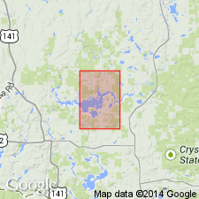
Magnetic green schist unit is mapped in southern part of the Kiernan quad, eastern Iron Co, MI (Lake Superior region), but is not exposed in the quad. Map unit has been traced magnetically from vicinity of Sagola in west-central Dickinson Co, MI, where it has been correlated with rocks of Lower Precambrian Dickinson group (first used), from there northwestward across Lake Mary quad into Kiernan quad in sec 14, T43N, R31W. Rock is known only from a few outcrops and test pits near Sagola and from drillholes in Lake Mary quad. Name "Dickinson group" attributed to report in preparation by James, Laney, Clark, and others [see James (1958)]. In drill core and exposures south of quad the map unit is mainly green and red (oxidized?), fine-grained, chloritic and sericitic schist; strongly foliated; foliations generally finely crinkled; contains magnetite and martite. Rock is probably altered volcanic material, mainly of basic composition. Underlies Randville dolomite. Age is early Precambrian.
Source: GNU records (USGS DDS-6; Reston GNULEX).
- Usage in publication:
-
- Dickinson group*
- Modifications:
-
- Original reference
- Dominant lithology:
-
- Arkose
- Amphibolite
- Schist
- AAPG geologic province:
-
- Lake Superior region
Summary:
Pg. 27, 30 (table 1), 31. Dickinson group. Name applied to a sequence of lower Precambrian rocks (Archean of older reports) consisting of metamorphosed sedimentary and volcanic rocks. In central Dickinson County, is divided into three formations (all new): East Branch arkose (oldest), Solberg schist, and Six-Mile Lake amphibolite. Rocks are steeply dipping or vertical and sequence is believed to be conformable. Group unconformably overlies older pre-Dickinson granite gneiss and has been invaded by granitic rocks of batholithic dimensions. Separated by a covered interval from strata of the Dickinson group is the newly defined Hardwood gneiss, which may be in part or wholly equivalent to the Dickinson group. Age is early Precambrian. Report includes stratigraphic sequence chart.
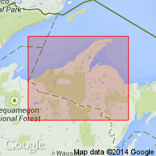
Type locality not designated. Named from Dickinson Co., where group occurs in an easterly trending belt about 4 mi wide in central part of T. 42 N., R. 28, 29, and 30 W., Northern Peninsula, northwestern MI (Lake Superior region).
Source: US geologic names lexicon (USGS Bull. 1200, p. 1116); supplemental information from GNU records (USGS DDS-6; Reston GNULEX).

- Usage in publication:
-
- Dickinson Group*
- Modifications:
-
- Overview
- AAPG geologic province:
-
- Lake Superior region
Summary:
Present in the Lake Superior region gneiss terrane of northwestern MI. Metamorphosed strata include arkose, graywacke, schist, and amphibolite--latter found in uppermost units. These apparently grade laterally and vertically into the informally designated unit, gneiss at Granite Bluffs, as well as into other unnamed granitic gneisses. Unconformably overlies the informally designated unit, granite gneiss of the Norway Lake area. Correlation chart. Is assigned a Late Archean age on the basis of radiometric dates from the East Branch Arkose (formation rank) together with the presence of inclusions of schist and quartzite in the gneiss at Norway Lake (informal).
Source: GNU records (USGS DDS-6; Reston GNULEX).
For more information, please contact Nancy Stamm, Geologic Names Committee Secretary.
Asterisk (*) indicates published by U.S. Geological Survey authors.
"No current usage" (†) implies that a name has been abandoned or has fallen into disuse. Former usage and, if known, replacement name given in parentheses ( ).
Slash (/) indicates name conflicts with nomenclatural guidelines (CSN, 1933; ACSN, 1961, 1970; NACSN, 1983, 2005, 2021). May be explained within brackets ([ ]).