

- Usage in publication:
-
- Diamond Butte Basalt*
- Modifications:
-
- Named
- Geochronologic dating
- Mapped
- Dominant lithology:
-
- Basalt
- AAPG geologic province:
-
- Plateau sedimentary province
Summary:
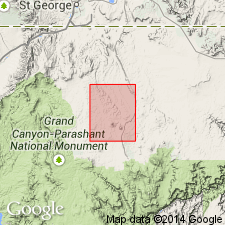
Named for exposures capping Diamond Butte, the designated type area, located in sec 33, T37N, R10W, in south-central part of map area (USGS Russell Spring 7.5' quad), northern Mohave Co, AZ, Plateau sedimentary province. Also forms caprock for Twin Butte located about 5 km southeast of Diamond Butte. Consists of one or possibly two flows about 30 m thick. Basalt is dark-gray, massive, with finely crystalline, aphanitic groundmass; includes sparse olivine phenocrysts. Flow(s) lacks associated dikes or pyroclastic material. Source of basalt is unknown though is assumed to have originated from local feeder dikes at Diamond Butte now covered by landslide debris. Basalt flowed in an easterly direction from Diamond Butte area down a gentle Tertiary erosion surface on Moenkopi Formation and across Hurricane Monocline; does not occur east of Hurricane Fault. Unit is stratigraphically at a similar position as other basalts of similar age on Uinkaret and Shivwits Plateaus. Unconformably overlies upper red member of Moenkopi Formation; older than newly named Moriah Knoll Basalt (Pleistocene). Assigned Pliocene age based on K-Ar whole-rock age of 4.3 +/-0.6 Ma (Harold Mehnert, 1993, USGS, written commun.).
Source: GNU records (USGS DDS-6; Denver GNULEX).
For more information, please contact Nancy Stamm, Geologic Names Committee Secretary.
Asterisk (*) indicates published by U.S. Geological Survey authors.
"No current usage" (†) implies that a name has been abandoned or has fallen into disuse. Former usage and, if known, replacement name given in parentheses ( ).
Slash (/) indicates name conflicts with nomenclatural guidelines (CSN, 1933; ACSN, 1961, 1970; NACSN, 1983, 2005, 2021). May be explained within brackets ([ ]).