

- Usage in publication:
-
- Dewey limestone lentil
- Dewey limestone member
- Modifications:
-
- Original reference
- Dominant lithology:
-
- Limestone
- AAPG geologic province:
-
- Chautauqua platform
Summary:
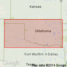
Pg. 30, 37. Dewey limestone lentil. Bluish semicrystalline limestone, usually somewhat shaly but often massively bedded, 3 to 15 feet thick. Stratigraphically 50 to 100 feet above Hogshooter limestone. Is above horizon of Drum limestone, but author cannot correlate it. In northern part of area included in Copan member of Wann formation; in southern part of area is basal member of Ramona formation. All included in Sapulpa group. Fossils (CAMPOPHYLLUM TORQUIUM). Age is Pennsylvanian. Report includes stratigraphic chart.
Named from Dewey, Washington Co., OK. Is continuous and prominent from a point 2 miles east of Wann, south and west to and beyond limits of the Nowata quadranlge.
Source: US geologic names lexicon (USGS Bull. 896, p. 606); supplemental information from GNU records (USGS DDS-6; Denver GNULEX).

- Usage in publication:
-
- Dewey limestone
- Modifications:
-
- Overview
- AAPG geologic province:
-
- Chautauqua platform
Summary:
Some authors have regarded Dewey limestone as = upper part of Drum limestone of Kansas, and it is so treated on the 1926 geologic map of Oklahoma, but many geologists now consider it younger than Drum limestone. The beds separating Dewey and Hogshooter limestones were in 1925 named Nellie Bly formation.
Source: US geologic names lexicon (USGS Bull. 896, p. 606).
- Usage in publication:
-
- Dewey limestone
- Modifications:
-
- Overview
- AAPG geologic province:
-
- Chautauqua platform
Summary:
Pg. 51-56. Dewey limestone. Included in Skiatook group. Underlies Chanute formation; overlies Nellie Bly formation.
[See also 1940, AAPG Bull., v. 24, no. 4, p. 720 (table 1), 725.]
Source: US geologic names lexicon (USGS Bull. 1200, p. 1108-1109).
- Usage in publication:
-
- Dewey limestone member
- Modifications:
-
- Areal extent
- AAPG geologic province:
-
- Chautauqua platform
Summary:
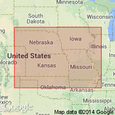
Pg. 2030. Dewey limestone member of Drum limestone. Northward tracing proves that Dewey member of Drum is the same as limestone called Cement City in Kansas City area. Dewey has priority over Cement City and is recognized as a formational unit in Oklahoma. Kansas Geological Survey proposes to use Dewey in place of Cement City for lower member of the Drum. Other State surveys will continue Cement City until question of stratigraphic identity of the type of this unit (near Kansas City) and the Dewey is removed.
Source: US geologic names lexicon (USGS Bull. 1200, p. 1108-1109).
- Usage in publication:
-
- Dewey limestone
- Modifications:
-
- Principal reference
- AAPG geologic province:
-
- Chautauqua platform
Summary:
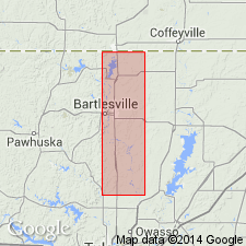
Pg. 68-72. Dewey limestone. Described in Okfuskee County where it consists of a lower limestone or arenaceous limestone member and an overlying shale. Base is about 40 feet above uppermost Nellie Bly sandstone. Type locality stated.
Type locality: in old quarry of Dewey Portland Cement Company, near Dewey, in sec. 26, T. 27 N., R. 13 E., Washington Co., OK.
Source: US geologic names lexicon (USGS Bull. 1200, p. 1108-1109).
- Usage in publication:
-
- Dewey limestone
- Modifications:
-
- Areal extent
- AAPG geologic province:
-
- Chautauqua platform
Summary:
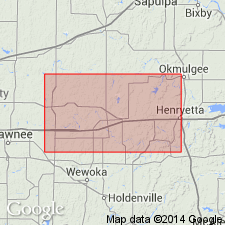
Pg. 25-28. Dewey limestone. In a study of gas and oil fields of Indian Territory, the Drum limestone was traversed by G.I. Adams from outcrop west of Coffeyville to Bartlesville. It occurs on divide between the Verdigris and Caney, extending southward to Hogshooter Creek, thence northwestward to Bartlesville (Adams, Girty, and White, 1903, USGS Bull. 211). It is evident from text and map that Adams was following Hogshooter limestone from Kansas-Oklahoma line to SE cor. T. 26 N., R. 13 E., where he stepped up to the Dewey and followed it to Bartlesville. Sandstone and limestone conglomerate were erroneously shown on geologic map of Oklahoma (1926) as Dewey limestone from sec. 13, T. 28 N., R. 14 E., northeastward to Kansas-Oklahoma line across and area in which the Dewey was removed by pre-Chanute erosion. Thickness 20 to 50 feet in Creek County. Overlies Nellie Bly formation; underlies Chanute limestone. Skiatook group.
Source: US geologic names lexicon (USGS Bull. 1200, p. 1108-1109).
For more information, please contact Nancy Stamm, Geologic Names Committee Secretary.
Asterisk (*) indicates published by U.S. Geological Survey authors.
"No current usage" (†) implies that a name has been abandoned or has fallen into disuse. Former usage and, if known, replacement name given in parentheses ( ).
Slash (/) indicates name conflicts with nomenclatural guidelines (CSN, 1933; ACSN, 1961, 1970; NACSN, 1983, 2005, 2021). May be explained within brackets ([ ]).