

- Usage in publication:
-
- Devil's Hole formation*
- Modifications:
-
- Named
- Dominant lithology:
-
- Tuff
- AAPG geologic province:
-
- Las Vegas-Raton basin
Summary:
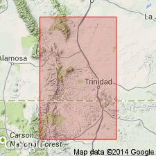
Named for exposures in Devil's Hole, north-central part of Huerfano Park, Huerfano Co., CO in the Las Vegas-Raton basin. No type section described because of scarcity and discontinuity of outcrops. Occurs in northwestern part of Huerfano Park and extends for an unknown distance into Wet Mountain Valley. Consists of light-gray conglomeratic tuff. Matrix is tuffaceous, consisting of angular fragments of glass, pumice, perlite, and pre-Cambrian gneiss and schist. Local channels filled with pebbles of pre-Cambrian rocks. Stringers of manganese and sandstone dikes containing pebbles of pumice and pre-Cambrian rocks. Intertongues westward with [unnamed?] red conglomeratic sandstone derived from Pennsylvanian and Permian rocks. Ranges from 25 to 1,300 ft thick. Unconformably overlies Farisita conglomerate (new unit). Tentatively assigned to Miocene because of stratigraphic position and because of similarity to other units nearby in CO that have a high content of volcanic debris and are assigned to the Miocene.
Source: GNU records (USGS DDS-6; Denver GNULEX).
- Usage in publication:
-
- Devils Hole Formation*
- Modifications:
-
- Reference
- AAPG geologic province:
-
- Las Vegas-Raton basin
Summary:
Reference locality designated at T24S, R70W along road from Gardner to Ophir Creek, Huerfano Co., CO in Las Vegas-Raton basin. The section is about 1,500 ft thick and divisible into: 1) lower member 100 ft thick of yellowish-gray to buff cross-bedded conglomerate containing well-rounded cobbles and pebbles of Precambrian granitic rocks, rounded blocks of pumice and perlite in a sandy tuffaceous and arkosic matrix, and an overlying arkosic tuff; 2) upper member 700 ft thick of lenticular, discontinuous, cross-bedded boulder conglomerates alternating with tuffaceous, evenly bedded friable sandstone containing pebbles of Precambrian rocks and pumice. Upper 150 ft of upper member contains resistant fluviatile pumice boulder conglomerate. Some blocks of pumice more than 3 ft in diameter. Basal contact with Farisita Conglomerate marked by abrupt appearance of pumice and ash in finer grained rocks. Upper contact with Deer Peak Volcanics (new) sharp; pumiceous beds of Devils Hole overlain by gray to brown poorly sorted volcanic conglomerate of andesite and latite fragments derived from Deer Peak volcano. Source was Rosita volcanic field. One pumice bed dated as 32.1 +/-9 m.y. An ash flow dated as 27.5 +/-2.8 m.y. by fission-track method. Is unfossiliferous. Assigned an Oligocene age. Mapped south into Ts24 and 25S, Rs70 and 71W. Mapped previously as Rosita Formation and as various unnamed units ranging from Eocene to Pleistocene.
Source: GNU records (USGS DDS-6; Denver GNULEX).
- Usage in publication:
-
- Devils Hole Formation*
- Modifications:
-
- Age modified
- AAPG geologic province:
-
- Las Vegas-Raton basin
Summary:
Is part of the early cycle (32 to 27 m.y. b.p., or Oligocene) of volcanic rocks at the Rosita center, Custer Co., CO in the Las Vegas-Raton basin.
Source: GNU records (USGS DDS-6; Denver GNULEX).
For more information, please contact Nancy Stamm, Geologic Names Committee Secretary.
Asterisk (*) indicates published by U.S. Geological Survey authors.
"No current usage" (†) implies that a name has been abandoned or has fallen into disuse. Former usage and, if known, replacement name given in parentheses ( ).
Slash (/) indicates name conflicts with nomenclatural guidelines (CSN, 1933; ACSN, 1961, 1970; NACSN, 1983, 2005, 2021). May be explained within brackets ([ ]).