

- Usage in publication:
-
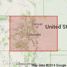
- Denver formation*
- Modifications:
-
- Named
- Dominant lithology:
-
- Conglomerate
- Sandstone
- Clay
- AAPG geologic province:
-
- Denver basin
Summary:
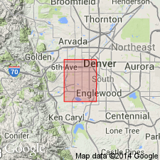
Prior to this paper rocks assigned to Denver formation were included in the Arapahoe formation. Named for its occurrence around the city of Denver, Denver Co, CO in the Denver basin. "Willow Creek series" [renamed Arapahoe formation by Eldridge, this vol., p. 86-118] lies below the Denver Monument Creek beds overlie Denver unconformably. Thought to occupy an area less than 400 sq mi. The west boundary is base of Table Mountain in Golden, CO. The north boundary is at north bank of Clear Creek to the [south] Platte and south bank of San or Coal Creek from the Platte to about 15 mi southeast of Denver. The south limit is east of Mount Carbon on Bear Creek. Eastward, it passes under the high land around Parker on the Denver, Texas, and Gulf RR. Estimated to be about 1,400 ft thick. Upper half can only be seen on Green Mountain. Lithologically variable. Lower part is an alternation of conglomerate, grit, sandstone, sandy clay and clay. Upper part predominately coarse conglomerate with minor clay and sandy beds. Pebbles in the conglomerates rarely exceed 3 inches in diameter. Clays contain fragments of augite or hornblende or plagioclase. Pebbles are of every variety of andesite. Formation color is reddish-brown. Andesitic lavas whose location has been destroyed were source for some of the material in the formation. About 900 ft above base of formation on Green Mountain, a conglomerate contains granite, gneiss, red sandstone and white sandstone pebbles, and fossil wood, as well as andesite pebbles. This conglomerate suggests new source area in late Denver time. About 100 flora specimens, a few invertebrates, crocodile tooth, dinosaur bones, and BISON ALTICORNIS specimen found. Considered Tertiary age.
Source: GNU records (USGS DDS-6; Denver GNULEX).
- Usage in publication:
-
- Denver formation*
- Modifications:
-
- Revised
- AAPG geologic province:
-
- Denver basin
Summary:
Pg. 71, 78 (table 2), 84. Denver formation has yielded invertebrates found only in Laramie formation in Denver basin. Proposed that Laramie be redefined to include Arapahoe formation as a member, basal part of Denver formation, and basal part of Dawson arkose. Age is Paleocene.
Source: US geologic names lexicon (USGS Bull. 1200, p. 1093-1094).
- Usage in publication:
-
- Denver formation
- Modifications:
-
- Overview
- Areal extent
- AAPG geologic province:
-
- Denver basin
Summary:
Arapahoe formation-Denver formation contact placed at a widespread disconformity at the base of the lowest, thickest, most prominent basalt andesite pebble conglomerate bed of the Denver (rather than at the first appearance of andesitic debris as stated by Emmons, Cross, and Eldridge in 1896). This basal bed can be traced to Castle Rock and Colorado Springs as an andesitic sandstone. A green to brown graywacke shale and sandstone in the Matheson-Bland-Byers areas thought to be the same basal unit. Is typically developed in the Denver-Golden Green Mountain area of CO in the Denver basin. Typically composed of andesitic and basaltic sandstone, shale, and conglomerate. Becomes finer grained eastward. Denver should include all dark clastic sediments derived from erosion of basic lavas. As a result, this formation contrasts with the underlying Arapahoe and overlying Dawson arkose. Geologic map; mapped around edges of basin with a basal member of Late Cretaceous age (Tda [?]) and a redefined overlying Paleocene part (Tde).
Source: GNU records (USGS DDS-6; Denver GNULEX).
- Usage in publication:
-
- Denver formation*
- Modifications:
-
- Mapped 1:24k (Golden quad, Jefferson Co, CO)
- Dominant lithology:
-
- Sandstone
- Claystone
- Conglomerate
- AAPG geologic province:
-
- Denver basin
Summary:
Is Upper Cretaceous and Paleocene formation mapped in northern Jefferson Co, CO (Denver basin). Unconformably? overlies Arapahoe formation (Upper Cretaceous); is youngest bedrock unit mapped; interbedded with Paleocene lava flows in upper part. Cretaceous and Tertiary parts separately mapped; boundary based on paleontology. Outcrops in southern third of map area. Described as light-gray to brown silty claystone, tuffaceous sandstone, and andesitic conglomerate. Cretaceous-Tertiary boundary occurs in lower part and may represent major unconformity. Fossil leaves and vertebrates are found throughout unit, but dinosaur remains are restricted to lower (Cretaceous) part. Fossil leaves provide best criteria for differentiating Cretaceous from Tertiary parts of unit. Thickness is 700 ft.
Source: GNU records (USGS DDS-6; Denver GNULEX).

- Usage in publication:
-
- Denver formation*
- Modifications:
-
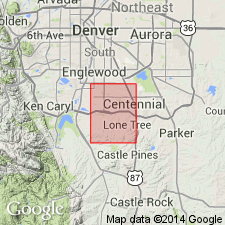
- Mapped 1:24k (Littleton quad, Arapahoe, Douglas, and Jefferson Cos, CO)
- Dominant lithology:
-
- Sandstone
- AAPG geologic province:
-
- Denver basin
Summary:
Is Upper Cretaceous and Paleocene formation mapped in southwest Arapahoe, northwest Douglas, and east-central Jefferson Cos, CO (Denver basin). Occurs as part of tongue within middle part of Dawson arkose (Upper Cretaceous and Paleocene). Consists of andesitic tuffaceous sandstone east of South Platte River in Arapahoe and Douglas Cos; one small outcrop occurs at west end of Patrick Lake, Jefferson Co. Most outcrops occur as smooth bare exposures on steep slopes of higher hills south of Littleton or as vertical cliffs along more active streams. Andesitic sandstone is clayey, olive brown, or olive gray, and contains sandy ironstone layers, and locally zeolites as cement or lining of small vugs. [Thickness not discussed.]
Source: GNU records (USGS DDS-6; Denver GNULEX).

- Usage in publication:
-
- Denver? Formation
- Modifications:
-
- Revised
- AAPG geologic province:
-
- South Park basin
Summary:
Revised in that Denver underlies Agate Creek Formation, a new name, in South Park basin. Deposited mainly in Eocene and possibly in Paleocene time. Geologic map.
Source: GNU records (USGS DDS-6; Denver GNULEX).
- Usage in publication:
-
- Denver Formation*
- Modifications:
-
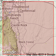
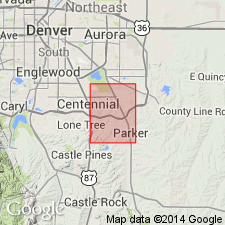
- Mapped 1:24k (Parker quad, Arapahoe and Douglas Cos, CO)
- Dominant lithology:
-
- Claystone
- AAPG geologic province:
-
- Denver basin
Summary:
Is Paleocene formation mapped in northern Douglas Co, CO (Denver basin). Only upper tongue of Denver is present in quad. Upper tongue intertongues with upper part of Dawson Arkose (upper part is Paleocene; lower part of Dawson which does not outcrop in quad is Upper Cretaceous). Unit is described as a claystone, medium-gray to grayish-brown; very plastic when wet, retains moisture for a long time; silty; blocky; commonly has extremely high swelling-pressure potential. Contains leaf and other plant fossils, which are very abundant in some layers, scattered throughout unit. Thickness is 20-50 ft.
Source: GNU records (USGS DDS-6; Denver GNULEX).

- Usage in publication:
-
- Denver Formation*
- Modifications:
-
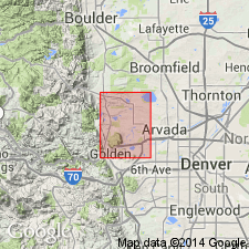
- Mapped 1:24k (Morrison quad, Jefferson Co, CO)
- Dominant lithology:
-
- Claystone
- Siltstone
- Sandstone
- Conglomerate
- AAPG geologic province:
-
- Denver basin
Summary:
Upper Cretaceous and Paleocene formation mapped in Jefferson Co, CO (Denver basin). Exposures occur in eastern two-thirds of quad. Map unit described as yellowish-brown to grayish-olive fluvial claystone, siltstone, friable sandstone, conglomerate, and interlayered olive-gray mudflows ranging from clay with few small volcanic pebbles to clay with many boulder-sized angular volcanic blocks or rounded boulders. Sandstone and finer grained fluvial rocks tuffaceous; commonly weather to montmorillonitic clay having low to high swell potential. Fluvial conglomerate composed of about 95% andesitic volcanic rocks and 5% granitic igneous and metamorphic rocks. Although quite altered, conglomerate has high penetration resistance. Clayey matrix in mudflows weathers to montmorillonite with high swell potential. Blocks of shoshonite in mudflows only slightly weathered. Heulandite and chabazite partly fill cavities in pebbles and sandstone. Some fine-grained layers unstable on slopes as gentle as 8 deg; many earth-flows mapped on slopes steeper than 15 deg. Contains fossil leaves, dinosaur and mammal bones, and silicified wood. Thickness 950 ft. Overlies Arapahoe Formation (Upper Cretaceous); underlies Green Mountain Conglomerate (Paleocene) disconformably. Two flows of Table Mountain Shoshonite (Paleocene) interlayered with andesitic sedimentary rock above middle of Denver on South Table Mountain.
Source: GNU records (USGS DDS-6; Denver GNULEX).
- Usage in publication:
-
- Denver Formation*
- Modifications:
-
- Geochronologic dating
- AAPG geologic province:
-
- Denver basin
Summary:
Denver Formation. Sample collected from a biotite-bearing dacite pumice in the Denver Formation, about 21 m above the Cretaceous-Tertiary boundary [m above base of formation not stated], South Table Mountain near Golden, CO, in SW/4 NW/4 sec. 31, T. 3 S., R. 69 W., Jefferson Co., CO. K-Ar age (biotite) 64.3 +/-0.7 Ma. Age is Paleocene. U.S. National Museum vertebrate locality about 11 m below sample horizon includes Puercan-age mammals.
Source: Modified from GNU records (USGS DDS-6; Denver GNULEX).
- Usage in publication:
-
- Denver Formation*
- Modifications:
-
- Mapped 1:24k (Highlands Ranch quad, Arapahoe and Douglas Cos, CO)
- Dominant lithology:
-
- Sandstone
- Claystone
- AAPG geologic province:
-
- Denver basin
Summary:
Paleocene upper tongue of formation is mapped in southwestern Arapahoe and northern Douglas Cos, CO (Denver basin). Intertongues with middle part of Paleocene upper part of Dawson Arkose. Unit divided into three facies, each separately mapped. Facies are, in ascending order, rocks undifferentiated which are mapped where claystone and sandstone are too thin to map; claystone facies of soft, gray and brown claystone containing weathered fragments of andesite; and sandstone facies of friable, fine-grained sandstone, generally in various shades of brown and composed of quartz, feldspar, and clay together with weathered fragments of andesite. Best exposures are in southeastern, southern, and west-central part of quad; numerous small exposures throughout quad. [Thickness not discussed.]
Source: GNU records (USGS DDS-6; Denver GNULEX).
- Usage in publication:
-
- Denver Formation*
- Modifications:
-
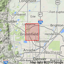
- Mapped 1:24k (Lafayette quad, Adams Boulder, and Jefferson Cos, CO)
- Dominant lithology:
-
- Claystone
- Siltstone
- Sandstone
- Conglomerate
- AAPG geologic province:
-
- Denver basin
Summary:
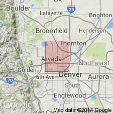
Is Upper Cretaceous and Paleocene formation mapped in northwestern Adams Co, CO (Denver basin). Conformably overlies Arapahoe Formation (Upper Cretaceous) though contact not exposed; unconformably underlies Rocky Flats Alluvium (Pleistocene). Exposed in southeastern part of quad. Unit described as olive-gray to gray claystone and siltstone interbedded with light-brown to orange-brown (weathered) fluvial sandstone and pebble conglomerate. Sandstone and conglomerate are tuffaceous and commonly weather to montmorillonite and related highly swelling clay minerals. Dips gently to southeast. Contains fossil leaves, dinosaur and mammal bones, and petrified wood. Thickness at least 50 m near Federal Heights; thicker to southeast.
Source: GNU records (USGS DDS-6; Denver GNULEX).
- Usage in publication:
-
- Denver Formation*
- Modifications:
-
- Mapped 1:24k (Arapahoe, Denver, and Jefferson Cos, CO)
- Dominant lithology:
-
- Sandstone
- Siltstone
- Claystone
- Shale
- Conglomerate
- AAPG geologic province:
-
- Denver basin
Summary:
Is Upper Cretaceous and Paleocene formation mapped undivided with Arapahoe Formation (Upper Cretaceous) in western Arapahoe, western Denver, and eastern Jefferson Cos, CO (Denver basin). Overlies Arapahoe; unconformably underlies Rocky Flats Alluvium (Pleistocene). Combined unit described as brown, yellowish-brown, gray, and blue-gray interbedded sandstone, claystone, siltstone, shale, and conglomerate. Cross-bedded and lenticular units are common throughout map unit. Shale and claystone generally exhibit marked swelling properties when wetted. Olive-brown andesitic sandstone beds are diagnostic of Denver. Most extensive outcrops are in western part of quad; scattered smaller outcrops over much of quad. Engineering properties discussed. Thickness of combined units is 810 ft reported in well log from location in downtown Denver.
Source: GNU records (USGS DDS-6; Denver GNULEX).
- Usage in publication:
-
- Denver Formation*
- Modifications:
-
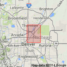
- Mapped 1:24k (Arvada quad, Adams, Denver, and Jefferson Cos, CO)
- Dominant lithology:
-
- Sandstone
- Claystone
- Siltstone
- Shale
- Conglomerate
- AAPG geologic province:
-
- Denver basin
Summary:
Is Upper Cretaceous and Paleocene formation mapped undivided with Arapahoe Formation (Upper Cretaceous) in southwestern Adams, northwestern Denver, and northeastern Jefferson Cos, CO (Denver basin). Is oldest map unit in quad; Denver overlies Arapahoe Formation and unconformably underlies Rocky Flats Alluvium (Pleistocene). Map unit is described as brown, yellowish-brown, gray, and blue-gray interbedded sandstone, claystone, siltstone, shale, and conglomerate; cross-bedded and lenticular units common throughout map unit. Shale and claystone generally swell markedly when wetted. Olive-brown andesitic sandstone beds are diagnostic of Denver. Outcrops are scattered over quad though are most extensive in northeastern part. Engineering properties discussed. A thickness of 781 ft is reported in well log from Westminster area.
Source: GNU records (USGS DDS-6; Denver GNULEX).
- Usage in publication:
-
- Denver Formation*
- Modifications:
-
- Mapped 1:24k (Commerce City quad, Adams and Denver Cos, CO)
- Dominant lithology:
-
- Sandstone
- Claystone
- Siltstone
- Shale
- Conglomerate
- AAPG geologic province:
-
- Denver basin
Summary:
Is Upper Cretaceous and Paleocene formation mapped undivided with Arapahoe Formation (Upper Cretaceous) in western Adams and northern Denver Cos, CO (Denver basin). Is oldest map unit in quad; unconformably underlies Rocky Flats Alluvium (Pleistocene). Map unit is described as brown, yellowish-brown, gray, and bluish-gray interbedded sandstone, claystone, siltstone, shale, and conglomerate; olive-brown andesitic sandstone beds are diagnostic of Denver Formation. Cross-bedded and lenticular units are common throughout map unit. Outcrops mainly on western side of South Platte River valley and in northwestern part of quad. Engineering properties discussed. Thickness of map unit of 785 ft reported in well log from northeastern Commerce City (NE/4 sec 5, T3S, R67W).
Source: GNU records (USGS DDS-6; Denver GNULEX).
- Usage in publication:
-
- Denver Formation*
- Modifications:
-
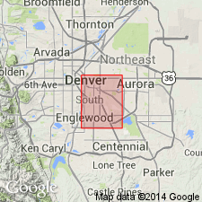
- Mapped 1:24k (Englewood quad, Adams, Arapahoe, and Denver Cos, CO)
- Dominant lithology:
-
- Claystone
- Siltstone
- Sandstone
- Conglomerate
- AAPG geologic province:
-
- Denver basin
Summary:
Is Upper Cretaceous and Paleocene formation mapped in southwestern Arapahoe and eastern Denver Cos, CO (Denver basin). Shown on Correlation of Map Units to be oldest unit in map area and unconformably underlies Verdos Alluvium (Pleistocene). Unit described as olive-gray to light-gray, silty claystone and sandy siltstone interbedded with thin, lenticular beds of olive-yellow to light-brown, tuffaceous sandstone and andesitic pebble conglomerate. Sandstones and finer grained units contain varying amounts of montmorillonitic clays that produce low to very high swelling pressures when wetted. Occurs within 1.5-3 m of surface in most of southeastern part of quad. Outcrops primarily in north-central and southeastern parts of quad. Tables of physical properties. Thickness ranges from about 90 m in downtown Denver to about 300 m in southeast corner of quad.
Source: GNU records (USGS DDS-6; Denver GNULEX).
- Usage in publication:
-
- Denver Formation*
- Modifications:
-
- Mapped 1:24k (Adams Co, CO)
- Dominant lithology:
-
- Sandstone
- Claystone
- Siltstone
- Shale
- Conglomerate
- AAPG geologic province:
-
- Denver basin
Summary:
Is Upper Cretaceous and Paleocene formation mapped undivided with Arapahoe Formation (Upper Cretaceous) in southwestern Adams Co, CO (Denver basin). Is oldest map unit in quad; Denver overlies Arapahoe Formation and unconformably underlies Verdos Alluvium (Pleistocene). Map unit described as brown, yellowish-brown, gray, and bluish-gray, interbedded sandstone, claystone, siltstone, shale, and conglomerate. Cross-bedded and lenticular units common throughout map unit. Olive-brown, andesitic sandstone beds are diagnostic of Denver Formation. Outcrops mainly in northeastern part of quad; two small outcrops in northwestern part of quad. Engineering properties discussed. Thickness of map unit of 994 ft reported in well log from sec 24, T3S, R67W in southwestern part of quad.
Source: GNU records (USGS DDS-6; Denver GNULEX).
For more information, please contact Nancy Stamm, Geologic Names Committee Secretary.
Asterisk (*) indicates published by U.S. Geological Survey authors.
"No current usage" (†) implies that a name has been abandoned or has fallen into disuse. Former usage and, if known, replacement name given in parentheses ( ).
Slash (/) indicates name conflicts with nomenclatural guidelines (CSN, 1933; ACSN, 1961, 1970; NACSN, 1983, 2005, 2021). May be explained within brackets ([ ]).