

- Usage in publication:
-
- Deer Peak Volcanics*
- Modifications:
-
- Original reference
- Dominant lithology:
-
- Volcanics
- AAPG geologic province:
-
- Las Vegas-Raton basin
Summary:
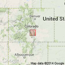
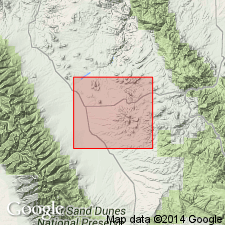
Pg. 7-8, geol. map. Deer Peak Volcanics. Consist of the Deer Peak stock in the southern Wet Mountains and the flows, lahars, and volcanic sediments derived from the Deer Peak volcano. Thickness 1,055 to 1,640 feet at type; 855 feet at reference section. Principal part of the Deer Peak stock is rhyodacite porphyry containing phenocrysts of hornblende and plagioclase set in a fine-grained to aphanitic matrix. Rock is light gray and weathers to shades of tan and brown. Andesitic lahars and volcanic sediments derived from the Deer Peak volcano were mapped as Rosita Formation (herein restricted and called Rosita Andesite) by Siems (1968, Colo. Sch. Mines Quart., v. 63, no. 3, p. 89-124); at Devils Hole, similar materials were considered the upper part of Devils Hole Formation by Guyton and others (1960, Michigan Univ. MS thesis). Overlies unnamed Precambrian rocks; interfingers with Devils Hole Formation; underlies Santa Fe(?) Formation. Age is Oligocene.
Type section: near head of Froze Creek drainage, in secs. 22 and 27, T. 23 S., R. 70 W., Custer Co., south-central CO. Named from rocks on flanks of Deer Peak, southern Wet Mountains, Custer Co., south-central CO.
Reference section: in sec. 4, T. 23 S., R. 70 W., Custer Co., south-central CO.
Source: Publication; US geologic names lexicon (USGS Bull. 1520, p. 82).
- Usage in publication:
-
- Deer Peak Volcanics*
- Modifications:
-
- Age modified
- AAPG geologic province:
-
- Las Vegas-Raton basin
Summary:
Is part of early cycle (32 to 27 Ma, Oligocene) of volcanic rocks at the Rosita center, Custer Co., CO in the Las Vegas-Raton basin.
Source: GNU records (USGS DDS-6; Denver GNULEX).
For more information, please contact Nancy Stamm, Geologic Names Committee Secretary.
Asterisk (*) indicates published by U.S. Geological Survey authors.
"No current usage" (†) implies that a name has been abandoned or has fallen into disuse. Former usage and, if known, replacement name given in parentheses ( ).
Slash (/) indicates name conflicts with nomenclatural guidelines (CSN, 1933; ACSN, 1961, 1970; NACSN, 1983, 2005, 2021). May be explained within brackets ([ ]).