

- Usage in publication:
-
- Darrough felsite*
- Modifications:
-
- Named
- AAPG geologic province:
-
- Great Basin province
Summary:
Darrough felsite. Masses of fine-grained felsitic rocks largely intrusive into older rocks, chiefly the Pablo formation (new); also probably flows. The rocks are mostly rhyolitic in appearance and are fine-grained and porcelain-like in texture, commonly with well-defined flow banding. Contains abundant inclusions, particularly near contacts. Locally, in central parts of larger masses, the texture is coarser, resembling a fine-grained granitic rock. Age is Permian(?).
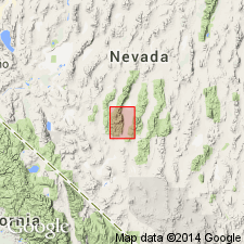
Type locality: east front of Toyabe [Toiyabe] Range, west of Darrough's Hot Springs [in T. 11 N., R. 42 E., Carvers 7.5-min quadrangle], Nye Co., south-central NV.
Source: US geologic names lexicon (USGS Bull. 1200, p. 1044).
- Usage in publication:
-
- Darrough Felsite*
- Modifications:
-
- Geochronologic dating
- AAPG geologic province:
-
- Great Basin province
Summary:
Pg. 7, geologic time scale (inside front cover). Sample from a quartz monzonite dike that cuts through the Darrough Felsite. K-Ar age on biotite 26.5 +/-0.9 Ma. [Age of dike close to Oligocene/Miocene boundary (23.7 Ma; ranges from 23 to 26 m.y.).] Sample no. USGS(D)77FP-109. Sample locality: north side of Belcher Canyon on east flank of Toiyabe Range, Lat. 38 deg. 50 min. 42 sec. N., Long. 117 deg. 12 min. 58 sec. W., in SW/4 NW/4 sec. 1, T. 11 N., R. 42 E., Carver [Carvers] 7.5-min quadrangle, Nye Co., NV. Collected by F.G. Poole. Age determined by USGS personnel in Denver, CO (R.F. Marvin, H.H. Mehnert, E.A. Brandt). Decay constants, recommended by the IUGS Subcommission on Geochronology (Steiger and Jager, 1977, Earth and Planetary Science Letters, v. 36, p. 359-362) are used.
Source: Publication.
- Usage in publication:
-
- Darrough Felsite*
- Modifications:
-
- Age modified
- AAPG geologic province:
-
- Great Basin province
Summary:
Unit age in report area is considered to be Mesozoic and Tertiary; overall age is thus revised from Cretaceous and (or) older to: Tertiary, Mesozoic, and older(?).
Source: GNU records (USGS DDS-6; Menlo GNULEX).
For more information, please contact Nancy Stamm, Geologic Names Committee Secretary.
Asterisk (*) indicates published by U.S. Geological Survey authors.
"No current usage" (†) implies that a name has been abandoned or has fallen into disuse. Former usage and, if known, replacement name given in parentheses ( ).
Slash (/) indicates name conflicts with nomenclatural guidelines (CSN, 1933; ACSN, 1961, 1970; NACSN, 1983, 2005, 2021). May be explained within brackets ([ ]).