

- Usage in publication:
-
- Daniels conglomerate*
- Modifications:
-
- Original reference
- Dominant lithology:
-
- Conglomerate
- AAPG geologic province:
-
- Basin-and-Range province
Summary:
Pg. 16 (table 1), 46-47, pl. 1; 1946, USGS Prof. Paper 209, p. 42-44, pl. 3 [1947]. Daniels conglomerate. Coarse stream gravel, partly cemented; includes a little interbedded quartz latite. Carries boulders 4 feet in diameter, but most of the pebbles are less than 3 inches through. As much as 250 feet thick in Chico Shunie Hills, but thinner elsewhere. Unconformably overlies Cornelia quartz monzonite (new), Cardigan gneiss (new), and Chico Shunie quartz monzonite in southern part of quadrangle and Sneed andesite (new) and Childs latite (new) in the Childs Mountain localities. Conglomerate seems more likely to be early Pliocene or even older rather than a correlative of the Gila conglomerate of southeast Arizona. Age is considered middle(?) Tertiary.
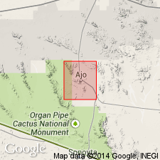
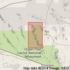
Poorly exposed in hills just north of Daniels Arroyo, from which it is named, Ajo quadrangle, Pima Co., southwestern AZ. Principal exposure is in southwestern part of Chico Shunie Hills, just north of Daniels Arroyo, where it forms a belt about 1.5 mi wide practically from west edge of T. 13 S., R. 6 W., to west boundary of the quadrangle northwest of Teepee Butte.
Source: US geologic names lexicon (USGS Bull. 1200, p. 1041).
- Usage in publication:
-
- Daniels Conglomerate*
- Modifications:
-
- Age modified
- Dominant lithology:
-
- Conglomerate
- Sandstone
- Silt
- Gypsum
- Tuff
- AAPG geologic province:
-
- Basin-and-Range province
Summary:
Is a tan to reddish, poorly indurated, coarse conglomerate, pebbly to sandy conglomerate, subordinate pebbly sandstone, and minor sandstone 180 to 240 m thick. Clasts range in diameter from 5 to 20 cm. Clasts derived from Cardigan Gneiss, Chico Shunie Quartz Monzonite, Mesozoic granite, hornblende andesite, and locally Childs Latite in a poorly sorted, friable, arkosic matrix. Bedding locally horizontal but generally poorly defined. Has a tuffaceous sequence at top locally. Interfingers with Childs Latite and with an unnamed welded tuff. Three parts mapped (geologic map)--the Daniels undivided, some lake deposits (pink to tan fine-grained silt and sandstone and gypsum about 5 cm thick), and welded tuff (tan to pink and densely welded). Mapped in west part of area in Pima Co, AZ in the Basin-and-Range province. Age modified from Pliocene? to Miocene on basis of relationship with other dated Miocene volcanic units.
Source: GNU records (USGS DDS-6; Denver GNULEX).
For more information, please contact Nancy Stamm, Geologic Names Committee Secretary.
Asterisk (*) indicates published by U.S. Geological Survey authors.
"No current usage" (†) implies that a name has been abandoned or has fallen into disuse. Former usage and, if known, replacement name given in parentheses ( ).
Slash (/) indicates name conflicts with nomenclatural guidelines (CSN, 1933; ACSN, 1961, 1970; NACSN, 1983, 2005, 2021). May be explained within brackets ([ ]).