

- Usage in publication:
-
- Culpeper group
- Modifications:
-
- First used
- AAPG geologic province:
-
- Piedmont-Blue Ridge province
Summary:
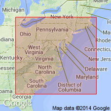
The formations of rock contained within the Culpeper basin, which extends across northeastern Virginia and into Maryland to the Gettysburg basin, from which it is separated by a narrow "neck", are here informally designated formations K through A of the informal Culpeper group. Formation K, 3,900 m (12,800 ft) thick, is composed mostly of fluvial sandstone and siltstone. Its age is Late Triassic and Early Jurassic based on palynoflora. Formation J, 72 m (240 ft) thick, is a basalt unit. Formation I, 508 m (1,670 ft) thick, is composed of fluvial sandstone and siltstone and two lacustrine units with fish beds. Formation H, 92 m (300 ft) thick, is a basalt unit. Formation G, 114 m (308 ft) thick, is composed of fluvial sandstone and siltstone. Formation F, 577 m (1,890 ft) thick, contains four basalt flows with interbedded sedimentary rocks. Formation E, 186 m (610 ft) thick, is a poorly exposed sedimentary unit. Formation D, 60 m (200 ft) thick, is a basalt unit. Formation C, 65 m (2,140 ft) thick, is a sedimentary unit. Formation B, 53 m (175 ft) thick, is a basalt unit. Formation A, 1,000 m (3,300 ft) thick, is composed largely of conglomerate lenses. Age of the Culpeper group is late Carnian to Pliensbachian.
Source: GNU records (USGS DDS-6; Reston GNULEX).
- Usage in publication:
-
- Culpeper Group
- Modifications:
-
- Named
- Dominant lithology:
-
- Sandstone
- Basalt
- AAPG geologic province:
-
- Piedmont-Blue Ridge province
- Culpeper basin
Summary:
The sedimentary and extrusive igneous rocks of the Culpeper basin in Virginia and Maryland are here named the Culpeper Group. The name was used informally by Cornet (1977), who designated informal formations K through A of the Culpeper. It includes the Reston Formation; Manassas Sandstone; Bull Run Formation and its Leesburg, Goose Creek, Cedar Mountain, and Barboursville Conglomerate Members; Buckland Formation; and Waterfall Formation. Age is Late Triassic and Early Jurassic.
Source: GNU records (USGS DDS-6; Reston GNULEX).

- Usage in publication:
-
- Culpeper Group*
- Modifications:
-
- Revised
- AAPG geologic province:
-
- Piedmont-Blue Ridge province
Summary:
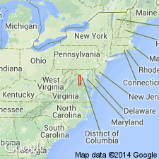
Culpeper Group revised to include the complete lithostratigraphic sequence of Upper Triassic and Lower Jurassic sedimentary and extrusive igneous rocks of the Newark Supergroup in the Culpeper and Barboursville basins in VA and MD. The lower part of the Culpeper Group includes the mostly Upper Triassic sequence of continental sedimentary rocks occupying the entire Barboursville basin and the southern quarter and eastern half of the Culpeper basin, including the Manassas Sandstone and its Rapidan, Reston, Tuscarora Creek, and Poolesville Members; the Balls Bluff Siltstone and its Leesburg Member; the Tibbstown Formation and its Haudricks Mountain and Mountain Run Members; and the Catharpin Creek Formation and its Goose Creek Member. The Triassic-Jurassic boundary is in the Catharpin Creek. The upper part of the Culpeper Group includes the Lower Jurassic sequence of tholeiitic basalt flows and intercalated sedimentary rocks in the west-central Culpeper basin, including the Mount Zion Church Basalt, the Midland Formation, the Hickory Grove Basalt, the Turkey Run Formation, the Sander Basalt, and the Waterfall Formation and its Millbrook Quarry Member. Thickness varies from 330 m to 7,900 m (2,000 to 26,000 ft).
Source: GNU records (USGS DDS-6; Reston GNULEX).
For more information, please contact Nancy Stamm, Geologic Names Committee Secretary.
Asterisk (*) indicates published by U.S. Geological Survey authors.
"No current usage" (†) implies that a name has been abandoned or has fallen into disuse. Former usage and, if known, replacement name given in parentheses ( ).
Slash (/) indicates name conflicts with nomenclatural guidelines (CSN, 1933; ACSN, 1961, 1970; NACSN, 1983, 2005, 2021). May be explained within brackets ([ ]).