


- Usage in publication:
-
- Cross Mountain group
- Modifications:
-
- Original reference
- Dominant lithology:
-
- Shale
- Sandstone
- Coal
- AAPG geologic province:
-
- Appalachian basin
Summary:
Pg. 1, 11, 19, pls. 2, 3, 4, 6, 8. Cross Mountain group. Includes strata above Frozen Head sandstone of Vowell Mountain group (new). Thickness at type section 554 feet. Includes (descending) Tub Spring sandstone (new), Upper Wild Cat coal, Lower Wild Cat coal, Cold Gap coal, Low Gap sandstone (new), shale interval, Upper Grassy Spring coal, and Lower Grassy Spring coal. Age is Early Pennsylvanian (Pottsville).
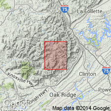
Type locality: Cross Mountain, Lake City quadrangle, Anderson Co., eastern TN. Section is on road leading to top [VABM 3534] of Cross Mountain, [Lake City 7.5-min quadrangle, 1952 ed., Anderson Co., eastern TN]. Group includes youngest Pennsylvanian beds in Tennessee and is preserved only on the higher peaks and ridges in the Cumberland Mountains.
Source: Publication; US geologic names lexicon (USGS Bull. 1200, p. 990).

- Usage in publication:
-
- Cross Mountain Formation
- Modifications:
-
- [Revised]
- Mapped
- AAPG geologic province:
-
- Appalachian basin
Summary:
(East-central and East sheets.) Cross Mountain Formation. Mostly shale, interbedded with sandstone, siltstone, and thin coal beds. Maximum preserved thickness 554 feet in east-central Tennessee; 270 feet in eastern Tennessee. Lies above Frozen Head Sandstone Member of Vowell Mountain Formation. Age is Pennsylvanian.
[The Cross Mountain Group of Wilson and others (1956) is reduced to formation rank. Its constituent formations, the Tub Spring and Low Gap, are also reduced in rank to members (not incl. on State geol. map). See also under Frozen Head and Vowell Mountain.]
Source: Publication.
- Usage in publication:
-
- Cross Mountain Formation
- Modifications:
-
- Areal extent
- AAPG geologic province:
-
- Appalachian basin
Summary:
Consists of clayey to sandy, light-brown to dark-gray shale with coal beds and minor intercalated sandstone and siltstone; and yellowish-gray to yellowish-brown, fine- to medium-grained, thin-to thick-bedded sandstone, cross-bedded in part. Thickness is 400+ ft. Includes Grassy Spring, Cold Gap, and Lower Wildcat coal beds.
Source: GNU records (USGS DDS-6; Reston GNULEX).
For more information, please contact Nancy Stamm, Geologic Names Committee Secretary.
Asterisk (*) indicates published by U.S. Geological Survey authors.
"No current usage" (†) implies that a name has been abandoned or has fallen into disuse. Former usage and, if known, replacement name given in parentheses ( ).
Slash (/) indicates name conflicts with nomenclatural guidelines (CSN, 1933; ACSN, 1961, 1970; NACSN, 1983, 2005, 2021). May be explained within brackets ([ ]).