


- Usage in publication:
-
- Crab Orchard Mountains group
- Modifications:
-
- Original reference
- Dominant lithology:
-
- Conglomerate
- Shale
- Coal
- Sandstone
- AAPG geologic province:
-
- Appalachian basin
Summary:
Pg. 1, 4, pls. 3, 4, 6. Crab Orchard Mountains group. Includes all strata from top of Gizzard group to base of Crooked Fork group (new). At type section, approximately 640 feet thick; 300 feet in vicinity of Jamestown; 900 feet along eastern edge of Walden Ridge. Includes (ascending) Sewanee conglomerate, Whitwell shale, Newton sandstone, Vandever formation, and Rockcastle conglomerate. Age is Early Pennsylvanian (Pottsville).
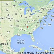
Type section (composite): along U.S. Highway 70N and the railroad tracks of the Tennessee Central Railway Company where they cut across the Crab Orchard Mountains, Cumberland Co., eastern TN.
[GNC remark (ca. 1966, US geologic names lexicon, USGS Bull. 1200, p. 971): The USGS currently classifies the Crab Orchard Mountains as a formation on the basis of a study now in progress.]
Source: US geologic names lexicon (USGS Bull. 1200, p. 970-971).
- Usage in publication:
-
- Crab Orchard Mountains Formation*
- Modifications:
-
- Revised
- AAPG geologic province:
-
- Appalachian basin
Summary:
Unit is geographically extended into northwestern GA and reduced to formation rank. Comprises (ascending) Sewanee, Whitwell Shale, Newton Sandstone, and Vandever Members. Overlies Gizzard Formation.
Source: GNU records (USGS DDS-6; Reston GNULEX).
- Usage in publication:
-
- Crab Orchard Mountains Group
- Modifications:
-
- Revised
- AAPG geologic province:
-
- Appalachian basin
Summary:
Crab Orchard Mountains Group comprises (ascending) Sewanee Conglomerate, Whitwell Formation, Newton Sandstone, Vandever Formation, and Rockcastle Conglomerate.
Source: GNU records (USGS DDS-6; Reston GNULEX).

- Usage in publication:
-
- Crab Orchard Mountains Group
- Modifications:
-
- Mapped
- AAPG geologic province:
-
- Appalachian basin
Summary:
(East-central sheet.) Crab Orchard Mountains Group. Conglomerate, sandstone, siltstone, shale, and coal. Thickness 200 to 950 feet. Includes (descending) Rockcastle Conglomerate (separately mapped), Vandever Formation, Newton Sandstone, Whitwell Shale, and Sewanee Conglomerate. Lies below Crooked Fork Group and above Gizzard Group. Age is Pennsylvanian.
Source: Publication.
- Usage in publication:
-
- Crab Orchard Mountains Group
- Modifications:
-
- Revised
- AAPG geologic province:
-
- Appalachian basin
GNU Staff, 1990, GNU Staff remark by E.D. Koozmin. Crab Orchard Mountains Group.: U.S. Geological Survey Digital Data Series, DDS-6, 1 CD-ROM., release 3
Summary:
The U.S. Geological Survey appears to be the only user of Crab Orchard Mountains as a formation rather than a group. The last USGS usage as a formation was by Culbertson (1963). The State of Tennessee and many other workers since 1963 use it as a group. Therefore, any subsequent USGS reports probably should also use it as a group.
Source: GNU records (USGS DDS-6; Reston GNULEX).
- Usage in publication:
-
- Crab Orchard Mountains Formation*
- Modifications:
-
- Areal extent
- AAPG geologic province:
-
- Appalachian basin
Summary:
The Pottsville in the Plateau coal field of AL is correlated with the Gizzard and Crab Orchard Mountains Formations. In the Warrior, Cahaba, and Coosa coal fields the Pottsville is informally divided into a non-productive lower part and a productive upper part. Unit is of Early Pennsylvanian age.
Source: GNU records (USGS DDS-6; Reston GNULEX).

- Usage in publication:
-
- Crab Orchard Mountains Group
- Modifications:
-
- Areal extent
- AAPG geologic province:
-
- Appalachian basin
Summary:
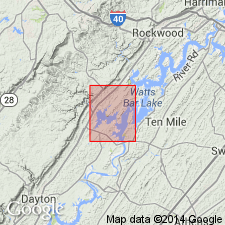
Crab Orchard Mountains Group mapped in Roane and Morgan Cos., eastern TN. Subdivided into (ascending) Sewanee Conglomerate (130 to 240 ft), Whitwell Shale (30 to 100 ft), Newton Sandstone (10 to 120 ft), Vandever Formation (210 to 410 ft) and Rockcastle Conglomerate (160 to 290 ft). Overlies Gizzard Group (undivided) and underlies Dorton Shale of Crooked Fork Group. Age is Early Pennsylvanian.
Source: GNU records (USGS DDS-6; Reston GNULEX).

- Usage in publication:
-
- Crab Orchard Mountains Group*
- Modifications:
-
- Revised
- Areal extent
- AAPG geologic province:
-
- Appalachian basin
Summary:
Crab Orchard Mountains Group is used only in TN and includes Sewanee Conglomerate, Whitwell Shale, Newton Sandstone, Vandever Formation, and Rockcastle Conglomerate. Overlies Gizzard Group. Includes strata previously assigned to Lee Formation or Group, which are restricted from TN except in Cumberland overthrust sheet.
Source: GNU records (USGS DDS-6; Reston GNULEX).
For more information, please contact Nancy Stamm, Geologic Names Committee Secretary.
Asterisk (*) indicates published by U.S. Geological Survey authors.
"No current usage" (†) implies that a name has been abandoned or has fallen into disuse. Former usage and, if known, replacement name given in parentheses ( ).
Slash (/) indicates name conflicts with nomenclatural guidelines (CSN, 1933; ACSN, 1961, 1970; NACSN, 1983, 2005, 2021). May be explained within brackets ([ ]).