

- Usage in publication:
-
- Cove Fort Quartzite
- Modifications:
-
- Named
- Dominant lithology:
-
- Quartzite
- AAPG geologic province:
-
- Great Basin province
Summary:
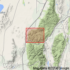
Name applied to an 83 ft thick cream-colored vitreous quartzite that conformably overlies the Middle Devonian Guilmette Formation and disconformably underlies the Mississippian Redwall Limestone. Is present at south end of Pavant Mountains. Section measured at southeast corner of White Sage Flat in sec 16, T24S, R6W. Mapped (geologic map) as a narrow band on the east side of White Sage Flat, Millard Co, UT in the Great Basin province. No type locality designated. Location of place name Cove Fort not stated. Divisible into a lower white to cream, highly indurated clean quartz sand, a middle gray limestone intraformational breccia with sand, and an upper reddish-gray, poorly sorted quartzite with calcareous cement. Is 85 ft thick along Dog Valley. Occupies the same stratigraphic interval as the Victoria Quartzite of the Tintic district but it is probably older than the Victoria. Is probably Late Devonian age.
Source: GNU records (USGS DDS-6; Denver GNULEX).
- Usage in publication:
-
- Cove Fort Quartzite*
- Modifications:
-
- Areal extent
- AAPG geologic province:
-
- Great Basin province
Summary:
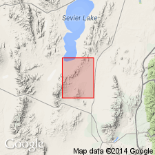
Consists of white to buff or light-gray, massive, somewhat vuggy quartzite with some argillaceous beds near base. Weathered surface is characterized by large shallow pits and indentations. Mapped at Lime Pass, Beaver Co, UT in the Great Basin province, where it averages 35 m thick. Unconformably overlies Middle Devonian Simonson Dolomite; underlies Late Devonian Crystal Pass Member of Sultan Limestone. Of Late Devonian age.
Source: GNU records (USGS DDS-6; Denver GNULEX).
For more information, please contact Nancy Stamm, Geologic Names Committee Secretary.
Asterisk (*) indicates published by U.S. Geological Survey authors.
"No current usage" (†) implies that a name has been abandoned or has fallen into disuse. Former usage and, if known, replacement name given in parentheses ( ).
Slash (/) indicates name conflicts with nomenclatural guidelines (CSN, 1933; ACSN, 1961, 1970; NACSN, 1983, 2005, 2021). May be explained within brackets ([ ]).