The National Geologic Map Database is migrating to a new infrastructure. We apologize for any service disruptions during this process.
|
|---|


- Usage in publication:
-
- Cottonwood Falls limestone
- Modifications:
-
- Original reference
- AAPG geologic province:
-
- Nemaha anticline
Summary:
Pg. 112-114. Limestone No. 13 of section along Neosho River from Indian Territory to White City, Kansas, is famous †Cottonwood Falls limestone [now Cottonwood limestone; see GNC remark below], quarried near Cottonwood Falls, where it consists of two layers, the upper one 2.5 feet thick and the lower one 3 feet thick. Underlain and overlain by 30 feet of dark sandy shale.
Named from Cottonwood Falls, Chase Co., KS.
[GNC remark (ca. 1938, US geologic names lexicon, USGS Bull. 896, p. 529): The abbreviated form Cottonwood limestone is well established in the literature. The formation is overlain by Florena shale member of Garrison formation and underlain by Eskridge formation. Included in Council Grove group. See also Beattie formation.]
Source: US geologic names lexicon (USGS Bull. 896, p. 529).
- Usage in publication:
-
- Cottonwood limestone member
- Modifications:
-
- Revised
Summary:
Pg. 13. Beattie formation (new) comprises (descending) Morrill limestone, Florena shale, and Cottonwood limestone members.
Source: US geologic names lexicon (USGS Bull. 1200, p. 953-954).

- Usage in publication:
-
- Cottonwood limestone member
- Modifications:
-
- Overview
Summary:
Pg. 47. Cottonwood limestone member of Beattie limestone. Underlies Florena shale member; overlies Eskridge shale. Thickness about 6 feet. Age is Early Permian (Wolfcamp).
Source: US geologic names lexicon (USGS Bull. 1200, p. 953-954).
- Usage in publication:
-
- Cottonwood limestone*
- Modifications:
-
- Mapped 1:500k
Summary:
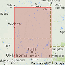
Cottonwood limestone of Council Grove group mapped in Oklahoma. Age is Permian.
Source: US geologic names lexicon (USGS Bull. 1200, p. 953-954).
- Usage in publication:
-
- Cottonwood limestone
- Modifications:
-
- Revised
Summary:
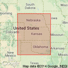
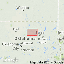
Pg. 101-103. In Pawnee County, classed as limestone in Council Grove group. Overlies Eskridge shale and underlies Garrison shale. As currently classified in Nebraska, Kansas, and north-central Oklahoma, the Cottonwood is basal member of Beattie formation overlain in turn by Florena shale and Morrill limestone members. Members of Beattie can be identified in Pawnee County just south of Arkansas River in two northernmost outliers of Cottonwood limestone. Only Cottonwood member is traceable for any distance across county. Accordingly, Beattie formation has been ignored in subdividing Council Grove group for this report. Maximum development is along Arkansas River where Cottonwood occurs as single resistant bed of light-greenish-gray limestone 2.2 feet thick. Age is Early Permian (Wolfcamp).
Source: US geologic names lexicon (USGS Bull. 1200, p. 953-954).

- Usage in publication:
-
- Cottonwood Limestone Member
- Modifications:
-
- Overview
Summary:
(Paleozoic Era; Permian System by H.G. O'Connor, D.E. Zeller, C.K. Bayne, J.M Jewett, and Ada Swineford, p. 47.) Cottonwood Limestone Member of Beattie Formation of Council Grove Group. Massive, light buff, cherty limestone, weathers nearly white; contains abundant fusulinids in upper part. In southern Kansas and locally elsewhere it is thin-bedded and shaly. Contains five distinct facies (L.F. Laporte, 1962, GSA Bull., v. 73, no. 5, p. 521-544). Along much of its outcrop it is marked by a fringe of shrubs on the grass-covered slopes of the Flint Hills. Thickness about 6 feet; thins to the south. Occurs above Eskridge Shale of Council Grove Group and below Florena Shale Member of Beattie Formation. Age is Early Permian; Gearyan Provincial Stage (of H.G. O'Connor, 1963, AAPG Bull., v. 47, p. 1873-1877).
Source: Publication.
For more information, please contact Nancy Stamm, Geologic Names Committee Secretary.
Asterisk (*) indicates published by U.S. Geological Survey authors.
"No current usage" (†) implies that a name has been abandoned or has fallen into disuse. Former usage and, if known, replacement name given in parentheses ( ).
Slash (/) indicates name conflicts with nomenclatural guidelines (CSN, 1933; ACSN, 1961, 1970; NACSN, 1983, 2005, 2021). May be explained within brackets ([ ]).