

- Usage in publication:
-
- Coronados Volcanics*
- Modifications:
-
- Named
- Biostratigraphic dating
- Dominant lithology:
-
- Basalt
- Limestone
- AAPG geologic province:
-
- Alaska Southeastern region
Summary:
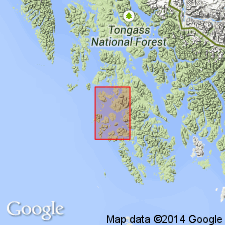
Named for exposures at type locality at eastern part of Coronados Islands at entrance to Port St. Nicholas on west coast of Prince of Wales Island [55 deg 25'N, 133 deg 10'W] southeast AK. Composed of dark-greenish-gray pillow basalts interbedded with massive limestone. Basalts are porphyritic and amygdaloidal, and limestone is fossiliferous. Thickness is greater than 150 m. Underlies Wadleigh Limestone and upper part of formation is interlayered with Wadleigh-type limestone suggesting lateral equivalency of the nonvolcanic Wadleigh Limestone. Age is Middle Devonian based of biostratigraphic dating of corals, and stratigraphic relations.
Source: GNU records (USGS DDS-6; Menlo GNULEX).
For more information, please contact Nancy Stamm, Geologic Names Committee Secretary.
Asterisk (*) indicates published by U.S. Geological Survey authors.
"No current usage" (†) implies that a name has been abandoned or has fallen into disuse. Former usage and, if known, replacement name given in parentheses ( ).
Slash (/) indicates name conflicts with nomenclatural guidelines (CSN, 1933; ACSN, 1961, 1970; NACSN, 1983, 2005, 2021). May be explained within brackets ([ ]).