

- Usage in publication:
-
- Cornishville limestone
- Modifications:
-
- Original reference
- Dominant lithology:
-
- Limestone
- AAPG geologic province:
-
- Cincinnati arch
Summary:
Pg. 23, 31, 33, 36, 132, 133. Cornishville limestone. Fossiliferous coarse-grained limestone underlying Greendal member of Catheys formation, overlying Perryville member, and forming top member of Lexington limestone. [Age is Middle Ordovician.]
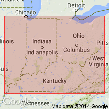
[Named from Cornishville, Mercer Co., central KY.]
Source: US geologic names lexicon (USGS Bull. 896, p. 523).
- Usage in publication:
-
- Cornishville bed
- Modifications:
-
- Revised
- AAPG geologic province:
-
- Cincinnati arch
Summary:
Pg. 377-385. Cornishville bed [of central Kentucky]. Consists of 5 to 6 feet of granular limestone containing a typical Trenton fauna. Top member of Perryville formation [Cornishville limestone member of Perryville formation, see also GNC remarks under Perryville]. Overlies Salvisa horizon of Perryville. [Age is Middle Ordovician.]
Source: US geologic names lexicon (USGS Bull. 896, p. 523).
- Usage in publication:
-
- [Cornishville limestone member]
- Modifications:
-
- Not used
- AAPG geologic province:
-
- Cincinnati arch
Summary:
Pg. 1635-1636. [Cornishville limestone member of Perryville formation.] Not used. The Cornishville with its supposedly recurrent upper Benson fauna is actually uppermost Benson and the entire Perryville is a Benson facies.
Source: US geologic names lexicon (USGS Bull. 1200, p. 944).
- Usage in publication:
-
- Cornishville formation
- Modifications:
-
- Revised
- AAPG geologic province:
-
- Cincinnati arch
Stokley, J.A., and Walker, F.H., 1953, Industrial limestones of Kentucky no. 3: Kentucky Geological Survey Report of Investigations, 9th series, no. 8, 62 p.
Summary:
Pg. 44-45. Cornishville formation. At Harrodsburg, Mercer County, central Kentucky, the Cornishville formation is 6 feet thick. Overlies Salvisa formation. [Age is Middle Ordovician.]
Source: US geologic names lexicon (USGS Bull. 1200, p. 944).
- Usage in publication:
-
- Cornishville Bed*
- Modifications:
-
- Revised
- AAPG geologic province:
-
- Cincinnati arch
Summary:
Designated Cornishville Bed of Perryville Limestone Member of Lexington Limestone. Consists of medium-gray to medium-dark-gray, fossiliferous, micrograined limestone in nodular beds. Fossils are mostly brachiopods. Upper bed of Perryville Member. Thickness is 0 to 10 ft. Underlain by Salvisa Bed of Perryville; overlain by Brannon Member of Lexington Limestone. Age is Middle Ordovician.
Source: GNU records (USGS DDS-6; Reston GNULEX).
- Usage in publication:
-
- Cornishville Bed*
- Modifications:
-
- Reference
- AAPG geologic province:
-
- Cincinnati arch
Summary:
Cornishville Bed of Perryville Limestone Member of Lexington Limestone is mostly nodular-bedded calcisiltite and fine-grained calcarenite containing abundant brachiopods and a few bryozoans. Locally it contains beds of cross-bedded calcarenite and stromatoporoids may be common. Ranges in thickness from 2 to nearly 10 ft. Underlain by Salvisa Bed of Perryville; overlain by Brannon Member of Lexington Limestone. Occurs in restricted area in central Kentucky southeast of Lexington.
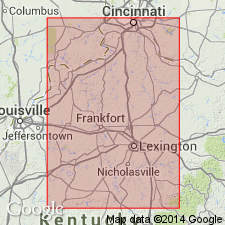
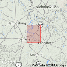
Reference section: in small abandoned quarry 0.4 mi south of Perryville, on east side of road that meets intersection of U.S. Highways 150 and 68 in Perryville, Boyle Co., KY. State coordinates, south zone, E. 2,222,200 ft, N. 478,500 ft.
Source: GNU records (USGS DDS-6; Reston GNULEX).
For more information, please contact Nancy Stamm, Geologic Names Committee Secretary.
Asterisk (*) indicates published by U.S. Geological Survey authors.
"No current usage" (†) implies that a name has been abandoned or has fallen into disuse. Former usage and, if known, replacement name given in parentheses ( ).
Slash (/) indicates name conflicts with nomenclatural guidelines (CSN, 1933; ACSN, 1961, 1970; NACSN, 1983, 2005, 2021). May be explained within brackets ([ ]).