

- Usage in publication:
-
- Corcoran clay
- Modifications:
-
- Named
- Dominant lithology:
-
- Clay
- AAPG geologic province:
-
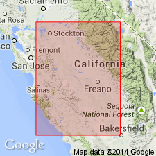
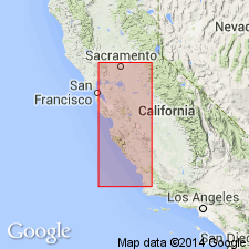
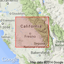
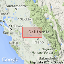
- San Joaquin basin
Summary:
Named from town of Corcoran, Kings Co, CA. Type section designated in subsurface of core, [W/2] sec.15 T15S R14E, Mount Diablo Meridian, San Joaquin Valley, CA. Extends over area of 4000 sq mi. Lies 200 to 800 ft below surface. Consists of dark, greenish gray silty clay, generally massive and well sorted with high porosity, low specific gravity, and noticeable absence of sand. Is highly diatomaceous. Thickness ranges from 50 to 120 ft. Lies in or over upper part of Tulare formation. "Present evidence limits the age between extreme upper Pliocene and mid-Pleistocene" p.2357. "Taking into consideration the opinions of the vertebrate paleontologists and micropaleontologists along with Woodring's [1952] correlation chart, and recalling the stratigraphic position of the Corcoran with relation to the entire Tulare formation, the writers believe that the Corcoran is Pleistocene." p.2367.
Source: GNU records (USGS DDS-6; Menlo GNULEX).
- Usage in publication:
-
- Corcoran clay member*
- Modifications:
-
- Adopted
- Revised
- AAPG geologic province:
-
- San Joaquin basin
Summary:
Corcoran clay of Frink and Kues (1954) is reduced in rank and adopted as member in upper part of Tulare formation. Age is late Pliocene and Pleistocene(?) on basis of fossil diatom assemblages (K.E. Lohman, personal commun., 1954).
Source: GNU records (USGS DDS-6; Menlo GNULEX).
- Usage in publication:
-
- Corcoran Clay Member*
- Modifications:
-
- Age modified
- AAPG geologic province:
-
- San Joaquin basin
Summary:
Corcoran Clay Member of Tulare Formation conformably underlies sanidine-bearing pumice with K-Ar age of 0.60 +/-0.02 Ma (G.B. Dalrymple, personal commun., 1963). "This apparent conformable relationship suggests that Corcoran Clay Member is probably not much older than the 600,000 year old pumice." p.131
Source: GNU records (USGS DDS-6; Menlo GNULEX).
- Usage in publication:
-
- Corcoran Clay Member*
- Modifications:
-
- Age modified
- AAPG geologic province:
-
- San Joaquin basin
Summary:
Corcoran Clay Member of Tulare Formation underlies about half of Tulare-Wasco area, mostly west of U.S. HWY 99. "... represents nearly valley-wide lake deposition in part of Pleistocene time..." p.B9. [no basis given for age assignment]
Source: GNU records (USGS DDS-6; Menlo GNULEX).
- Usage in publication:
-
- Corcoran Clay member*
- Modifications:
-
- Areal extent
- Biostratigraphic dating
- AAPG geologic province:
-
- San Joaquin basin
Summary:
Corcoran Clay Member of Tulare Formation extends beneath entire Los Banos-Kettleman City area in subsurface. Along western edge from Tumey Hills northward, unit has been uplifted and is exposed in roadcut at north end of Panoche Hills at an altitude of 500 ft. Also exposed along east edge of Laguna Seca Hills. Fossil mammal bones have been excavated from Corcoran Clay Member in San Luis project canal section of California Aqueduct in 1964. Assemblage includes remains of mammoths, camels and EQUUS identified by Dr. J.E. Mawby (written commun., 1967) and age given as Irvingtonian (middle Pleistocene) or younger.
Source: GNU records (USGS DDS-6; Menlo GNULEX).
- Usage in publication:
-
- Corcoran Clay Member*
- Modifications:
-
- Revised
- Areal extent
- AAPG geologic province:
-
- San Joaquin basin
Summary:
Corcoran Clay member recognized in subsurface of east side of San Joaquin Valley where it is assigned to Turlock Lake Formation. Believed to underlie Friant Pumice member. Corcoran Clay Member of Tulare Formation remains in good standing on west side of San Joaquin Valley. Age remains Pleistocene.
Source: GNU records (USGS DDS-6; Menlo GNULEX).
For more information, please contact Nancy Stamm, Geologic Names Committee Secretary.
Asterisk (*) indicates published by U.S. Geological Survey authors.
"No current usage" (†) implies that a name has been abandoned or has fallen into disuse. Former usage and, if known, replacement name given in parentheses ( ).
Slash (/) indicates name conflicts with nomenclatural guidelines (CSN, 1933; ACSN, 1961, 1970; NACSN, 1983, 2005, 2021). May be explained within brackets ([ ]).