

- Usage in publication:
-
- Copper Hill volcanics*
- Modifications:
-
- Mapped 1:62.5k
- Dominant lithology:
-
- Volcanics
- AAPG geologic province:
-
- Sierra Nevada province
Summary:
Copper Hill volcanics. Mafic, intermediate, and sparse felsic volcanic rocks. Amygdaloidal mafic lava. Thick-bedded volcanic breccia. Tuff and lapilli tuff. Age is Late Jurassic. Report includes cross section.
Source: US geologic names lexicon (USGS Bull. 1350, p. 172-173).
- Usage in publication:
-
- Copper Hill volcanics*
- Modifications:
-
- Named
- Dominant lithology:
-
- Andesite
- Volcaniclastics
- AAPG geologic province:
-
- Sierra Nevada province
Summary:
Pg. 30-31, pls. 1-11 (see also L.D. Clark and others, 1963, San Andreas quadrangle, USGS Geol. Quad. Map GQ-222). Copper Hill volcanics. Name applied to sequence of volcanic rocks that overlies and intertongues with Salt Spring slate (new). Volcanics are mainly pyroclastic rocks, probably mostly andesitic or basaltic, dark to medium green in color. Partial sections show volcanic rocks of unit are more than 7,000 feet thick on Cosumnes River. More than 3,000 feet thick on Mokelumne River. Extends from north of Cosumnes River to south of Stanislaus River within and west of Bear Mountains fault zone. Volcanics are truncated on east by faults and top of formation probably not preserved in that area. Exposed along Stanislaus River and all rivers to north. Volcanics were mapped as diabase and amphibolite by Turner (1894, USGS Geol. Atlas of the US folio, no. 11) and Lindgren and Turner (1894, USGS Geol. Atlas of the US folio, no. 3). They were placed in Logtown Ridge formation by Taliaferro (1943, California Div. Mines Bull., no. 125) and Taliaferro and Solari (1949, California Div. Mines Bull., no. 145, map only). The part near Copperopolis was tentatively assigned to Amador group by Heyl and Eric (1948, California Div. Mines Bull., no. 144). Parts of volcanics were named Mountain Spring volcanics and Newton Mine volcanics by Heyl and Eric (1948). Is in fault contact with ultra mafic rocks of probable Late Jurassic age. Age, based on stratigraphic relations with Salt Spring slate, is probably Late Jurassic.
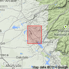
Type section: along Cosumnes River, Amador and El Dorado Cos., CA. Named from inactive Copper Hill mine, in NE/4 sec. 34, T. 8 N., R. 9 E., Amador Co., CA.
[Author does not capitalize rank terms; however, units are considered formal.]
Source: US geologic names lexicon (USGS Bull. 1350, p. 172-173); supplemental information from GNU records (USGS DDS-6; Menlo GNULEX).
For more information, please contact Nancy Stamm, Geologic Names Committee Secretary.
Asterisk (*) indicates published by U.S. Geological Survey authors.
"No current usage" (†) implies that a name has been abandoned or has fallen into disuse. Former usage and, if known, replacement name given in parentheses ( ).
Slash (/) indicates name conflicts with nomenclatural guidelines (CSN, 1933; ACSN, 1961, 1970; NACSN, 1983, 2005, 2021). May be explained within brackets ([ ]).