

- Usage in publication:
-
- Copley meta-andesite*
- Modifications:
-
- Named
- Dominant lithology:
-
- Tuff
- Volcanics
- AAPG geologic province:
-
- Klamath Mountains province
Summary:
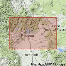
Named for occurrence in vicinity of Copley, 2.5 mi southwest of Summit City, [sec.32 T33N R5W, Shasta Dam 7.5' quad, Shasta Co, CA; no type locality designated] Included earlier as Clear Creek greenstone (Hershey, 1901), Clear Creek series (Hershey, 1903), and Clear Creek volcanic series (Hershey, 1904). Includes great mass of lava made up of many separate volcanic flows of considerable variety and sheets of tuffs more or less distinctly bedded, but generally so compressed as to develop slaty cleavage. Is generally pale green on weathered surface, but darker green and compact on fresh, somewhat shaly fracture. Thickness is 1,000 +/-ft. Overlain by Kennett formation (Middle Devonian); is oldest formation exposed in Redding quad. In places Bragdon formation rests on it. Age is Devonian or older.
Source: GNU records (USGS DDS-6; Menlo GNULEX).
- Usage in publication:
-
- Copley meta-andesite*
- Modifications:
-
- Areal extent
- AAPG geologic province:
-
- Klamath Mountains province
Summary:
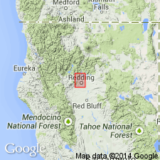
Geographically extended into French Gulch, Schell Mountain, Weaverville, and Trinity Dam 15' quads. Two sections measured in Weaverville quad exceed Diller's estimate, but in neither case is total thickness exposed on Stacey Creek unit measures more than 1200 feet; on Shirttail Peak, about 1500 feet.
Source: GNU records (USGS DDS-6; Menlo GNULEX).
- Usage in publication:
-
- Copley greenstone*
- Modifications:
-
- Redescribed
- AAPG geologic province:
-
- Klamath Mountains province
Summary:
Copley meta-andesite (named by Diller, 1906) is renamed Copley greenstone, because unit is greenish, metamorphic rock in which primary ferromagnesian minerals have been altered to chlorite and epidote.
Source: GNU records (USGS DDS-6; Menlo GNULEX).
- Usage in publication:
-
- Copley greenstone*
- Modifications:
-
- Overview
- AAPG geologic province:
-
- Klamath Mountains province
Summary:
Is oldest unit exposed in west Shasta district of probably Middle Devonian age. Composed of volcanic flows, volcanic breccia, and tuffs of intermediate and basic composition, and few beds of shale and rhyolite tuff. Lower part contains massive flows; upper contains much pillow lava and pyroclastic material. Is at least 3,700 ft thick with base not exposed. Is intruded by Mule Mountain stock; overlain by Balaklala rhyolite and in part interfingers with it. Is Middle Devonian age based on stratigraphic position.
Source: GNU records (USGS DDS-6; Menlo GNULEX).
- Usage in publication:
-
- Copley Greenstone*
- Modifications:
-
- Geochronologic dating
- Age modified
- AAPG geologic province:
-
- Klamath Mountains province
Summary:
Copley Greenstone. Pre-late Middle Devonian age previously based on stratigraphic position. New radiometric data on Mule Mountain stock supports age inference and strongly suggests that Copley Greenstone and Mule Mountain stock are cogenetic because of compatible petrology. In addition geochemistry studies between Mule Mountain stock and Balaklala rhyolite (Barker and others, 1979) conclude that Balaklala extrusive rocks and the stock are cogenetic. Inasmuch as Copley intertongues with Balaklala Rhyolite, age of Copley is defined as early Middle Devonian.
Source: Modified from GNU records (USGS DDS-6; Menlo GNULEX).
- Usage in publication:
-
- Copley Greenstone*
- Modifications:
-
- Age modified
- AAPG geologic province:
-
- Klamath Mountains province
Summary:
Age revised from Middle Devonian to: Early Devonian based on locally interlayered (mostly intrusive?) relation with overlying Balaklala Rhyolite which is considered to be Early Devonian in age.
Source: GNU records (USGS DDS-6; Menlo GNULEX).
- Usage in publication:
-
- Copley Greenstone*
- Modifications:
-
- Overview
- AAPG geologic province:
-
- Klamath Mountains province
Summary:
Detailed petrography and geochemistry study focusing on geodynamic environment and evolution of unit in time and space. Stratigraphic column at least 1800 m thick can be subdivided into two large units that are conformable. Lower unit near Oak Bottom (French Gulch quad) consists of coarse volcanic breccias, lapilli tuffs, and of picritic, basaltic, and andesitic flows interlayered with graded lapilli tuffs, tuffs, and cinerites. Upper unit (near Dale Bottom) is thick (400 m) pillowed volcanic pile resting on pillow breccia. Occurrence of bombs and lapilli in lower section suggest in part subaerial deposition while blows and graded tuffs were deposited under submarine conditions. Pillowed lavas in upper unit suggest eruption in pelagic environment. Geochemistry characterized by low titanium dioxide contents and its basaltic-andesite composition suggests it belongs to low-K tholeiitic suite from island-arc geodynamic environment.
Source: GNU records (USGS DDS-6; Menlo GNULEX).
For more information, please contact Nancy Stamm, Geologic Names Committee Secretary.
Asterisk (*) indicates published by U.S. Geological Survey authors.
"No current usage" (†) implies that a name has been abandoned or has fallen into disuse. Former usage and, if known, replacement name given in parentheses ( ).
Slash (/) indicates name conflicts with nomenclatural guidelines (CSN, 1933; ACSN, 1961, 1970; NACSN, 1983, 2005, 2021). May be explained within brackets ([ ]).