


- Usage in publication:
-
- Coleman Junction bed
- Modifications:
-
- Original reference
- Dominant lithology:
-
- Limestone
- Clay
- AAPG geologic province:
-
- Bend arch
Summary:
Pg. 421. Coleman Junction bed in Albany division. In descending order: yellowish friable limestone, 8 to 10 feet; clay, 10 feet; massive, hard, brittle, yellowish brown, slightly cherty limestone, 20 feet. Basal member of Albany division (Albany is uppermost of 5 Carboniferous divisions of Cummins, 1891). Underlies Lost Creek bed. Overlies Santa Anna Branch bed of Cisco division. Fossiliferous (pelecypods, brachiopods, gastropods). Age is possibly Permian.
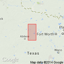
Section measured west of mouth of Santa Anna Branch and north of Jim Ned Creek. Caps well-marked escarpment northward from the Brady Mountains.
[Named from Coleman Junction, Coleman Co., Colorado River region, central TX.]
Source: US geologic names lexicon (USGS Bull. 896, p. 487); supplemental information from GNU records (USGS DDS-6; Denver GNULEX).

- Usage in publication:
-
- Coleman Junction limestone member
- Modifications:
-
- Revised
- Areal extent
- AAPG geologic province:
-
- Bend arch
Summary:
Pg. 40. Coleman Junction limestone member of Putnam formation. Upper member of Putnam formation, which is top formation of Cisco group. Assigned to Pennsylvanian. Overlies Santa Anna Branch shale (lower member of Putnam).
Named from Coleman Junction, Coleman Co., Colorado River region, central TX.
Source: US geologic names lexicon (USGS Bull. 896, p. 487).

- Usage in publication:
-
- Coleman Junction formation*
- Modifications:
-
- Revised
- AAPG geologic province:
-
- Bend arch
Summary:
Pg. 66 (fig. 1). Coleman Junction formation. Rank raised to formation in Putnam group. Underlies Hords Creek formation in Admiral group. [Age is Early Permian (Wolfcamp).]
Source: US geologic names lexicon (USGS Bull. 1200, p. 880-881).

- Usage in publication:
-
- Coleman Junction limestone member*
- Modifications:
-
- Mapped
- AAPG geologic province:
-
- Bend arch
Summary:
Sheet 2. Coleman Junction limestone member of Putnam formation. Described in Colorado River valley as member of Putnam formation. Consists of two to four subdivisions of limestone that are separated by thin shales. Thickness 8 to 25 feet. Overlies Santa Anna Branch shale member; underlies Lost Creek shale member of Admiral formation. Age is Early Permian (Wolfcamp).
Source: Publication; US geologic names lexicon (USGS Bull. 1200, p. 880-881).
- Usage in publication:
-
- Coleman Junction limestone member*
- Modifications:
-
- Areal extent
- AAPG geologic province:
-
- Bend arch
Summary:
Pg. 271-272, pl. 11. Coleman Junction limestone member of Putnam formation. Extended into Brazos River Valley where it is 4 to 15 feet thick. Overlies Santa Anna Branch shale member. In area of present report, the Admiral formation cannot easily be distinguished from underlying Putnam formation or overlying Belle Plains formation; therefore; the Coleman Junction limestone member of the Putnam, the four members of the Admiral formation, and Jim Ned shale member of Bell Plains formation have been mapped as one unit. [Age is Early Permian (Wolfcamp).]
Source: US geologic names lexicon (USGS Bull. 1200, p. 880-881).

- Usage in publication:
-
- Coleman Junction Formation
- Modifications:
-
- Revised
- Mapped
- AAPG geologic province:
-
- Bend arch
Summary:
Coleman Junction Formation of Albany Group. Mostly mudstone, 30 to 50 feet thick. Recognized in southernmost part of quadrangle, notably west of Woodson, Throckmorton County, central northern Texas. Includes Coleman Junction Limestone [unranked], 2 to 4 feet thick, at base. (Elsewhere, the Coleman Junction Limestone is included at base of Admiral Formation of Albany Group.) Underlies Hords Creek Limestone [unranked], = base of Admiral Formation in this area. Overlies Santa Anna Branch Shale of Cisco Group. Equivalent to part of Nocona Formation of Wichita Group and basal Admiral. Fossils. Age is Early Permian (late Wolfcamp).
Source: Publication.
For more information, please contact Nancy Stamm, Geologic Names Committee Secretary.
Asterisk (*) indicates published by U.S. Geological Survey authors.
"No current usage" (†) implies that a name has been abandoned or has fallen into disuse. Former usage and, if known, replacement name given in parentheses ( ).
Slash (/) indicates name conflicts with nomenclatural guidelines (CSN, 1933; ACSN, 1961, 1970; NACSN, 1983, 2005, 2021). May be explained within brackets ([ ]).