- Usage in publication:
-
- Colchester formation*
- Modifications:
-
- Named
- Dominant lithology:
-
- Shale
- Slate
- Sandstone
- Dolomite
- Limestone
- AAPG geologic province:
-
- New England province
Summary:
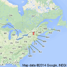
Named for exposures near village of Colchester, Colchester Township, Chittenden Co., northwestern VT. Extends from Canada to Monkton, VT. Greater part of formation in northern sections is shale, decreasing to the south where there are more beds of calcareous sandstone and sandy dolomite present. Shale is usually dark or black, distinctly banded, and speckled with mica scales. Sandstone is gray, in thin layers, locally argillaceous but calcareous in places. In Highgate and Swanton, VT, formation contains many nonbanded massive layers that weather to light gray or white, and many very strongly bedded layers that are used for flagstones. A few layers of sandy dolomite are present here and there. A notable feature of formation is a peculiar tough, dark-gray dolomite that weathers brick red and forms lenses as much as 5 ft thick and 50 ft long near base of formation. In Swanton, they are numerous and prominent and closely associated with a peculiar conglomerate of irregular dolomite boulders in a slate matrix. Formation also contains another set of lenses of massive blue, marbleized limestone, sharply separated from slate and best shown 2 mi southeast of Swanton; lenses measure 100 by 60 ft and 105 by 75 ft. Thickness of formation is 200 to 250 ft to the south and more than 500 ft to the north. Unconformably overlain by Milton dolomite; grades into underlying Mallett dolomite. Age is Early Cambrian.
Source: GNU records (USGS DDS-6; Reston GNULEX).
For more information, please contact Nancy Stamm, Geologic Names Committee Secretary.
Asterisk (*) indicates published by U.S. Geological Survey authors.
"No current usage" (†) implies that a name has been abandoned or has fallen into disuse. Former usage and, if known, replacement name given in parentheses ( ).
Slash (/) indicates name conflicts with nomenclatural guidelines (CSN, 1933; ACSN, 1961, 1970; NACSN, 1983, 2005, 2021). May be explained within brackets ([ ]).

