

- Usage in publication:
-
- Coils Creek Member
- Modifications:
-
- Named
- Dominant lithology:
-
- Limestone
- AAPG geologic province:
-
- Great Basin province
Summary:
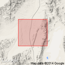
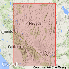
Named for small creek 4 mi W of Lone Mtn [39 deg 35'21"N, 116 deg 02'29"W]. Type section is on main SW ridge leading from peak of Lone Mtn [Bartine Ranch 15' quad, Eureka Co, NV]. Is top member of 3 of McColley Canyon Formation. Mapped in Roberts Mtns, Lone Mtn, and Table Mtn. Its stratigraphic position is occupied by lower Union Mountain Formation in Sulphur Springs Range. Composed of uniform medium to thick-bedded, medium-light-gray, very fine-grained limestone. At Lone Mtn is dolomite in upper part. Is approx 180 ft thick. Underlies Denay Limestone in Roberts Mtns. and Union Mountain Formation at Table Mtn and Lone Mtn. Conformably overlies Bartine Member (new) of McColley Canyon Formation. Generally contains few identifiable fossils; however has well-preserved horn corals and Elythyna fauna. Age is Early Devonian.
Source: GNU records (USGS DDS-6; Menlo GNULEX).

- Usage in publication:
-
- Coils Creek Member*
- Modifications:
-
- Biostratigraphic dating
- AAPG geologic province:
-
- Great Basin province
Summary:
Included as uppermost of 3 members of McColley Canyon Formation. Overlies Bartine Member of McColley Canyon Formation. Underlies Denay Limestone (Johnson, 1965). Ostracodes collected 515 feet above base of McColley Formation at foot of southwestern slope of Table Mountain, Bellevue Peak 15-min quadrangle, Eureka County, Nevada. Age is Early Devonian.
Source: GNU records (USGS DDS-6; Menlo GNULEX).
- Usage in publication:
-
- Coils Creek Member*
- Modifications:
-
- Areal extent
- AAPG geologic province:
-
- Great Basin province
Summary:
Recognized in N Simpson Park Range where underlies Denay Limestone and overlies Bartine Member of McColley Canyon Formation. Age is Dalejan and Zlichovian (Early Devonian).
Source: GNU records (USGS DDS-6; Menlo GNULEX).
For more information, please contact Nancy Stamm, Geologic Names Committee Secretary.
Asterisk (*) indicates published by U.S. Geological Survey authors.
"No current usage" (†) implies that a name has been abandoned or has fallen into disuse. Former usage and, if known, replacement name given in parentheses ( ).
Slash (/) indicates name conflicts with nomenclatural guidelines (CSN, 1933; ACSN, 1961, 1970; NACSN, 1983, 2005, 2021). May be explained within brackets ([ ]).