

- Usage in publication:
-
- Clarks Spring member*
- Modifications:
-
- Original reference
- Biostratigraphic dating
- AAPG geologic province:
-
- Great Basin province
Summary:
p. 14-16, pls. 1, 2. Clarks Spring member of Secret Canyon shale. Thin-bedded limestone with prominent yellow or red argillaceous partings. The thin limestone bands are commonly one-fourth to one-half inch thick and rarely exceed 2 inches in thickness. Limestone is fine-grained, silty, and blue, contrasting markedly with the yellow, or more rarely, red clay partings, which range from one-eighth to one-fourth inch thick. Locally mottled with yellow or red patches. Thickness probably 425 to 450 feet. Is upper member of Secret Canyon shale. Gradationally underlies Hamburg dolomite. Contacts between Clarks Spring member and lower shale member below are also gradational. Fossils [listed] identified by A.R. Palmer; fauna characterized by trilobites MODOCIA NEVADENSIS Palmer (PTYCHOPARIA OWENI of Walcott), and common specimens of ELDORADIA and BOLASPIDELLA. Age is considered late Middle Cambrian, based on fossils. (Secret Canyon shale is considered approximate age equivalent of Marjum limestone in House Range, Utah.)
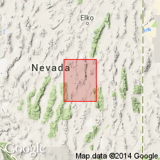
Type locality: especially good exposures of the member provided by roadcuts in upper New York Canyon, just north of Clarks Spring near head of southwesterly branch of New York Canyon, [along bdry. btw. NE/4 sec. 3 (unsurveyed), T. 18 N., R. 53 E., and SE/4 sec. 34 (unsurveyed), T. 19 N., R. 53 E., northwestern corner Pinto Summit 15-min quadrangle (1953 ed.)], Eureka mining district, Eureka Co., central NV.
[Additional locality information from USGS historical topographic map collection TopoView, accessed Memorial Day 2018.]
Source: Publication; US geologic names lexicon (USGS Bull. 1200, p. 824).
For more information, please contact Nancy Stamm, Geologic Names Committee Secretary.
Asterisk (*) indicates published by U.S. Geological Survey authors.
"No current usage" (†) implies that a name has been abandoned or has fallen into disuse. Former usage and, if known, replacement name given in parentheses ( ).
Slash (/) indicates name conflicts with nomenclatural guidelines (CSN, 1933; ACSN, 1961, 1970; NACSN, 1983, 2005, 2021). May be explained within brackets ([ ]).