

- Usage in publication:
-
- Clancy granodiorite
- Modifications:
-
- Named
- Dominant lithology:
-
- Granodiorite
- AAPG geologic province:
-
- Montana folded belt
Summary:
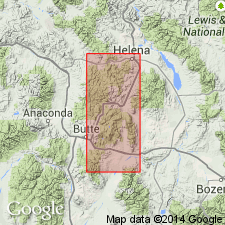
Named for exposures in Kain quarry on Clancy Creek south of Helena, Lewis and Clark Co, MT in the Montana folded belt province. No type locality designated. Geologic map; mapped across southern part of study area as a large body. Is coarse grained gray granodiorite. Quartz is conspicuous. Chemical analyses. Is younger than the Unionville granodiorite (named) and is second intrusion related to the Boulder bathylith of Late Cretaceous age.
Source: GNU records (USGS DDS-6; Denver GNULEX).
- Usage in publication:
-
- Clancy Granodiorite*
- Modifications:
-
- Geochronologic dating
- AAPG geologic province:
-
- Montana folded belt
Summary:
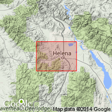
Is the second intrusive related to the Boulder batholith. Composed of coarse-grained hornblende-biotite-granodiorite, light gray. Two K-Ar determinations on biotite from its "type locality" [Kain quarry] yielded ages of 81 and 82 m.y. Mapped along the south border of the study area in Lewis and Clark Co, MT in the Montana folded belt province where it is in contact with Unionville Granodiorite.
Source: GNU records (USGS DDS-6; Denver GNULEX).
- Usage in publication:
-
- Clancy Granodiorite
- Modifications:
-
- Not used
Summary:
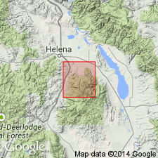
Not used in northern Elkhorn Mountains, Jefferson and Broadwater Cos, MT, Montana folded belt province. Replaced by Butte Quartz Monzonite because author believes units are same mass and Butte has priority over Clancy.
Source: GNU records (USGS DDS-6; Denver GNULEX).
For more information, please contact Nancy Stamm, Geologic Names Committee Secretary.
Asterisk (*) indicates published by U.S. Geological Survey authors.
"No current usage" (†) implies that a name has been abandoned or has fallen into disuse. Former usage and, if known, replacement name given in parentheses ( ).
Slash (/) indicates name conflicts with nomenclatural guidelines (CSN, 1933; ACSN, 1961, 1970; NACSN, 1983, 2005, 2021). May be explained within brackets ([ ]).