

- Usage in publication:
-
- Cima sandstone lentil
- Modifications:
-
- Principal reference
- Dominant lithology:
-
- Sandstone
- AAPG geologic province:
-
- San Joaquin basin
Summary:
Pg. 6 (fig. 2), 8 (fig. 4), 9, 22-23, pls. 2, 3, 4, 5. See also 1941 [abs.], GSA Bull., v. 52, no. 12, pt. 2, p. 1953. Cima sandstone lentil in Dos Palos shale member of Moreno formation. A sand lens lying 180+/- feet below top of the Dos Palos shale member (new). Is gray, fine-grained, silty, micaceous, massive, friable, and concretionary. [Thickness at type locality 80 to 90 feet. On p. 9 (table) thickness of 80 feet given; on p. 22 thickness of 85 feet given; on columnar section (pl. 4) thickness of 90 feet given.] Fossils rare (mollusks). Age is Late Cretaceous or Paleocene(?). On the basis of this mapping it is concluded that Anderson and Pack (1915) show base of Moreno formation in [Ortegalito] Creek some 1,800 feet stratigraphically lower than their type Moreno in Moreno Gulch.
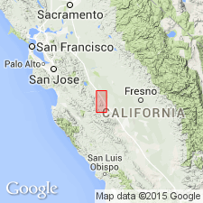
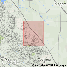
Type locality: Escarpado Canyon, Panoche Hills, 6 mi south of Moreno Gulch and 2 mi north of Panoche Creek, in secs. 7 and 8, T. 15 S., R. 12 E., [Chounet Ranch 7.5-min quadrangle], Fresno Co., southern CA. Cima is Spanish word for peak given to hill 1,800 ft south and 50 ft west of northeast corner sec. 7.
Source: Publication; US geologic names lexicon (USGS Bull. 1200, p. 803); GNU records (USGS DDS-6; Menlo GNULEX).
- Usage in publication:
-
- Cima Sandstone Lentil*
- Modifications:
-
- Revised
- Adopted
- Mapped
- Dominant lithology:
-
- Sandstone
- AAPG geologic province:
-
- San Joaquin basin
Summary:
Cima Sandstone Lentil of Moreno Formation is adopted by the USGS. (=Cima Sandstone Lentil of Payne, 1951.) Consists of light-gray to tan, fine- to very fine-grained, silty sandstone. Thickness up to about 30 m [about 98 feet]. Occurs within Dos Palos Shale Member of Moreno Formation [not considered a subunit of the Dos Palos]. Contains a few fossils (mollusks). Age is Paleocene (Danian). Author notes a general agreement among geologists that the Cretaceous/Tertiary boundary lies somewhere between base of Cima and top of Marca, [in lower part of Dos Palos].
Type section: Escarpado Canyon, [6 mi south of Moreno Gulch and 2 mi north of Panoche Creek, Panoche Hills], in sec. 8, T. 15 S., R. 12 E., Chounet Ranch 7.5-min quadrangle, Fresno Co., southern CA (see Payne, 1951).
Source: Publication; GNU records (USGS DDS-6; Menlo GNULEX).
For more information, please contact Nancy Stamm, Geologic Names Committee Secretary.
Asterisk (*) indicates published by U.S. Geological Survey authors.
"No current usage" (†) implies that a name has been abandoned or has fallen into disuse. Former usage and, if known, replacement name given in parentheses ( ).
Slash (/) indicates name conflicts with nomenclatural guidelines (CSN, 1933; ACSN, 1961, 1970; NACSN, 1983, 2005, 2021). May be explained within brackets ([ ]).