

- Usage in publication:
-
- Chuska sandstone*
- Modifications:
-
- Original reference
- Dominant lithology:
-
- Sandstone
- AAPG geologic province:
-
- Black Mesa basin
- San Juan basin
Summary:
Chuska sandstone. White and gray porous cross-bedded sandstone, 700 to 900 feet thick. Overlies Tohachi shale, probably with unconformity. Unconformably underlies basic lavas. Age is early Tertiary (Eocene?).
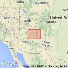
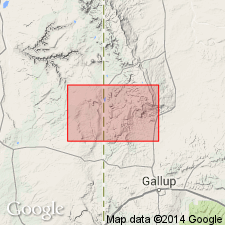
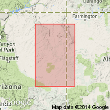
Named from Chuska Peak, McKinley Co., northwestern NM. [Extends into northeastern AZ.]
Source: US geologic names lexicon (USGS Bull. 896, p. 443).
- Usage in publication:
-
- Chuska sandstone
- Modifications:
-
- Overview
- AAPG geologic province:
-
- Black Mesa basin
- San Juan basin
Summary:
Composed of massive, cross-bedded, silica-cemented sandstone interbedded with weakly cemented less resistant sandstone. Is about 1,000 ft thick in northeast part of Tohatchi quad in western San Juan basin, McKinley Co, NM. Unconformably overlies formations from Summerville to Tohatchi age; underlies volcanic rocks six miles north of the area. Similar sediments, widespread and interbedded with volcanic debris near White Cone, Navajo Co, AZ in Black Mesa basin, contain fossils of middle or late Pliocene age; assigned in this quad to late Tertiary, probably Pliocene age.
Source: GNU records (USGS DDS-6; Denver GNULEX).
- Usage in publication:
-
- Chuska sandstone*
- Modifications:
-
- Age modified
- AAPG geologic province:
-
- Black Mesa basin
- San Juan basin
Summary:
Considered to be a correlative of the lower member of the Bidahochi formation to west and assigned to Pliocene. Fluvial facies of Bidahochi and the Chuska are similar lithologically. Both formations contain volcanic ash. The Bidahochi is found at elevations of 6,000 to 7,000 ft. The Chuska is found at elevations of 8,000 to 9,000 ft. Chuska occurs to northeast in AZ, Black Mesa basin and adjoining NM, San Juan basin.
Source: GNU records (USGS DDS-6; Denver GNULEX).
- Usage in publication:
-
- Chuska sandstone
- Modifications:
-
- Revised
- AAPG geologic province:
-
- San Juan basin
Summary:
A sequence 242 ft thick on south-facing scarp called Deza Bluffs in the Chuska Mountains, McKinley Co., NM in the San Juan basin, formerly included in Chuska sandstone by some, and in Tohatchi shale by others, is named as a separate formation--Deza formation, of middle Tertiary age. The lower contact of Chuska is revised, and the age of Chuska is considered middle Tertiary.
Source: GNU records (USGS DDS-6; Denver GNULEX).
- Usage in publication:
-
- Chuska Sandstone*
- Modifications:
-
- Age modified
- AAPG geologic province:
-
- San Juan basin
Summary:
Age modified from Pliocene? and from Miocene or Oligocene as assigned in earlier reports to early Oligocene to Eocene?. Some of the volcanic rocks of the Minette province, which intrude the Chuska Sandstone north of the mapped area, have been dated as middle Oligocene. The Chuska is at least as old as early Oligocene. Consists of gray, massive, cross-bedded, very fine to coarse grained sandstone and some siltstone of eolian and fluvial origin. About 1,000 ft thick. Mapped on the north part of map in McKinley Co, NM in the San Juan basin.
Source: GNU records (USGS DDS-6; Denver GNULEX).
For more information, please contact Nancy Stamm, Geologic Names Committee Secretary.
Asterisk (*) indicates published by U.S. Geological Survey authors.
"No current usage" (†) implies that a name has been abandoned or has fallen into disuse. Former usage and, if known, replacement name given in parentheses ( ).
Slash (/) indicates name conflicts with nomenclatural guidelines (CSN, 1933; ACSN, 1961, 1970; NACSN, 1983, 2005, 2021). May be explained within brackets ([ ]).