

- Usage in publication:
-
- Church Creek Formation
- Modifications:
-
- Named
- Biostratigraphic dating
- Dominant lithology:
-
- Mudstone
- Siltstone
- Sandstone
- AAPG geologic province:
-
- California Coast Ranges province
Summary:
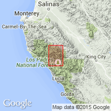
Name Church Creek Formation should be clearly distinguished from informal name "Church Creek Beds" (Reiche, 1937) which embraced all Tertiary units in area including Junipero Sandstone, Lucia Mudstone, and The Rocks Sandstone as well as Church Creek Formation. Type section designated along sides of draw leading north from fossil locality 7475 north to localities 7414 and 7470, sec.13 T19S R3E, valley of Church Creek, Monterey Co, CA. Consists of marine sequence of interbedded gray mudstone, soft brown siltstone, and brown and gray sandstone. Maximum thickness is about 1250 feet. Is 800 feet thick at type. Conformably overlies The Rocks Sandstone. Top part of unit cut by Church Creek fault. Shown on sketch map and structure section of Church Creek area. Foraminifers from type suggest unit belongs to Refugian Stage.
Source: GNU records (USGS DDS-6; Menlo GNULEX).
- Usage in publication:
-
- Church Creek Formation*
- Modifications:
-
- Adopted
- Biostratigraphic dating
- AAPG geologic province:
-
- California Coast Ranges province
Summary:
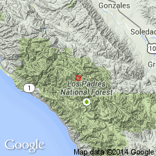
Church Creek Formation of Dickinson (1965) is adopted. Comparison between biostratigraphic dating based on foraminifers and on nannoplankton gives location of collection in Church Creek area. List of calcareous nannoplankton included. Age given as Refugian (Eocene).
Source: GNU records (USGS DDS-6; Menlo GNULEX).
- Usage in publication:
-
- Church Creek Formation*
- Modifications:
-
- Age modified
- AAPG geologic province:
-
- California Coast Ranges province
Summary:
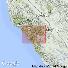
Age is middle and late Eocene on basis of foraminifers of Narizian and Refugian ages. Shown on map of part of Ventana and Black Butte Roadless Areas. Described as olive-gray mudstone and buff siltstone with subordinate thin- to thick-bedded calcareous sandstone and local conglomerate. Locally includes sandstone beds shown separately in middle part along Church Creek and in upper part near The Indians.
Source: GNU records (USGS DDS-6; Menlo GNULEX).
For more information, please contact Nancy Stamm, Geologic Names Committee Secretary.
Asterisk (*) indicates published by U.S. Geological Survey authors.
"No current usage" (†) implies that a name has been abandoned or has fallen into disuse. Former usage and, if known, replacement name given in parentheses ( ).
Slash (/) indicates name conflicts with nomenclatural guidelines (CSN, 1933; ACSN, 1961, 1970; NACSN, 1983, 2005, 2021). May be explained within brackets ([ ]).