

- Usage in publication:
-
- Childs latite*
- Modifications:
-
- Named
- Dominant lithology:
-
- Latite
- AAPG geologic province:
-
- Basin-and-Range province
Summary:
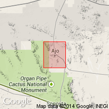
Named for exposures along west slope of Childs Mountain, Ts11 and 12S, R7W, Pima Co, AZ in the Basin-and-Range province. Also mapped to east in quad (geologic map) on north side of Batamote Mountains and southwest of Black Mountain in the south-central part of the quad. No type locality designated. Base not exposed. Is in contact with Batamote andesite (new). Maximum exposed thickness is 700 feet. Occurs in thin blocky flows 30 to 80 feet thick. Consists of gray to reddish (dark brown weathering) latite. Is mottled by glassy plagioclase phenocrysts nearly an inch long. Feldspars are andesine-labradorite and smaller crystals of augite in a glassy matrix. Assigned a Pliocene? age.
Source: GNU records (USGS DDS-6; Denver GNULEX).
- Usage in publication:
-
- Childs Latite
- Modifications:
-
- Age modified
- AAPG geologic province:
-
- Basin-and-Range province
Summary:
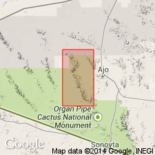
A flow-banded rhyolite that overlies the Childs Latite in Organ Pipe Cactus National Monument, Pima Co, AZ, Basin-and-Range province, yielded an age of 17.4 +/-0.5 m.y. A basaltic andesite sample from the Batamote Andesite, a unit that also overlies the Childs, yielded an age of 15.52 +/-0.54 m.y. These dates constrain the upper age limit of the Childs to greater than 15 m.y. and therefore, at least to Miocene age, rather than Pliocene as previously assigned.
Source: GNU records (USGS DDS-6; Denver GNULEX).
- Usage in publication:
-
- Childs Latite*
- Modifications:
-
- Overview
- AAPG geologic province:
-
- Basin-and-Range province
Summary:
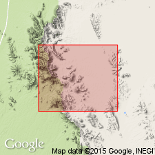
Consists of reddish-brown to brownish-gray coarsely porphyritic to gray coarse-grained intergranular flows and hypabyssal? rocks 100 to 140 m thick. Mapped along northwest part of area in Pima and adjoining Maricopa Cos, AZ in the Basin-and-Range province. The flows have plagioclase phenocrysts that are zoned from labradorite to andesine 0.7 to 2.5 cm long, and lesser amounts of iddingsite-rimmed olivine and diopsidic augite phenocrysts in an intergranular textured groundmass. Sparse vesicles commonly filled with calcite and zeolite. Forms thin flows that have basal flow breccias 1 to 3 m thick and scoriaceous oxidized flow surfaces. Is commonly interlayered with Daniels Conglomerate so that Daniels is found below and above Childs. Crops out as craggy to blocky flows. Assigned a Miocene age.
Source: GNU records (USGS DDS-6; Denver GNULEX).
For more information, please contact Nancy Stamm, Geologic Names Committee Secretary.
Asterisk (*) indicates published by U.S. Geological Survey authors.
"No current usage" (†) implies that a name has been abandoned or has fallen into disuse. Former usage and, if known, replacement name given in parentheses ( ).
Slash (/) indicates name conflicts with nomenclatural guidelines (CSN, 1933; ACSN, 1961, 1970; NACSN, 1983, 2005, 2021). May be explained within brackets ([ ]).