- Usage in publication:
-
- Cerro Bravo Andesite*
- Modifications:
-
- Named
- Dominant lithology:
-
- Andesite
- AAPG geologic province:
-
- Caribbean region
Summary:
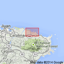
Named for Cerro Bravo, a hill about 95 m high in eastern part of Rio Grande quad, northeastern PR. Interpreted as an intrusive sheet rising in section northward. Consists chiefly of coarse-grained, nearly holocrystalline pyroxene andesite porphyry with diabasic intergranular texture. Plagioclase phenocrysts and plagioclase in the groundmass form most of the rock. Clinopyroxene, magnetite, and apatite occur interstitially. Thickness is 130 m or more. In El Yunque, cuts Hato Puerco Formation at high angle (Seiders, 1971b). Southwest of Quebrada Suspiro, transects rocks of Hato Puerco and Cambalache Formations; northeast of Quebrada Suspiro, is essentially a concordant sill within Cambalache Formation. In southwestern part of quad, Cerro Bravo not present in entire section from Hato Puerco to lower part of Frailes Formation. Further east, in Carolina and Gurabo quads, rocks identical to Cerro Bravo occur in an igneous sheet within Frailes Formation (Seiders, 1971a). Seiders concluded that this eastern igneous sheet is much like the Cerro Bravo, but is higher in section. He did not specify time of emplacement for either sheet, but classified them with diabasic porphyry dikes exposed in Rio Grande quad and adjacent areas to which he assigned a Cretaceous or Tertiary age. The two sheets could be comagmatic to each other and with Martin Gonzalez Lava of Cretaceous age. Shown in map explanation as Late Cretaceous(?) age.
Source: GNU records (USGS DDS-6; Reston GNULEX).
For more information, please contact Nancy Stamm, Geologic Names Committee Secretary.
Asterisk (*) indicates published by U.S. Geological Survey authors.
"No current usage" (†) implies that a name has been abandoned or has fallen into disuse. Former usage and, if known, replacement name given in parentheses ( ).
Slash (/) indicates name conflicts with nomenclatural guidelines (CSN, 1933; ACSN, 1961, 1970; NACSN, 1983, 2005, 2021). May be explained within brackets ([ ]).

