

- Usage in publication:
-
- Catskill Formation*
- Modifications:
-
- Revised
- AAPG geologic province:
-
- Appalachian basin
Summary:
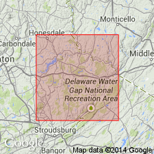
Upper Devonian Catskill Formation in Pike County, Pennsylvania, divided into (descending): Poplar Gap and Packerton Members (undivided), <250'-500'; Lackawaxen Member, 200'-500'; Delaware River Member, 2,600'-2,800'; Towamensing Member, 1,625' maximum. Overlies Trimmers Rock Formation; underlies Quaternary (Woodfordian) glacial deposits.
Source: GNU records (USGS DDS-6; Reston GNULEX).
- Usage in publication:
-
- Catskill Formation
- Modifications:
-
- Overview
- AAPG geologic province:
-
- Appalachian basin
Summary:
Author's purpose is to describe in detail the sedimentology of the Sherman Creek, Clarks Ferry and Duncannon Members of the upper part of the Catskill Formation as seen in three outcrops along Rte 322 in south-central PA. Outcrops are at Second Mountain, Peters Mountain, and Buffalo Mountain. All three members are composed of sandstone bodies and sandstone-mudstone interbeds and are recognized in part on the basis of the varying ratios of the two lithofacies associations. The Sherman Creek and Duncannon Members are composed of approximately equal amounts of sandstone and mudstone in the study area, while the Clarks Ferry is dominated by sandstone and is not as widespread. These three members are assigned to the alluvial plain depositional environment.
Source: GNU records (USGS DDS-6; Reston GNULEX).
For more information, please contact Nancy Stamm, Geologic Names Committee Secretary.
Asterisk (*) indicates published by U.S. Geological Survey authors.
"No current usage" (†) implies that a name has been abandoned or has fallen into disuse. Former usage and, if known, replacement name given in parentheses ( ).
Slash (/) indicates name conflicts with nomenclatural guidelines (CSN, 1933; ACSN, 1961, 1970; NACSN, 1983, 2005, 2021). May be explained within brackets ([ ]).