

- Usage in publication:
-
- Catheys limestone*
- Modifications:
-
- Named
- Dominant lithology:
-
- Limestone
- Shale
- AAPG geologic province:
-
- Appalachian basin
Summary:
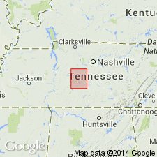
Named the Catheys limestone for Catheys Creek, Lewis and Maury Cos., west central TN. Consists of highly fossiliferous shales and knotty limestones, usually underlain by heavy-bedded subcrystalline limestone and overlain by fine-grained, blue and earthy limestones separated by thin seams of shale. Basal part occasionally includes some granular phosphatic layers. Thickness ranges from 0 to 100 feet. Unit overlies the Bigby limestone and unconformably underlies the Leipers formation. The Catheys is of Middle Ordovician (Trentonian) age.
Source: GNU records (USGS DDS-6; Reston GNULEX).
- Usage in publication:
-
- Catheys limestone
- Modifications:
-
- Principal reference
- Dominant lithology:
-
- Limestone
- Siltstone
- AAPG geologic province:
-
- Appalachian basin
Summary:
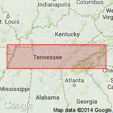
Pg. 136-157. Catheys limestone of Nashville group. Six major facies recognized: shaly, laminated siltstone, granular limestone, clayey limestone, dove-colored limestone, nodular limestone, and pale-colored limestone. Facies do not occur as stratigraphic units in chronological order but rather are interbedded with each other and may recur in both vertical and lateral distribution. In general, the Catheys thickens eastward from featheredge covered by younger sediments somewhere between Perry-Wayne-Hardin Counties and Maury-Giles Counties to as much as 250 feet in Sequatchie Valley. Overlies Bigby-Cannon limestone, being in contact with Bigby facies in western part and with Cannon facies in eastern part. Underlies Leipers formation. In Nashville group, Hayes and Ulrich did not specify type section. Bassler, 1932 (Tennessee Div. Geology Bull., no. 38) suggested section at Columbia. In present study, two sections are measured along Catheys Creek, each of which would serve as type section. Section along Dry Fork 65 feet; section along north slope of spur overlooking Catheys Creek 69 feet.
Suggested type sections:
(1) along road up Dry Fork Creek and up hill to east, beginning about 500 feet south of intersection of Dry Fork and Catheys Creek, 1 mi west of Isom, Maury Co.;
(2) On slope of spur overlooking Catheys Creek between Ivory Hollow and Shannon Branch, about 0.25 mi southeast of Taylorsville, and about 2 mi east of Isom, Maury Co.
Source: US geologic names lexicon (USGS Bull. 1200, p. 674).
- Usage in publication:
-
- Catheys Limestone*
- Modifications:
-
- Areal extent
- AAPG geologic province:
-
- Appalachian basin
Summary:
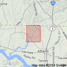
Geographically extended the Catheys Limestone to northern AL. Unit is mapped with the overlying Leipers Limestone as Catheys and Leipers Limestones, undifferentiated because the two limestones are lithologically similar; however, it is noted that an unconformity exists between the two formations. The Catheys and Leipers consists of three general facies which appear to have no particular stratigraphic position but grade laterally into each other; these are argillaceous, crystalline, and granular facies. Fossils are abundant in both units including brachiopods, bryozoans, corals, gastropods, and stomatoporoids. The Catheys overlies the Bigby-Cannon Limestone. The combined Catheys and Leipers Limestones are of Middle and Late Ordovician age.
Source: GNU records (USGS DDS-6; Reston GNULEX).
- Usage in publication:
-
- Catheys Formation
- Modifications:
-
- Areal extent
- AAPG geologic province:
-
- Appalachian basin
Summary:
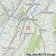
Geographically extended the Catheys Formation to northwestern GA. Lower part of formation consists of laminated or thin-bedded alternations of silty yellowish gray weathering calcilutite and calcisiltite and medium gray, fine-grained limestones. The middle and upper part consists of irregularly bedded, medium gray, fossiliferous limestones separated by partings or very thin beds of calcareous shale. Fossils include brachiopods and bryozoans. Thickness is about 250 feet. Unit overlies the Cannon Limestone and underlies the Inman Formation. The Catheys is of Middle Ordovician age.
Source: GNU records (USGS DDS-6; Reston GNULEX).

- Usage in publication:
-
- Catheys Formation*
- Modifications:
-
- Overview
- AAPG geologic province:
-
- Appalachian basin
Summary:
The Catheys Formation of the Nashville Group, as defined by Milici and Smith (1969), is here used in the Chickamauga terrane in GA, thereby extending the formation into GA.
Source: GNU records (USGS DDS-6; Reston GNULEX).
- Usage in publication:
-
- Catheys Member
- Modifications:
-
- Revised
- AAPG geologic province:
-
- Appalachian basin
Summary:
Catheys (Catoosa Co.) and Cannon and Hermitage (Walker Co.) regarded as members of Nashville Formation of Chickamauga Group in this report, following the nomenclature of Carter and Chowns (1986: AL Geol. Soc. Guidebook, 23rd Ann. Field Trip) and Carter and Chowns (in press: Amer. Assoc. Pet. Geol., Studies in Geology). Catheys underlies [informal] Ringgold Member of Sequatchie Formation in the Kingston thrust sheet.
Source: GNU records (USGS DDS-6; Reston GNULEX).

- Usage in publication:
-
- Catheys Formation*
- Modifications:
-
- Age modified
- AAPG geologic province:
-
- Cincinnati arch
Summary:
The Catheys Formation of the Nashville Group in central Tennessee consists of the granular phosphatic facies (massive, coarse-grained, blue-gray limestone), dove-colored facies (light gray, fine-grained, dense limestone), pale-colored facies (blue limestone that weathers pale), shaly facies (blue-gray clay shale and calcareous shale), nodular facies (blue-gray, irregular and knobby bedded limestone), and laminated siltstone facies (blue-gray, fine-grained, laminated limestone). These facies are interbedded and intertonguing. Thickness of total unit ranges from 25 feet in the central part of the area to 250 feet in the eastern part of the central basin of Tennessee. Overlies the Bigby-Cannon Limestone as used by Wilson (1949) of the Nashville Group and underlies the Leipers Formation or the Inman Formation to the east. Unit correlates with the Clays Ferry Formation and Kope Formation in Kentucky. The Catheys is of Middle and Late Ordovician age ranging from latest Shermanian to Edenian.
Source: GNU records (USGS DDS-6; Reston GNULEX).
For more information, please contact Nancy Stamm, Geologic Names Committee Secretary.
Asterisk (*) indicates published by U.S. Geological Survey authors.
"No current usage" (†) implies that a name has been abandoned or has fallen into disuse. Former usage and, if known, replacement name given in parentheses ( ).
Slash (/) indicates name conflicts with nomenclatural guidelines (CSN, 1933; ACSN, 1961, 1970; NACSN, 1983, 2005, 2021). May be explained within brackets ([ ]).